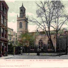
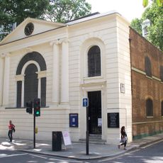
St Mary Staining, Medieval church site in City of London, England
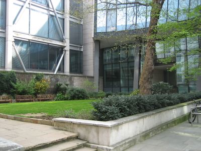
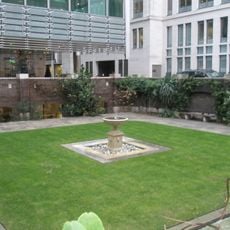
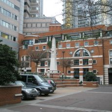
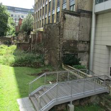
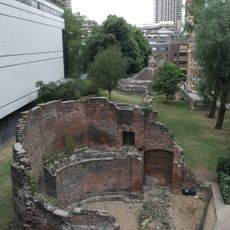
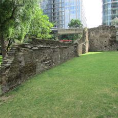
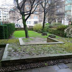
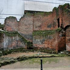
St Mary Staining was a medieval church that stood at the corner of Oat Lane and Staining Lane in the City of London. The site now functions as a public garden surrounded by modern office buildings, with preserved gravestones arranged along the northern wall.
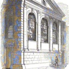
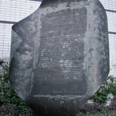
The church was first recorded in 1189 as Ecclesia de Staningehage and was destroyed in the Great Fire of London in 1666. After the fire, it was never rebuilt, and the land eventually became a public space.
The name likely comes from the painter-stainers guild members who worked in this neighborhood, or from an old word meaning stone that describes how it was built.
The grounds are freely accessible as a public garden cared for by the City of London Corporation. It serves as a quiet spot to pause and view the preserved gravestones while surrounded by busy office areas.
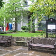
A nearby modern office building was designed with a semi-circular shape to avoid disturbing an ancient tree growing in the garden. This unusual architectural choice reflects how historic elements are protected during contemporary construction.
Location: City of London
GPS coordinates: 51.51670,-0.09500
Latest update: December 14, 2025 11:00
London Wall
161 m
125 London Wall
122 m
St Mary Aldermanbury
135 m
Goldsmiths' Hall
127 m
88 Wood Street
156 m
St Alban, Wood Street
63 m
St Anne and St Agnes
102 m
St Botolph's Aldersgate
158 m
St Michael Wood Street
123 m
John Heminges and Henry Condell Memorial
139 m
St John Zachary
77 m
St Olave Silver Street
70 m
Monkwell Square
133 m
English Runic Inscription 2
131 m
Unity
146 m
London Wall: section of Roman and medieval wall and bastion at Noble Street
59 m
London Wall: section of Roman and medieval wall and bastions, west and north of Monkwell Square
167 m
Wood Street Police Station
85 m
Aldersgate Flame
142 m
London Wall: the west gate of Cripplegate fort and a section of Roman wall in London Wall underground car park, adjacent to Nobl
94 m
Gate And Railings To Former Churchyard Of Church Of St Botolph
141 m
Footings To Former Church Of St Mary The Virgin
122 m
General Post Office North
161 m
London Wall: section of Roman wall and Roman, medieval and post-medieval gateway at Aldersgate
124 m
Police Call Box At North East Angle Of Number 1
140 m
St Martins House
178 m
Brewers' Hall
171 m
Bastion 14, London Wall
120 mVisited this place? Tap the stars to rate it and share your experience / photos with the community! Try now! You can cancel it anytime.
Discover hidden gems everywhere you go!
From secret cafés to breathtaking viewpoints, skip the crowded tourist spots and find places that match your style. Our app makes it easy with voice search, smart filtering, route optimization, and insider tips from travelers worldwide. Download now for the complete mobile experience.
A unique approach to discovering new places❞
— Le Figaro
All the places worth exploring❞
— France Info
A tailor-made excursion in just a few clicks❞
— 20 Minutes