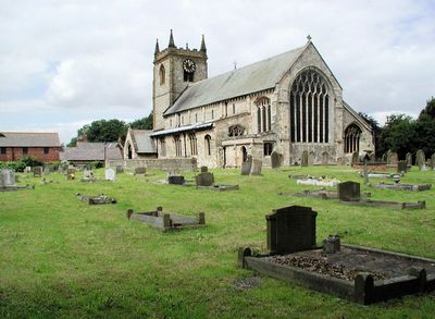
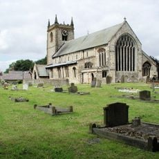
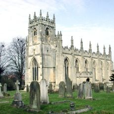
Swine Priory, Medieval priory in Swine, England
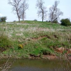
The priory is a medieval monastic site in Swine with a church containing eight carved wooden misericords from the late 14th century, featuring religious and secular motifs. Around the ruins are earthworks, old fishponds, drains, and a moat that reveal the original layout of the entire complex.
Robert de Verli founded the priory before 1154, creating a double monastery where monks and nuns lived together under the supervision of Fountains Abbey. The original structure was maintained across generations until it was abandoned during the dissolution of monasteries in the 16th century.
The church shows features from both the monastic and parish sides of medieval religious life, as monks and nuns worshipped in the same building. The visible architecture reveals how two separate communities shared one structure.
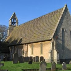
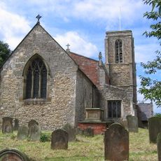
The site is freely accessible and allows visitors to explore the church and surrounding earthworks and old water features. Expect uneven ground and damp conditions, especially after rain, so wear suitable footwear for walking.
The priory had an unusual floor plan with lay facilities at the east end and the nun's section west of the central bell tower. This reversal of typical church orientation is a rare example of how double monasteries organized their practical spaces.
GPS coordinates: 53.80630,-0.27907
Latest update: December 14, 2025 18:45
Burton Constable Hall
5.5 km
Meaux Abbey
5.5 km
East Park
4.7 km
Church of St James and Boundary Wall
3.3 km
Church of St Mary
0 m
Church of St Augustine
4 km
Church of St Peter
3.8 km
Church of St Peter
4.4 km
Kingston Wesleyan Methodist Church
4.4 km
Bridge Over The Lake Approxiately 35 Metres To South-West Of Burton Constable Hall
5.1 km
Milestone, At W end of Bilton, beside roundabout leading to Asda supermarket.
3.6 km
Windmill At The Mill Public House
5.1 km
Water Chute On The Boating Lake In East Park
4.7 km
Haworth Hall And Attached Outbuildings Garden Wall And Summerhouse
5.1 km
4, Main Street
4.4 km
Swine Castle Hill
1.7 km
Ann Watson College And Adjoining Boundary Wall And Railings
3.4 km
7 And 8, The Oval
5.5 km
Cross At Grid Ref Ta 138358
380 m
9 And 10, The Oval
5.5 km
K6 Telephone Kiosk Adjoining Boundary Wall At Ferens Havens
4.9 km
1 and 2, the Oval
5.5 km
Sutton on Hull War Memorial
3.3 km
3 And 4, The Oval
5.5 km
Milestone, Holderness Road shops nr Ings Road X Rds
4.5 km
Milestone, Holderness Road, 100m N of island to Bilton Grange Estate
3.7 km
5 And 6, The Oval
5.5 km
Milestone, opp. Petrol Station, just S of turn to Preston
4.4 kmVisited this place? Tap the stars to rate it and share your experience / photos with the community! Try now! You can cancel it anytime.
Discover hidden gems everywhere you go!
From secret cafés to breathtaking viewpoints, skip the crowded tourist spots and find places that match your style. Our app makes it easy with voice search, smart filtering, route optimization, and insider tips from travelers worldwide. Download now for the complete mobile experience.
A unique approach to discovering new places❞
— Le Figaro
All the places worth exploring❞
— France Info
A tailor-made excursion in just a few clicks❞
— 20 Minutes