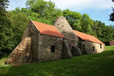
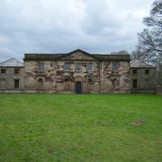
Derwentcote Steel Furnace, Steel furnace in County Durham, England
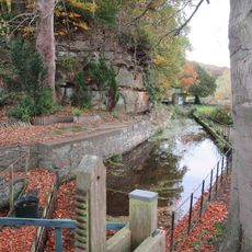
Derwentcote Steel Furnace is an industrial site in County Durham with a distinctive cone-shaped brick structure built for the cementation method of steel production. The site also includes workers' cottages and water-powered equipment that show how the entire operation functioned.
The site was built in 1733 and became one of the few places in England producing steel through this specialized cementation method. It operated for more than a century until economic changes led to its closure in the mid 1870s.
The site was a center of metalworking expertise where skilled workers practiced their craft over generations. The buildings and machinery show how people in the 1700s worked together to produce quality steel through precise techniques.
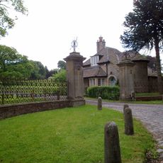
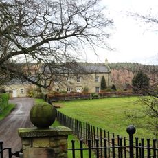
The furnace sits easily accessible beside the A694 road with parking available nearby. You can explore the grounds at your own pace, though guided visits provide better insight into the technical details of how things worked.
The building still retains equipment from the 1700s, including crucibles and original water-powered machinery. These surviving pieces offer a rare glimpse into what daily work actually looked like back then.
Location: County Durham
Website: https://english-heritage.org.uk/visit/places/derwentcote-steel-furnace
GPS coordinates: 54.90390,-1.79723
Latest update: December 14, 2025 11:21
Gibside
5.1 km
Hamsterley Hall
1.5 km
Vindomora
2.9 km
Banqueting House, Gibside
5.5 km
Shotley Park
4.9 km
Church of St Mary Magdalene
2.5 km
Church of St Ebba
3 km
Church of St John
3.7 km
St John the Evangelist
2.3 km
Monument To British Liberty
5.5 km
Burnopfield War Memorial
4.6 km
Pontop Hall
3.4 km
Pontburn Bridge
1.6 km
Mill Race Walls And Sluice With Piers And Sluice Keepers Shelter Adjacent
2 km
The Old Lodge At Hamsterley Hall And Wall Attached
1.5 km
Derwent Oak Farm
582 m
Gibside
5.1 km
Rowlands Gill War Memorial
3.8 km
Chapel House Circa 40 Metres To North West Of Chapel
4.4 km
The Chapel About 350 Metres West And 650 Metres South Of Gibside Hall
4.4 km
War Memorial at the Civic Centre
5.5 km
Pontburn Viaduct
1.5 km
Orangery About 300 Metres West And 260 Metres South Of Gibside
4.6 km
Boundary Stone At Ngr Nz 09705632, On West Side Of Mill Burn
3.4 km
Stables To South East Of Gibside
5.2 km
Chopwell War Memorial
2.2 km
Boundary Stone On South Side Of Mill Barn
4.8 km
Boundary Stone About 500 Metres North East Of Shotley Spa
4.5 kmVisited this place? Tap the stars to rate it and share your experience / photos with the community! Try now! You can cancel it anytime.
Discover hidden gems everywhere you go!
From secret cafés to breathtaking viewpoints, skip the crowded tourist spots and find places that match your style. Our app makes it easy with voice search, smart filtering, route optimization, and insider tips from travelers worldwide. Download now for the complete mobile experience.
A unique approach to discovering new places❞
— Le Figaro
All the places worth exploring❞
— France Info
A tailor-made excursion in just a few clicks❞
— 20 Minutes