Enable Location

We need your location to show you interesting places around you

Discover nearby places

Find interesting locations and hidden gems around you

Precise directions

Get accurate directions and distances to places

Your location is never shared with other users. It's only used when you tap the location button.

West Ogwell Church

Log in to your account

Start exploring — it's free

Trusted by 67,947 travelers worldwide

Continue with Google
Continue with Apple
or

We will send you a code to connect

By continuing, you accept our Terms and Conditions and our Privacy Policy

Check your inbox

We've sent a pincode in your inbox. Please enter the code below.

West Ogwell Church
Discussion Reviews 1 Photos
1.6k Popularity

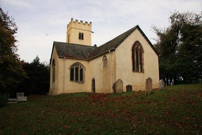
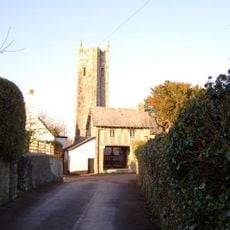
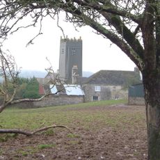
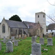
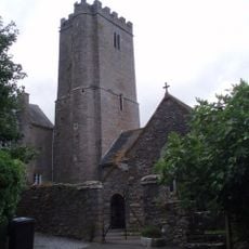
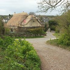
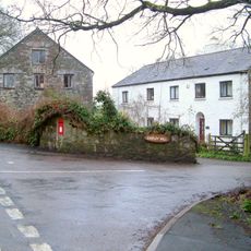
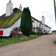
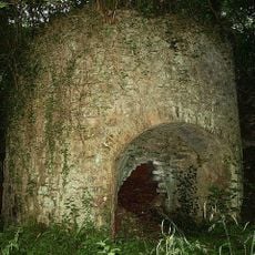
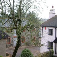
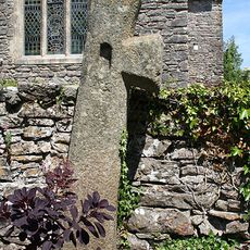
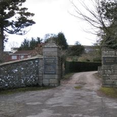
West Ogwell Church, Medieval church in Ogwell, England

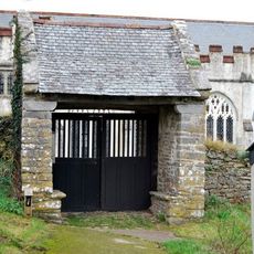
West Ogwell Church is a medieval church in Ogwell, Devon, featuring a two-stage west tower with a crenellated top and original elements from the 13th century. The structure holds Grade I listing status and represents part of the Teignbridge region's architectural heritage.

The church was built around 1200 and stands as one of the earliest recorded religious buildings in Devon's Teignbridge region. It has survived centuries while maintaining its medieval structural core.

The interior retains furnishings from the late 1700s, including original box pews and curved communion rails that reflect the period's style. These fittings show how worshippers gathered and prayed together in this space.

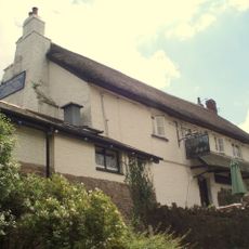
The building is maintained by the Churches Conservation Trust and remains open to visitors interested in medieval religious architecture. Check local opening times before planning a visit to ensure you can access the interior.

The site served as a filming location for the 2014 British horror film 'The Borderlands', adding a modern layer to this ancient structure. Many visitors overlook this film connection while focusing on the medieval history.

The community of curious travelers

AroundUs brings together thousands of curated places, local tips, and hidden gems, enriched daily by 60,000 contributors worldwide.

Start exploring
Location
Inception
13 century
GPS coordinates
50.51860,-3.66750
Latest update
December 14, 2025 13:03
Around this place
Seale-Hayne College
United Kingdom

Seale-Hayne College

3.1 km
Bradley
United Kingdom

Bradley

3.1 km
Holy Trinity Church, Torbryan
United Kingdom

Holy Trinity Church, Torbryan

3.3 km
Church of St Mary the Virgin
United Kingdom

Church of St Mary the Virgin

3.2 km
Church of St John the Baptist
United Kingdom

Church of St John the Baptist

3.1 km
Union Inn
United Kingdom

Union Inn

1.6 km
Church of St Mary the Virgin
United Kingdom

Church of St Mary the Virgin

1.3 km
Church of St Bartholomew
United Kingdom

Church of St Bartholomew

1.9 km
Jolly Sailor Inn
United Kingdom

Jolly Sailor Inn

2 km
Socket-Stone Of Cross 7M North Church Tower Of St Mary The Virgin
United Kingdom

Socket-Stone Of Cross 7M North Church Tower Of St Mary The Virgin

1.3 km
Cross In Churchyard 15 Metres East Of Lychgate
United Kingdom

Cross In Churchyard 15 Metres East Of Lychgate

3.3 km
Torre Cottage
United Kingdom

Torre Cottage

2.1 km
Holbeam Cottage
United Kingdom

Holbeam Cottage

1.3 km
Chercombe Bridge
United Kingdom

Chercombe Bridge

1.7 km
Chipley Mill
United Kingdom

Chipley Mill

1.9 km
The Convent
United Kingdom

The Convent

58 m
K6 Telephone Kiosk adjacent to Binkwell Cottages
United Kingdom

K6 Telephone Kiosk adjacent to Binkwell Cottages

3.3 km
Seale-Hayne
United Kingdom

Seale-Hayne

3.1 km
Ingsdon Mill  Mill House
United Kingdom

Ingsdon Mill Mill House

1.9 km
Pair Of Limekilns About 300 Metres South-West Of Chercombe Bridge
United Kingdom

Pair Of Limekilns About 300 Metres South-West Of Chercombe Bridge

1.5 km
Lower Woodland Farmhouse
United Kingdom

Lower Woodland Farmhouse

3 km
Church of St Bartholmew Cross Against South Wall in Churchyard
United Kingdom

Church of St Bartholmew Cross Against South Wall in Churchyard

1.9 km
Pair Of Entrance Piers At East Entrance To Ingsdon School, Including The Flanking Walls
United Kingdom

Pair Of Entrance Piers At East Entrance To Ingsdon School, Including The Flanking Walls

2.9 km
Millcross Bridge, About 10 Metres South Of A383
United Kingdom

Millcross Bridge, About 10 Metres South Of A383

1.8 km
Denbury camp
United Kingdom

Denbury camp

1.6 km
Cross In Churchyard 21 Metres North Of North East Corner Of Church Of St John The Baptist
United Kingdom

Cross In Churchyard 21 Metres North Of North East Corner Of Church Of St John The Baptist

3 km
Milestone On North Side Of A383, About 80 Metres East Of Chipley Mill
United Kingdom

Milestone On North Side Of A383, About 80 Metres East Of Chipley Mill

1.9 km
Lych Gate On South Side Of Churchyard
United Kingdom

Lych Gate On South Side Of Churchyard

3.3 km
Show the full map
Reviews
Share your experience

No review yet

Discussions
Start a discussion...

No discussion yet

« West Ogwell Church - Medieval church in Ogwell, England » is provided by Around Us (aroundus.com). Images and texts are derived from Wikimedia project under a Creative Commons license. You are allowed to copy, distribute, and modify copies of this page, under the conditions set by the license, as long as this note is clearly visible.

Discover hidden gems everywhere you go!

From secret cafés to breathtaking viewpoints, skip the crowded tourist spots and find places that match your style. Our app makes it easy with voice search, smart filtering, route optimization, and insider tips from travelers worldwide. Download now for the complete mobile experience.

Around Us App Screenshot

A unique approach to discovering new places

Le Figaro

All the places worth exploring

France Info

A tailor-made excursion in just a few clicks

20 Minutes

Around Us
Travel Guide & Maps
Download

Send to your phone

QR Code
1

Open the camera app on your mobile.

2

Point at the QR code with your camera. A notification will appear.

3

Tap the notification to open the link.