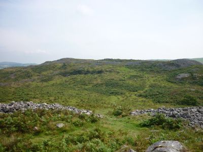
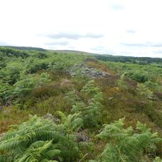
Y Garn Goch, Iron Age hillfort in Carmarthenshire, Wales
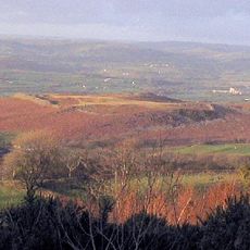
Y Garn Goch is an Iron Age hillfort in Carmarthenshire, Wales, rising to approximately 236 meters and featuring two separate fortifications called Y Gaer Fawr and Y Gaer Fach positioned along its ridge. The larger fort covers significantly more ground than the smaller one, and both structures follow the contours of the hilltop.
The hillfort was built and fortified between 47 and 78 AD as a defensive settlement during the Iron Age expansion in the region. Archaeological evidence shows the site saw human activity from around 600 BC until approximately 300 AD, indicating a long period of habitation and use.
The Welsh name Y Garn Goch means 'the red cairn', referring to the reddish sandstone formations visible throughout the hilltop. This name reflects how locals have long connected the landscape's natural colors to its identity.
The site is accessible via public footpaths from a designated parking area, with a moderate walk of around 15 minutes to reach the first fort. Wear sturdy footwear as the ground is uneven and can become slippery when wet.
The larger fort, Y Gaer Fawr, contains six entrance points marked by standing stones that once supported wooden gates and controlled access to the settlement. This arrangement reveals the careful defensive planning of the Iron Age builders.
The community of curious travelers
AroundUs brings together thousands of curated places, local tips, and hidden gems, enriched daily by 60,000 contributors worldwide.