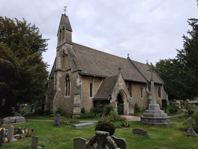
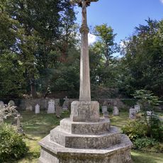
Holy Trinity Church, Anglican parish church in Headington Quarry, Oxford, England.
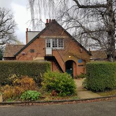
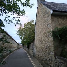
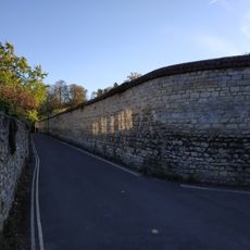
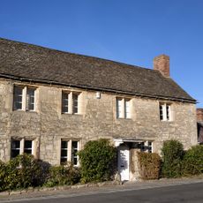
Holy Trinity Church is a Grade II listed building with limestone walls and slate roof located in the Headington Quarry district. The structure displays characteristic Victorian architectural features and holds a notable place in this area that was once shaped by stone quarrying work.
The church was founded in 1848 to serve the growing population of stone quarry workers and their families in Headington Quarry. Its construction during the Victorian period documents the industrial development and rise of residential communities tied to the local stone industry.
The church serves as a gathering place where regular Sunday services bring together people from the neighborhood for communal worship. These gatherings help shape the local community's social and spiritual rhythms throughout the year.
Visitors can find the church easily in this established neighborhood where regular activities take place. The community also offers smaller gatherings in private homes, creating flexible opportunities to participate in various activities.
The community connects local service with global outreach, supporting mission work in different parts of the world. This blend of neighborhood focus and worldwide involvement gives the congregation a distinctive character.
Location: Oxford
Inception: 1848
Address: 46 Quarry Road, Headington, Oxford OX3 8NU, UK
Website: http://hthq.org.uk
GPS coordinates: 51.75770,-1.19800
Latest update: December 9, 2025 18:47
The Kilns
560 m
Headington Shark
1.1 km
CS Lewis Nature Reserve
569 m
Rock Edge Nature Reserve
613 m
Brasenose Wood and Shotover Hill
1.1 km
The Kilns (C S Lewis House)
561 m
White Hart Inn
1.2 km
The Britannia Public House
1.1 km
Church of England School
74 m
Bury Knowle
967 m
Pavement Fronting Numbers 10 To 14
1.2 km
1 and 2, North Place
1 km
Headington Quarry War Memorial
14 m
Wall of Mathers Farm Fronting Larkins Lane
1.2 km
Stone In London Road Outside Number 196
690 m
9, The Croft
1.2 km
10, St Andrews Road
1.2 km
1 and 3, St Andrews Road
1.2 km
Building At Rear Of Number 12 (Fronting The Croft)
1.2 km
Barn Of Mathers Farm
1.1 km
11, The Croft
1.2 km
Boundary Wall Of Number 56 Fronting The Croft
1.1 km
Wall of Headington House
1.1 km
Boundary Wall Of Bury Knowle
960 m
8, The Croft
1.2 km
1 and 2, Larkins Lane
1.2 km
Milestone Approximately 98 Metres West Of Junction With Merewood Avenue
1.2 km
Mathers Farmhouse
1.2 kmVisited this place? Tap the stars to rate it and share your experience / photos with the community! Try now! You can cancel it anytime.
Discover hidden gems everywhere you go!
From secret cafés to breathtaking viewpoints, skip the crowded tourist spots and find places that match your style. Our app makes it easy with voice search, smart filtering, route optimization, and insider tips from travelers worldwide. Download now for the complete mobile experience.
A unique approach to discovering new places❞
— Le Figaro
All the places worth exploring❞
— France Info
A tailor-made excursion in just a few clicks❞
— 20 Minutes