Stanmore Country Park, London, Nature reserve in Stanmore, London, United Kingdom
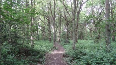
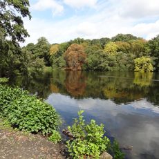
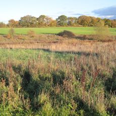
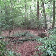
Stanmore Country Park is a nature reserve in Stanmore, London, featuring ancient woodland with wild service trees and hornbeam, interspersed with grassland areas that vary in soil composition. The different habitat types support a wide range of plant and animal species throughout the site.
The land was part of Warren House estate in the 18th century before the Middlesex County Council acquired it in 1937 to create public space. This acquisition protected the woodland from development.
Local volunteer wardens maintain the park's biodiversity by conducting species monitoring and implementing conservation measures throughout the protected area.
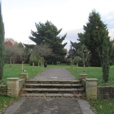
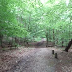
You can enter the park through gateways at Kerry Avenue and Dennis Lane, with a walking trail that passes through different landscapes. Wear sturdy shoes as the ground varies and can be uneven in places.
The site contains many ant nest mounds scattered through the woodland, which reveal that these areas were grassland in recent times. These traces keep the land's history visible in today's landscape.
GPS coordinates: 51.62180,-0.30698
Latest update: December 12, 2025 12:06
The Hive Stadium
2.4 km
Stanmore and Canons Park Synagogue
570 m
Edgwarebury Park
1.7 km
Bentley Priory Nature Reserve
1.6 km
Railway Hotel
2.3 km
Harrow Weald Common
2.7 km
St John the Evangelist, Great Stanmore
867 m
Church of St Lawrence, Little Stanmore
1.9 km
Aldenham Reservoir
2.7 km
Seven Balls
2 km
Chandos Mausoleum
1.9 km
Edgware Way Grassland
1.3 km
St Margaret of Antioch, Edgware
2.3 km
Harrow Weald SSSI
2.6 km
Church of St Nicholas
2.7 km
Church of St John
861 m
Old Stanmore Church
912 m
Church of All Saints
2.2 km
Garden Temple, Supporting Walls And Raised Paved Area In Canons Park
1.2 km
Abercorn Arms Public House
622 m
Convent Of St Mary At The Cross
2.7 km
Stanmore War Memorial
856 m
Edgware War Memorial
2.2 km
Grave Of Captain Leefe Robinson VC
2.2 km
K6 Telephone Kiosk Outside The Abercorn Arms Public House
623 m
Days Almshouses
1.7 km
Brockley Hill Romano-British pottery and settlement
1.2 km
Boundary Stone About 70 Metres South West Of Number 180
2.4 kmVisited this place? Tap the stars to rate it and share your experience / photos with the community! Try now! You can cancel it anytime.
Discover hidden gems everywhere you go!
From secret cafés to breathtaking viewpoints, skip the crowded tourist spots and find places that match your style. Our app makes it easy with voice search, smart filtering, route optimization, and insider tips from travelers worldwide. Download now for the complete mobile experience.
A unique approach to discovering new places❞
— Le Figaro
All the places worth exploring❞
— France Info
A tailor-made excursion in just a few clicks❞
— 20 Minutes