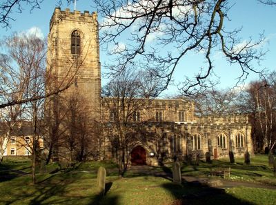
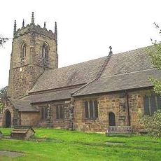
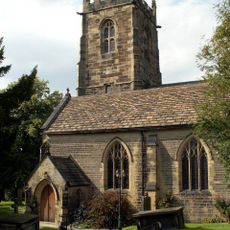
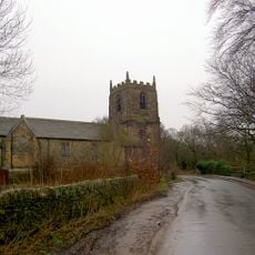
Church of All Saints, Parish church in Darton, England
The Church of All Saints is a stone parish church in Darton with a gilded hammer beam roof in the nave. The interior displays Victorian stained glass windows and features original roof bosses throughout the structure.
Construction of the church began in 1480 on the site of two earlier structures dating back to 1160. The current building was completed in 1517.
The interior shows medieval stone carvings with decorative details on the choir stalls and four Green Men figures carved into the stone. These handcrafted details reveal the skill of the artisans who worked on the building.
Access to the building is limited to certain times, so visitors should check opening hours before planning a visit. The church sits centrally in the village with parking available nearby for convenience.
An 11th-century stone altar was discovered in 1924 after being hidden during the Reformation. The altar remains in its original position inside the building today.
Location: Darton
Location: Barnsley
Inception: 16 century
GPS coordinates: 53.58490,-1.53154
Latest update: December 14, 2025 18:45
Woolley Hall
3.6 km
Church In Bretton Park
3.7 km
Church of St Paul
3.6 km
Church of St Peter, Woolley
3.2 km
Church of All Saints
3.3 km
Church of All Hallows
3.7 km
Rock Well approximately 50 metres west of Dam Head Cottages in Bretton Park
3.3 km
Archway Lodge In Bretton Park Including Flanking Walls
3.9 km
Milepost Approximately 600 Metres South Of Junction With Park Road
3.8 km
Bridge over The Cut (east end) in Bretton Park
3.4 km
Birthwaite Hall Including Attached Range To West
1.2 km
Milepost Approximately 500 Metres North Of Junction With Barugh Green Lane
1.7 km
Barugh Bridge
1.2 km
Milepost Aproximately 500 Metres West Of Junction With Claycliffe Road
2 km
Victoria Jubilee Museum
3.3 km
Footbridge Over Pond Approximately 600 Metres North East Of Cascade Bridge In Cannon Hall Park
3.7 km
Milestone Opposite Number 9 Malt Kiln
3.3 km
Windhill Gate Farmhouse An Attached Outbuildings
1.8 km
Milepost Approximately 150 Metres West Of Rowland Road
2.9 km
Milestone Approximately 200 Metres North Of Junction With Spring Lane
2.8 km
Milestone Approximately 600 Metres East Of Barnby Hall Farm
2.2 km
Milestone Approximately 100 Metres South Of Track To Snapethorpe Farm
1.4 km
Footbridge in Menagerie Wood approximately 200 metres south east of Cascade Bridge in Bretton Park
3.7 km
Guide Post Opposite East End Of Kirkfield Close
3.2 km
Overflow to Lower Lake, 3 weirs to east side of dam and pump house adjacent to Middle Weir in Bretton Park
3.4 km
Milestone, on green just off A635 at Cawthorne
3.2 km
Milestone, 175m N of Woolley X-roads, adj SLOW on road
3.9 km
Milestone, third of a mile west of TI jct of A635/A637 (Redbrook)
2 kmVisited this place? Tap the stars to rate it and share your experience / photos with the community! Try now! You can cancel it anytime.
Discover hidden gems everywhere you go!
From secret cafés to breathtaking viewpoints, skip the crowded tourist spots and find places that match your style. Our app makes it easy with voice search, smart filtering, route optimization, and insider tips from travelers worldwide. Download now for the complete mobile experience.
A unique approach to discovering new places❞
— Le Figaro
All the places worth exploring❞
— France Info
A tailor-made excursion in just a few clicks❞
— 20 Minutes