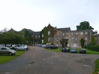
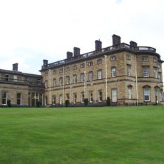
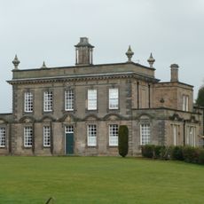
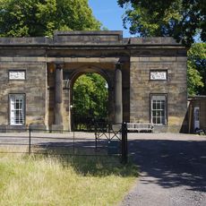
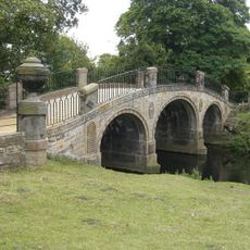
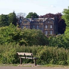
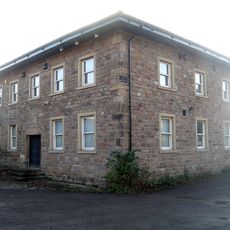
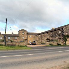
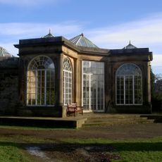
Woolley Hall, Grade II* listed house in Woolley, England.
Woolley Hall is a sandstone house with an H-shaped layout, slate roof, and two distinct wings extending from a central section. Inside, the rooms contain decorative elements and a grand staircase made from oak.
The house was built starting in 1635 after changes in land ownership brought new resources to the estate. The building grew and was modified over time as different owners added their own touches.
The building reflects early Jacobean architectural tastes in how its rooms and halls are arranged and decorated. The way spaces are organized shows what mattered to those who shaped the house over the centuries.
The hall now serves as a venue for events and conferences under local council management. Access may vary depending on what events are scheduled, so it is best to check ahead before planning a visit.
The estate has passed through the hands of notable families over several centuries, each leaving their mark on how the property developed. These layers of ownership are woven into the building itself in ways visitors may not immediately notice.
Location: Woolley
GPS coordinates: 53.61340,-1.50720
Latest update: December 12, 2025 14:25
Yorkshire Sculpture Park
4.1 kmBretton Hall College
4.3 km
Bretton Hall
4.3 km
Kettlethorpe Hall
3.7 km
Church of St John the Divine, Calder Grove
4.2 km
Church of St John the Baptist
4.2 km
Church In Bretton Park
3.7 km
Church of All Saints
3.6 km
Church of St Peter, Woolley
767 m
Church of St James
2.8 km
Rock Well approximately 50 metres west of Dam Head Cottages in Bretton Park
3.8 km
Archway Lodge In Bretton Park Including Flanking Walls
3.8 km
Milepost Approximately 600 Metres South Of Junction With Park Road
3.6 km
Bridge over The Cut (east end) in Bretton Park
3.7 km
Birthwaite Hall Including Attached Range To West
3.7 km
Wheelhouse Restaurant
2.8 km
Barugh Bridge
4 km
Windhill Gate Farmhouse An Attached Outbuildings
1.8 km
Milepost Approximately 1000 Metres North East Of West Bretton Traffic Island
4.3 km
Milestone Approximately 10 Metres North Of Junction With Branch Road
3.9 km
Overflow to Lower Lake, 3 weirs to east side of dam and pump house adjacent to Middle Weir in Bretton Park
3.7 km
The Boat House
2.6 km
Wayside cross known as Kirk Cross
4.3 km
Milestone Approximately 200 Metres North Of Junction With Spring Lane
1.8 km
Camellia House in Bretton Park approximately 80 metres west of Bretton Hall
4.5 km
Milestone Approximately 100 Metres South Of Track To Snapethorpe Farm
4 km
Footbridge in Menagerie Wood approximately 200 metres south east of Cascade Bridge in Bretton Park
4.5 km
Milestone, 175m N of Woolley X-roads, adj SLOW on road
792 mVisited this place? Tap the stars to rate it and share your experience / photos with the community! Try now! You can cancel it anytime.
Discover hidden gems everywhere you go!
From secret cafés to breathtaking viewpoints, skip the crowded tourist spots and find places that match your style. Our app makes it easy with voice search, smart filtering, route optimization, and insider tips from travelers worldwide. Download now for the complete mobile experience.
A unique approach to discovering new places❞
— Le Figaro
All the places worth exploring❞
— France Info
A tailor-made excursion in just a few clicks❞
— 20 Minutes