Enable Location

We need your location to show you interesting places around you

Discover nearby places

Find interesting locations and hidden gems around you

Precise directions

Get accurate directions and distances to places

Your location is never shared with other users. It's only used when you tap the location button.

Mannington Hall

Log in to your account

Start exploring — it's free

Trusted by 65,834 travelers worldwide

Continue with Google
Continue with Apple
or

We will send you a code to connect

By continuing, you accept our Terms and Conditions and our Privacy Policy

Check your inbox

We've sent a pincode in your inbox. Please enter the code below.

Discussion Reviews 1 Photos
8.6k Popularity

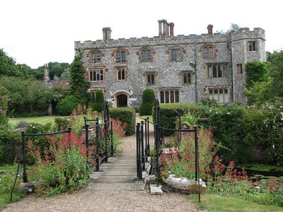
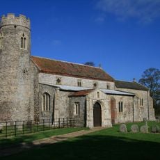
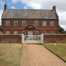
Mannington Hall, Medieval country house in Itteringham, England.

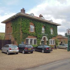
Mannington Hall is a 15th-century manor house in Itteringham, Norfolk, surrounded by a moat on all sides. The building features towers and mullioned windows, with a layout that reflects the defensive priorities of the period in which it was built.

The house was built around 1460 by William Lumnor, who obtained oak timber from John Paston for its construction. In the 18th century, Horace Walpole, 2nd Earl of Orford, made substantial changes to the property, shaping much of what visitors see today.

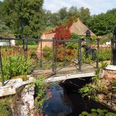
The rose garden is divided into sections, each dedicated to a different period in the history of rose cultivation. Walking through them feels like moving through time, with older varieties grown just as they would have been centuries ago.

The gardens open to visitors from May through September, while the paths around the grounds can be walked year-round. Sturdy footwear is a good idea, as paths can be uneven or muddy depending on the weather.

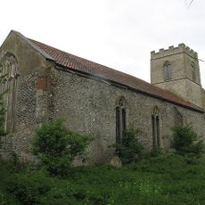
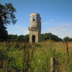
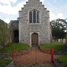
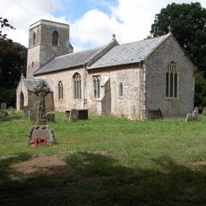
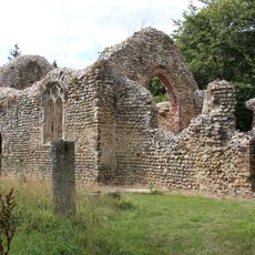
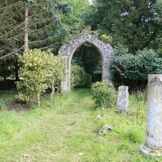
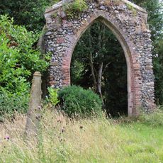
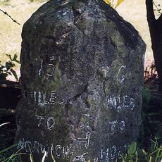
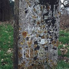
Hidden within woodland to the southwest of the house are the ruins of an 11th-century church that most visitors never notice. Nearby, a collection of ancient inscriptions gathered by Horace Walpole has been set into the walls of the estate, making the grounds something of an open-air display.

The community of curious travelers

AroundUs brings together thousands of curated places, local tips, and hidden gems, enriched daily by 60,000 contributors worldwide.

Start exploring
Location
GPS coordinates
52.84290,1.18171
Latest update
March 3, 2026 08:19
Around this place
The Mausoleum
United Kingdom

The Mausoleum

3.4 km
Wolterton Hall
United Kingdom

Wolterton Hall

2 km
Barningham Hall
United Kingdom

Barningham Hall

3.4 km
Church of St Michael
United Kingdom

Church of St Michael

3.1 km
Church of St Andrew, Wickmere
United Kingdom

Church of St Andrew, Wickmere

2.8 km
Church of St Margaret
United Kingdom

Church of St Margaret

3.8 km
Church of St Peter
United Kingdom

Church of St Peter

3.9 km
Church of St Margaret
United Kingdom

Church of St Margaret

2 km
Church of St Andrew
United Kingdom

Church of St Andrew

1.3 km
Church of St Mary, Barningham Winter
United Kingdom

Church of St Mary, Barningham Winter

3.7 km
Church of St Peter
United Kingdom

Church of St Peter

3 km
Church of St Andrew
United Kingdom

Church of St Andrew

3.2 km
Church of St Peter and St Paul
United Kingdom

Church of St Peter and St Paul

3.6 km
Church of St Mary
United Kingdom

Church of St Mary

1 km
Temple In Garden Of Mannington Hall Circa 50 Metres South Of South East Corner Of Moat
United Kingdom

Temple In Garden Of Mannington Hall Circa 50 Metres South Of South East Corner Of Moat

105 m
Remains of Parish Church of Mannington
United Kingdom

Remains of Parish Church of Mannington

241 m
Congregational Chapel
United Kingdom

Congregational Chapel

2.8 km
Arch 12 Metres South East Of Chancel Of Mannington Church
United Kingdom

Arch 12 Metres South East Of Chancel Of Mannington Church

241 m
Saracen's Head
United Kingdom

Saracen's Head

2.7 km
Itteringham War Memorial
United Kingdom

Itteringham War Memorial

1.1 km
Draw Bridge At Mannington Hall
United Kingdom

Draw Bridge At Mannington Hall

26 m
The Tower House
United Kingdom

The Tower House

3.6 km
Arch Circa 9 Metres South West Of Nave Of Mannington Church
United Kingdom

Arch Circa 9 Metres South West Of Nave Of Mannington Church

249 m
Little Barningham War Memorial
United Kingdom

Little Barningham War Memorial

1.3 km
Walls To Garden And Moat, Bridge And Attached Gazebo And Arch At Mannington Hall
United Kingdom

Walls To Garden And Moat, Bridge And Attached Gazebo And Arch At Mannington Hall

30 m
Manor Farm House And Attached Garden Walls
United Kingdom

Manor Farm House And Attached Garden Walls

1.3 km
Milestone, opp. sign for rd narrows and bridge weight limit
United Kingdom

Milestone, opp. sign for rd narrows and bridge weight limit

3.5 km
Milestone, between Wolterton Hall and church ruins
United Kingdom

Milestone, between Wolterton Hall and church ruins

2 km
Show the full map
Reviews
Share your experience

No review yet

Discussions
Start a discussion...

No discussion yet

« Mannington Hall - Medieval country house in Itteringham, England » is provided by Around Us (aroundus.com). Images and texts are derived from Wikimedia project under a Creative Commons license. You are allowed to copy, distribute, and modify copies of this page, under the conditions set by the license, as long as this note is clearly visible.

Discover hidden gems everywhere you go!

From secret cafés to breathtaking viewpoints, skip the crowded tourist spots and find places that match your style. Our app makes it easy with voice search, smart filtering, route optimization, and insider tips from travelers worldwide. Download now for the complete mobile experience.

Around Us App Screenshot

A unique approach to discovering new places

Le Figaro

All the places worth exploring

France Info

A tailor-made excursion in just a few clicks

20 Minutes

Around Us
Travel Guide & Maps
Download

Send to your phone

QR Code
1

Open the camera app on your mobile.

2

Point at the QR code with your camera. A notification will appear.

3

Tap the notification to open the link.