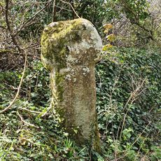
Lesingey Round, Iron Age ringfort near Penzance, England
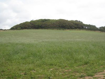
Lesingey Round is an Iron Age ringfort near Penzance that features a circular earthwork with a raised bank and ditch surrounding it. The structure sits on a hillside and overlooks Mount's Bay, standing about 4.5 meters (15 feet) above ground level.
This ringfort was built during the Iron Age to serve defensive and residential purposes. The site gained scheduled monument status in 1958, officially protecting its archaeological remains for future study and preservation.
The circular earthwork shows how Iron Age communities organized their living spaces for both defense and daily farming work. The design reflects practical choices people made to protect their families and livestock while settling in this coastal area.
The site sits about 1.5 kilometers (1 mile) west of Penzance town center and is accessible from nearby roads. The terrain is uneven and exposed to weather, so wear sturdy footwear and check conditions before heading out.
The site has two names: Lesingey Round in English and Ker Lysyngi in Cornish, preserving the region's older linguistic identity. This dual naming reflects how local history and the Celtic language of Cornwall remain intertwined in the landscape today.
The community of curious travelers
AroundUs brings together thousands of curated places, local tips, and hidden gems, enriched daily by 60,000 contributors worldwide.