Enable Location

We need your location to show you interesting places around you

Discover nearby places

Find interesting locations and hidden gems around you

Precise directions

Get accurate directions and distances to places

Your location is never shared with other users. It's only used when you tap the location button.

Kūh-e Hezār

Log in to your account

Start exploring — it's free

Trusted by 65,435 travelers worldwide

Continue with Google
Continue with Apple
or

We will send you a code to connect

By continuing, you accept our Terms and Conditions and our Privacy Policy

Check your inbox

We've sent a pincode in your inbox. Please enter the code below.

Kūh-e Hezār
Discussion Reviews 1 Photos
4k Popularity

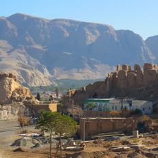
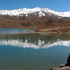
Kūh-e Hezār, Mountain peak in Kerman Province, Iran

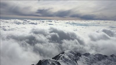
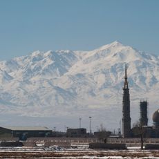
Kūh-e Hezār is a mountain summit in Kerman Province, Iran, reaching around 4,500 feet (4,500 m) and ranking among the highest peaks in the country. Its slopes pass through several distinct elevation bands, from forested lower zones to bare rock near the top.

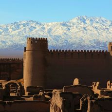
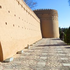
The mountain was long used as a passage route by travelers crossing through the Kerman region, making it part of the area's geography for centuries. Stone structures near the summit point to earlier human presence and a possible connection to old beliefs.

The name comes from the Persian word 'hezar', meaning 'thousand', referring to the many wild plants found on its slopes. Hikers moving through the lower elevations notice how the plant cover changes noticeably as they gain height.

The main approach follows the northern route from Rain Waterfall, with a mountain shelter at around 10,170 ft (3,100 m) offering basic accommodation. Starting the climb early in the morning is advisable, as weather at high elevation can change quickly.

The village of Bab Zangi sits on the mountain slopes at around 10,800 ft (3,300 m) and is considered one of the highest permanently inhabited settlements in the country. Life there continues through winter, even though conditions at that elevation are very harsh.

The community of curious travelers

AroundUs brings together thousands of curated places, local tips, and hidden gems, enriched daily by 60,000 contributors worldwide.

Start exploring
Location
Elevation above the sea
4,500 m
GPS coordinates
29.51172,57.27108
Latest update
March 3, 2026 14:04
Reviews
Share your experience

No review yet

Discussions
Start a discussion...

No discussion yet

« Kūh-e Hezār - Mountain peak in Kerman Province, Iran » is provided by Around Us (aroundus.com). Images and texts are derived from Wikimedia project under a Creative Commons license. You are allowed to copy, distribute, and modify copies of this page, under the conditions set by the license, as long as this note is clearly visible.

Discover hidden gems everywhere you go!

From secret cafés to breathtaking viewpoints, skip the crowded tourist spots and find places that match your style. Our app makes it easy with voice search, smart filtering, route optimization, and insider tips from travelers worldwide. Download now for the complete mobile experience.

Around Us App Screenshot

A unique approach to discovering new places

Le Figaro

All the places worth exploring

France Info

A tailor-made excursion in just a few clicks

20 Minutes

Around Us
Travel Guide & Maps
Download

Send to your phone

QR Code
1

Open the camera app on your mobile.

2

Point at the QR code with your camera. A notification will appear.

3

Tap the notification to open the link.