Enable Location

We need your location to show you interesting places around you

Discover nearby places

Find interesting locations and hidden gems around you

Precise directions

Get accurate directions and distances to places

Your location is never shared with other users. It's only used when you tap the location button.

Monte Gariglione

Log in to your account

Start exploring — it's free

Trusted by 63,523 travelers worldwide

Continue with Google
Continue with Apple
or

We will send you a code to connect

By continuing, you accept our Terms and Conditions and our Privacy Policy

Check your inbox

We've sent a pincode in your inbox. Please enter the code below.

Monte Gariglione
Discussion Reviews 1 Photos
2.3k Popularity

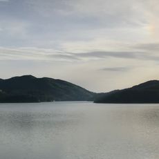
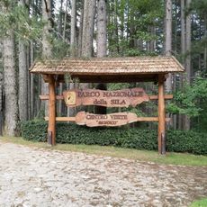
Monte Gariglione, Mountain summit in Sila National Park, Italy.

Monte Gariglione is a mountain summit in Sila National Park that rises to about 1765 meters. The peak is surrounded by forests of beech, fir, and aspen trees interspersed with granite outcrops that emerge from the landscape.

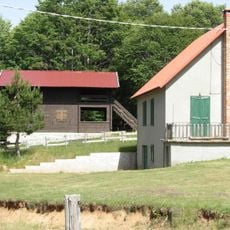
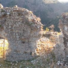
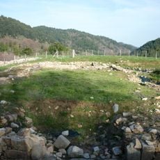
Barracks were built on the mountain's slopes in 1908 to process timber for railway sleepers, but operations were abandoned just six years later in 1914. This brief industrial chapter eventually gave way to the natural landscape visitors see today.

Ancient Greeks named the mountain after the Turkey oak, which they considered sacred to Zeus and planted extensively throughout the region.

You can reach the summit by following a trail from the barracks site that takes roughly two hours of walking. The route is straightforward to hike with gradual elevation gain throughout.

During winter, the mountain slopes transform into suitable terrain for cross-country skiing with paths overlooking valleys below. Many visitors are surprised to discover this winter sports option in the southern Italian landscape.

The community of curious travelers

AroundUs brings together thousands of curated places, local tips, and hidden gems, enriched daily by 60,000 contributors worldwide.

Start exploring
Elevation above the sea
1,765 m
GPS coordinates
39.13673,16.64198
Latest update
December 13, 2025 11:41
Reviews
Share your experience

No review yet

Discussions
Start a discussion...

No discussion yet

« Monte Gariglione - Mountain summit in Sila National Park, Italy » is provided by Around Us (aroundus.com). Images and texts are derived from Wikimedia project under a Creative Commons license. You are allowed to copy, distribute, and modify copies of this page, under the conditions set by the license, as long as this note is clearly visible.

Discover hidden gems everywhere you go!

From secret cafés to breathtaking viewpoints, skip the crowded tourist spots and find places that match your style. Our app makes it easy with voice search, smart filtering, route optimization, and insider tips from travelers worldwide. Download now for the complete mobile experience.

Around Us App Screenshot

A unique approach to discovering new places

Le Figaro

All the places worth exploring

France Info

A tailor-made excursion in just a few clicks

20 Minutes

Around Us
Travel Guide & Maps
Download

Send to your phone

QR Code
1

Open the camera app on your mobile.

2

Point at the QR code with your camera. A notification will appear.

3

Tap the notification to open the link.