Sakura Bridge, Footbridge in Sumida Park, Japan
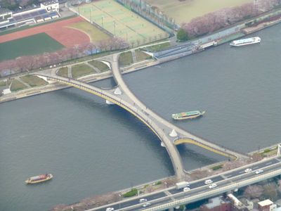
Sakura Bridge is a pedestrian crossing over the Sumida River with a distinctive X-shaped structure connecting the Taito and Sumida districts of Tokyo. The design allows views of both riverbanks and surrounding parks from different vantage points along its span.
The bridge opened in April 1985 and later received the Tanaka Prize from the Japan Society of Civil Engineers for its engineering achievement. This structure marked a turning point in connecting the riverside communities across the Sumida.
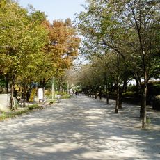
The bridge takes its name from the Japanese cherry blossom viewing tradition, as hundreds of sakura trees line both sides of Sumida Park. On warm days, you can see visitors picnicking beneath the flowering branches, with blossoms falling like snow onto the paths below.
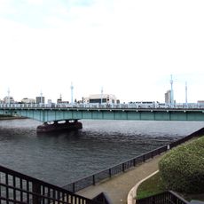
Access to the bridge comes through multiple entry points from Sumida Park, with Asakusa station on the Ginza Line being the nearest public transport option. Walking from the park itself offers the most natural way to reach and cross the span.
The X-shaped design was innovative at the time of completion and creates multiple vantage points along its length that serve different purposes. From various spots, visitors can observe both the annual fireworks in July and glimpse Tokyo Skytree standing in the distance.
The community of curious travelers
AroundUs brings together thousands of curated places, local tips, and hidden gems, enriched daily by 60,000 contributors worldwide.