Chest opened
+${chestReward.xp} XP
Explorer
NOUVEAU ×${chestReward.collectible.quantity}
tapez pour fermer

See the monuments around you in AR Open chests in the app

Around Us is built for your phone — point your camera at the streets and discover the monuments and places around you in augmented reality. Around Us is built for your phone — chests unlock when you walk, explore and capture nearby places.

•

Enable Location

We need your location to show you interesting places around you

Discover nearby places

Find interesting locations and hidden gems around you

Precise directions

Get accurate directions and distances to places

Your location is never shared with other users. It's only used when you tap the location button.

Kototoi Bridge

Log in to your account

Start exploring — it's free

Trusted by 94,369 travelers worldwide

Continue with Google
Continue with Apple
or

We will send you a code to connect

By continuing, you accept our Terms and Conditions and our Privacy Policy

Check your inbox

We've sent a pincode in your inbox. Please enter the code below.

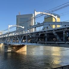
Kototoi Bridge, Historic bridge in Asakusa, Tokyo, Japan

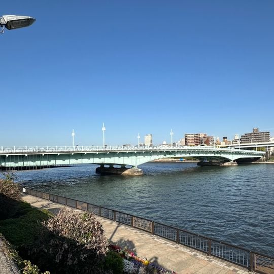
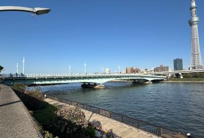
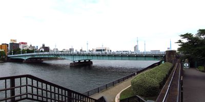
The Kototoi Bridge is a 238.7-meter steel three-span cantilever plate girder bridge over the Sumida River, linking Taitō and Sumida wards. Its pale green steel deck rests on two rounded concrete piers, with a shallow arched underside and slender white lampposts along the railing.

The crossing completed in 1928 replaced the Edo-period ferry Takeya-no-Watashi that once operated at this location. The structure later earned recognition as a Tokyo Metropolitan Government-designated heritage site.

The name comes from a waka by Ariwara no Narihira asking after a lost love, though the poem's setting was the Hashiba ferry near present-day Shirahige Bridge. A stronger claim links it to Kototoi dango, sold since 1871 by Toyama Sakichi, whose shop gave the area the nickname Kototoi-ga-oka. Kawabata Yasunari called the bridge "male" against the curved, "female" Kiyosu Bridge.

The crossing provides direct access to Sumida Park and connects with the Tobu Isesaki Line nearby. Pedestrians can use the width of the span to reach both riverbanks and enjoy views of the waterway.

The span became a gathering point for many people during the March 1945 air raids over Tokyo. The events of that night left visible traces that remain on the stone balustrades today.

The community of curious travelers

AroundUs brings together thousands of curated places, local tips, and hidden gems, enriched daily by 94,369 contributors worldwide.
Start exploring
Location
Location
Location
Location
Mukōjima
Inception
February 10, 1928
GPS coordinates
35.71406,139.80364
Latest update
October 31, 2026 22:16
Reviews
Share your experience

No review yet

Discussions
Start a discussion...

No discussion yet

« Kototoi Bridge - Historic bridge in Asakusa, Tokyo, Japan » is provided by Around Us (aroundus.com). Images and texts are derived from Wikimedia project under a Creative Commons license. You are allowed to copy, distribute, and modify copies of this page, under the conditions set by the license, as long as this note is clearly visible.

Discover hidden gems everywhere you go!

From secret cafés to breathtaking viewpoints, skip the crowded tourist spots and find places that match your style. Our app makes it easy with voice search, smart filtering, route optimization, and insider tips from travelers worldwide. Download now for the complete mobile experience.

Around Us App Screenshot
❝

A unique approach to discovering new places❞

— Le Figaro

❝

All the places worth exploring❞

— France Info

❝

A tailor-made excursion in just a few clicks❞

— 20 Minutes

Around Us
Travel Guide & Maps
Download

Send to your phone

QR Code
1

Open the camera app on your mobile.

2

Point at the QR code with your camera. A notification will appear.

3

Tap the notification to open the link.