Enable Location

We need your location to show you interesting places around you

Discover nearby places

Find interesting locations and hidden gems around you

Precise directions

Get accurate directions and distances to places

Your location is never shared with other users. It's only used when you tap the location button.

Mount Tenbo

Log in to your account

Start exploring — it's free

Trusted by 63,029 travelers worldwide

Continue with Google
Continue with Apple
or

We will send you a code to connect

By continuing, you accept our Terms and Conditions and our Privacy Policy

Check your inbox

We've sent a pincode in your inbox. Please enter the code below.

Mount Tenbo
Discussion Reviews 1 Photos
900+ Popularity

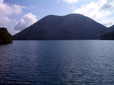
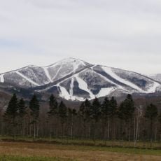
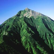
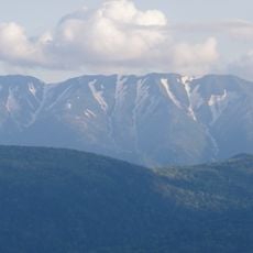
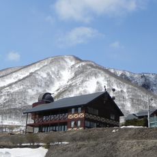
Mount Tenbo, Lava dome in Kamishihoro, Japan.

Mount Tenbo is a lava dome in Kamishihoro that rises about 1,174 meters (3,850 feet) with steep slopes covered in dense vegetation and volcanic rock. The geological structure creates distinctive shapes and surfaces visible from many angles.

The lava dome formed through volcanic processes near the Kikai Caldera, which erupted about 7,300 years ago. This volcanic activity shaped the landscape that visitors see today.

The lava dome shapes the local landscape that hikers encounter directly, with its volcanic form dominating the surroundings. The steep slopes and their plant life show how nature has reclaimed this volcanic terrain over time.

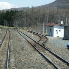
Hiking trails are accessible through established transportation routes and offer varying difficulty levels through volcanic terrain. It is wise to wear sturdy footwear and bring water and snacks before starting the hike.

Scientists regularly study the lava dome's structure to understand magmatic movements and potential volcanic activity in the region. These ongoing observations give visitors a sense of living geological processes at work.

The community of curious travelers

AroundUs brings together thousands of curated places, local tips, and hidden gems, enriched daily by 60,000 contributors worldwide.

Start exploring
Location
Elevation above the sea
1,174 m
GPS coordinates
43.26413,143.12502
Latest update
December 14, 2025 20:31
Reviews
Share your experience

No review yet

Discussions
Start a discussion...

No discussion yet

« Mount Tenbo - Lava dome in Kamishihoro, Japan » is provided by Around Us (aroundus.com). Images and texts are derived from Wikimedia project under a Creative Commons license. You are allowed to copy, distribute, and modify copies of this page, under the conditions set by the license, as long as this note is clearly visible.

Discover hidden gems everywhere you go!

From secret cafés to breathtaking viewpoints, skip the crowded tourist spots and find places that match your style. Our app makes it easy with voice search, smart filtering, route optimization, and insider tips from travelers worldwide. Download now for the complete mobile experience.

Around Us App Screenshot

A unique approach to discovering new places

Le Figaro

All the places worth exploring

France Info

A tailor-made excursion in just a few clicks

20 Minutes

Around Us
Travel Guide & Maps
Download

Send to your phone

QR Code
1

Open the camera app on your mobile.

2

Point at the QR code with your camera. A notification will appear.

3

Tap the notification to open the link.