Enable Location

We need your location to show you interesting places around you

Discover nearby places

Find interesting locations and hidden gems around you

Precise directions

Get accurate directions and distances to places

Your location is never shared with other users. It's only used when you tap the location button.

Log in to your account

Start exploring — it's free

Trusted by 64,725 travelers worldwide

Continue with Google
Continue with Apple
or

We will send you a code to connect

By continuing, you accept our Terms and Conditions and our Privacy Policy

Check your inbox

We've sent a pincode in your inbox. Please enter the code below.

福島大橋
Discussion Reviews Photo
1.4k Popularity

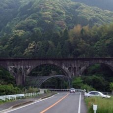
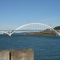
福島大橋, Prefectural road bridge between Imari and Matsuura, Japan

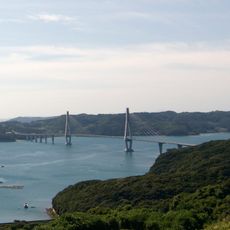
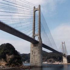
The Fukushima Bridge is a concrete structure that spans across Tatsunose Strait, connecting Imari City in Saga Prefecture to Matsuura City in Nagasaki Prefecture. The roadway measures 6 meters wide and was built with reinforced concrete beams to handle daily traffic between the two areas.

Construction of this bridge began in 1964 and was completed in 1967, marking an important milestone for transportation connectivity in northern Kyushu. The completion created a direct road link between the two prefectures where no such crossing previously existed.

This bridge forms part of Nagasaki Prefectural Road Route 103, serving as the only road connection between Fukushima and mainland Kyushu.

The bridge is free to drive across and provides the most direct route between the two prefectures without detours. Those exploring the region should know that this is the main passage connecting Imari and Matsuura.

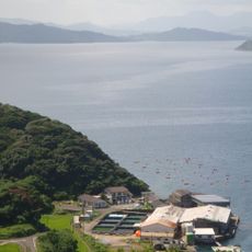
Located at coordinates 33.373139, 129.857583, the bridge provides essential connectivity for local fishing communities and agricultural transportation systems.

The community of curious travelers

AroundUs brings together thousands of curated places, local tips, and hidden gems, enriched daily by 60,000 contributors worldwide.

Start exploring
Location
Location
Part of
Nagasaki Prefectural Road and Saga Prefectural Road Route 103
GPS coordinates
33.37314,129.85758
Latest update
December 14, 2025 16:47
Reviews
Share your experience

No review yet

Discussions
Start a discussion...

No discussion yet

« 福島大橋 - Prefectural road bridge between Imari and Matsuura, Japan » is provided by Around Us (aroundus.com). Images and texts are derived from Wikimedia project under a Creative Commons license. You are allowed to copy, distribute, and modify copies of this page, under the conditions set by the license, as long as this note is clearly visible.

Discover hidden gems everywhere you go!

From secret cafés to breathtaking viewpoints, skip the crowded tourist spots and find places that match your style. Our app makes it easy with voice search, smart filtering, route optimization, and insider tips from travelers worldwide. Download now for the complete mobile experience.

Around Us App Screenshot

A unique approach to discovering new places

Le Figaro

All the places worth exploring

France Info

A tailor-made excursion in just a few clicks

20 Minutes

Around Us
Travel Guide & Maps
Download

Send to your phone

QR Code
1

Open the camera app on your mobile.

2

Point at the QR code with your camera. A notification will appear.

3

Tap the notification to open the link.