Enable Location

We need your location to show you interesting places around you

Discover nearby places

Find interesting locations and hidden gems around you

Precise directions

Get accurate directions and distances to places

Your location is never shared with other users. It's only used when you tap the location button.

Vliehors

Log in to your account

Start exploring — it's free

Trusted by 63,243 travelers worldwide

Continue with Google
Continue with Apple
or

We will send you a code to connect

By continuing, you accept our Terms and Conditions and our Privacy Policy

Check your inbox

We've sent a pincode in your inbox. Please enter the code below.

Vliehors
Discussion Reviews 1 Photos
7.9k Popularity

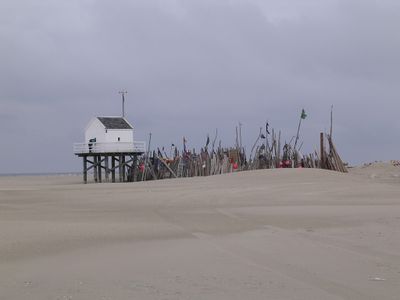
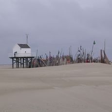
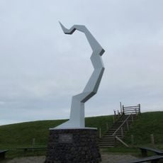
Vliehors, Military training area and beach on Vlieland, Netherlands.

Vliehors is a military training area and beach located on the western side of Vlieland, featuring extensive sand plains. The site functions as both an active training ground and a recreational area with distinct zones for different uses.

The area became a training ground for the Dutch Royal Air Force starting in the mid-20th century. Over time, recreational zones were gradually integrated alongside the military operations.

Local guides lead educational tours through the Vliehors Express, teaching visitors about the natural formations and military significance of this dual-purpose landscape.

You can visit on weekends when military exercises are not happening, though it is worth checking access conditions beforehand. Wear sturdy footwear and bring layers, as the exposed sand plain offers little shelter from wind or weather.

The plain supports bird species and plants adapted specifically to sandy, exposed conditions rarely found elsewhere in Europe. This combination of habitat and location makes it an important refuge for these specialized organisms.

The community of curious travelers

AroundUs brings together thousands of curated places, local tips, and hidden gems, enriched daily by 60,000 contributors worldwide.

Start exploring
Location
GPS coordinates
53.22970,4.90860
Latest update
December 8, 2025 20:00
Around this place
Eierland Lighthouse
Netherlands

Eierland Lighthouse

6.4 km
Dunes of Texel National Park
Netherlands

Dunes of Texel National Park

11.7 km
Drenkelingenhuisje, Vlieland
Netherlands

Drenkelingenhuisje, Vlieland

2.9 km
Eureka Orchideeën en Vogelbush
Netherlands

Eureka Orchideeën en Vogelbush

15 km
Het Posthuys
Netherlands

Het Posthuys

6 km
Luchtvaart- & Oorlogsmuseum Texel
Netherlands

Luchtvaart- & Oorlogsmuseum Texel

13.6 km
Het Noorden
Netherlands

Het Noorden

14.1 km
Waddenkerk, De Cocksdorp
Netherlands

Waddenkerk, De Cocksdorp

8.3 km
Duinen Vlieland
Netherlands

Duinen Vlieland

8.8 km
De Schicht
Netherlands

De Schicht

8.6 km
Francisca Romanakerk
Netherlands

Francisca Romanakerk

8.7 km
Organ of Francisca Romanakerk, De Cocksdorp
Netherlands

Organ of Francisca Romanakerk, De Cocksdorp

8.7 km
Stengweg 19, De Cocksdorp, Texel
Netherlands

Stengweg 19, De Cocksdorp, Texel

8.8 km
Monument voor verongelukte Stirling
Netherlands

Monument voor verongelukte Stirling

6.7 km
Woonhuis onder zadeldak, aan voorgevel houten voorschot met getoogd luik
Netherlands

Woonhuis onder zadeldak, aan voorgevel houten voorschot met getoogd luik

14.8 km
Woonhuis onder zadeldak tussen topgevels met houten voorschot; getoogd zolderluik
Netherlands

Woonhuis onder zadeldak tussen topgevels met houten voorschot; getoogd zolderluik

14.8 km
Boezemkolk met uitwateringskanelen, onderdeel uitmakend van het uitwateringscomplex van de polders "Het Noorden", "Eijerland", "Waal en Burg".
Netherlands

Boezemkolk met uitwateringskanelen, onderdeel uitmakend van het uitwateringscomplex van de polders "Het Noorden", "Eijerland", "Waal en Burg".

14.1 km
Voormalige uitwateringssluis met drie sluisdeuren en toevoerende kanalen, maakt onderdeel uit van het uitwateringscomplex van de polders "Het Noorden", "Eijerland", "Waal en Burg
Netherlands

Voormalige uitwateringssluis met drie sluisdeuren en toevoerende kanalen, maakt onderdeel uit van het uitwateringscomplex van de polders "Het Noorden", "Eijerland", "Waal en Burg

14.1 km
Pompgemaal van de polder Het Noorden, onderdeel uitmakend van het uitwateringscomplex van de polders "Het Noorden", "Eijerland", "Waal en Burg"
Netherlands

Pompgemaal van de polder Het Noorden, onderdeel uitmakend van het uitwateringscomplex van de polders "Het Noorden", "Eijerland", "Waal en Burg"

14.1 km
Gerekt woonhuis met houten voorschot waarin getoogd luik
Netherlands

Gerekt woonhuis met houten voorschot waarin getoogd luik

14.8 km
Hunsingo: oldambster boerderij
Netherlands

Hunsingo: oldambster boerderij

15.6 km
Postweg 70 en 72, De Cocksdorp, Texel
Netherlands

Postweg 70 en 72, De Cocksdorp, Texel

14.4 km
Woonhuisje onder zadeldak tussen topgevels met houten voorschot; getoogd zolderluik
Netherlands

Woonhuisje onder zadeldak tussen topgevels met houten voorschot; getoogd zolderluik

14.7 km
Monument ‘Dwangarbeiders’
Netherlands

Monument ‘Dwangarbeiders’

13.6 km
Oost 73, Oosterend
Netherlands

Oost 73, Oosterend

14.7 km
Woonhuis onder zadeldak tegen houten voorschot met getoogd luik
Netherlands

Woonhuis onder zadeldak tegen houten voorschot met getoogd luik

14.8 km
Dubbele arbeiderswoning met privaat
Netherlands

Dubbele arbeiderswoning met privaat

9.8 km
Woonhuis onder zadeldak; houten voorschot met getoogd zolderluik; twee vensters met negen ruiten
Netherlands

Woonhuis onder zadeldak; houten voorschot met getoogd zolderluik; twee vensters met negen ruiten

14.7 km
Show the full map
Reviews
Share your experience

No review yet

Discussions
Start a discussion...

No discussion yet

« Vliehors - Military training area and beach on Vlieland, Netherlands » is provided by Around Us (aroundus.com). Images and texts are derived from Wikimedia project under a Creative Commons license. You are allowed to copy, distribute, and modify copies of this page, under the conditions set by the license, as long as this note is clearly visible.

Discover hidden gems everywhere you go!

From secret cafés to breathtaking viewpoints, skip the crowded tourist spots and find places that match your style. Our app makes it easy with voice search, smart filtering, route optimization, and insider tips from travelers worldwide. Download now for the complete mobile experience.

Around Us App Screenshot

A unique approach to discovering new places

Le Figaro

All the places worth exploring

France Info

A tailor-made excursion in just a few clicks

20 Minutes

Around Us
Travel Guide & Maps
Download

Send to your phone

QR Code
1

Open the camera app on your mobile.

2

Point at the QR code with your camera. A notification will appear.

3

Tap the notification to open the link.