Enable Location

We need your location to show you interesting places around you

Discover nearby places

Find interesting locations and hidden gems around you

Precise directions

Get accurate directions and distances to places

Your location is never shared with other users. It's only used when you tap the location button.

Fort Henricus

Log in to your account

Start exploring — it's free

Trusted by 62,418 travelers worldwide

Continue with Google
Continue with Apple
or

We will send you a code to connect

By continuing, you accept our Terms and Conditions and our Privacy Policy

Check your inbox

We've sent a pincode in your inbox. Please enter the code below.

Fort Henricus

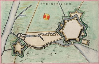
Fort Henricus, Military fort in De Heen, Netherlands

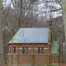
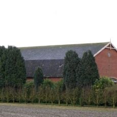
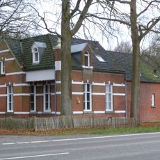
Fort Henricus is a military fortification near Steenbergen featuring five bastions surrounded by a water-filled moat. The complex includes residential buildings and functional structures arranged in a distinctive star-shaped layout.

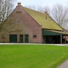
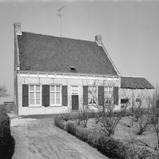
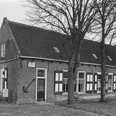
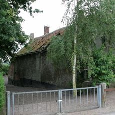
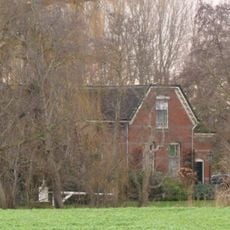
The fort was constructed in the 1620s to protect Steenbergen harbor and played an important role during several conflicts. By the early 19th century it lost its military importance and was later converted to agricultural use.

The fort once housed soldiers and their families who formed their own small community within its walls. The layout and remaining structures show how daily military life was organized in this isolated settlement.

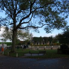
A marked walking path guides visitors through the site with informational signs explaining the fort's history and functions. The path is relatively flat and easy to follow, offering different views of the bastions and water-filled moat.

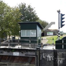
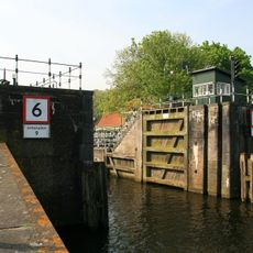
The fort contains a sophisticated sluice system that allowed defenders to intentionally flood surrounding fields as an additional defense strategy. This engineering technique could transform the landscape into impassable terrain when needed.

The community of curious travelers

AroundUs brings together thousands of curated places, local tips, and hidden gems, enriched daily by 60,000 contributors worldwide.

Start exploring
Location
Address
Schansdijk bij 5
GPS coordinates
51.60097,4.30593
Latest update
December 14, 2025 13:07
Around this place
Netherlands

Volkerak

5.5 km
Sint-Gummaruskerk
Netherlands

Sint-Gummaruskerk

1.6 km
Benedensas
Netherlands

Benedensas

4.4 km
Nederlands Hervormde Kerk, Steenbergen
Netherlands

Nederlands Hervormde Kerk, Steenbergen

1.8 km
Petrus- en Pauluskerk, Dinteloord
Netherlands

Petrus- en Pauluskerk, Dinteloord

6.2 km
Nieuwe watertoren
Netherlands

Nieuwe watertoren

2.1 km
Sint-Jacobskerk
Netherlands

Sint-Jacobskerk

1.8 km
De Vos
Netherlands

De Vos

4.2 km
Nederlands Hervormde Kerk (Dinteloord)
Netherlands

Nederlands Hervormde Kerk (Dinteloord)

6 km
Gibson en Warwickmonument
Netherlands

Gibson en Warwickmonument

1.8 km
Sint-Antonius van Paduakerk
Netherlands

Sint-Antonius van Paduakerk

6.1 km
Oorlogsmonument Steenbergen
Netherlands

Oorlogsmonument Steenbergen

1.8 km
Vredeskerk
Netherlands

Vredeskerk

2.8 km
Heilig Hartbeeld
Netherlands

Heilig Hartbeeld

1.7 km
Raadhuis Dinteloord
Netherlands

Raadhuis Dinteloord

6 km
Complex Afgeslechtedijk: woning
Netherlands

Complex Afgeslechtedijk: woning

2.4 km
De Heenwerf: schuur
Netherlands

De Heenwerf: schuur

5.1 km
Dorpswoning onder dwars, met pannen belegd zadeldak tussen zijtopgevels. In de gepleisterde voorgevel Empire schuiframen (zesdelig) en jaarankers
Netherlands

Dorpswoning onder dwars, met pannen belegd zadeldak tussen zijtopgevels. In de gepleisterde voorgevel Empire schuiframen (zesdelig) en jaarankers

6 km
Vlietdijk 4, Dinteloord
Netherlands

Vlietdijk 4, Dinteloord

4.4 km
Monument op de R.K. begraafplaats
Netherlands

Monument op de R.K. begraafplaats

2.1 km
Eenvoudige smederij annex woonhuis in Ambachtelijk-Traditionele bouwstij
Netherlands

Eenvoudige smederij annex woonhuis in Ambachtelijk-Traditionele bouwstij

3.4 km
De Heenwerf: woning
Netherlands

De Heenwerf: woning

5.1 km
Landgoed Dassenberg: neogotische kapel
Netherlands

Landgoed Dassenberg: neogotische kapel

5 km
Complex Afgeslechtedijk: schuur
Netherlands

Complex Afgeslechtedijk: schuur

2.4 km
Landgoed Dassenberg: boswachterswoning (annex tramstation)
Netherlands

Landgoed Dassenberg: boswachterswoning (annex tramstation)

5 km
Benedenas van de Roosendaalse en Steenbergse vliet
Netherlands

Benedenas van de Roosendaalse en Steenbergse vliet

4.4 km
Gemetselde sluishoofden met hardstenen hoekblokken en blokken voor de aanslagen van de deuren, op een houten paalfundering
Netherlands

Gemetselde sluishoofden met hardstenen hoekblokken en blokken voor de aanslagen van de deuren, op een houten paalfundering

4.4 km
Monument 1940-1945
Netherlands

Monument 1940-1945

6 km
Show the full map
« Fort Henricus - Military fort in De Heen, Netherlands » is provided by Around Us (aroundus.com). Images and texts are derived from Wikimedia project under a Creative Commons license. You are allowed to copy, distribute, and modify copies of this page, under the conditions set by the license, as long as this note is clearly visible.

Discover hidden gems everywhere you go!

From secret cafés to breathtaking viewpoints, skip the crowded tourist spots and find places that match your style. Our app makes it easy with voice search, smart filtering, route optimization, and insider tips from travelers worldwide. Download now for the complete mobile experience.

Around Us App Screenshot

A unique approach to discovering new places

Le Figaro

All the places worth exploring

France Info

A tailor-made excursion in just a few clicks

20 Minutes

Around Us
Travel Guide & Maps
Download

Send to your phone

QR Code
1

Open the camera app on your mobile.

2

Point at the QR code with your camera. A notification will appear.

3

Tap the notification to open the link.