
Søm batteri
Location: Kristiansand Municipality
GPS coordinates: 58.14680,8.05120
Latest update: April 26, 2025 00:27

Varodd Bridge
1.6 km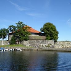
Christiansholm Fortress
2.8 km
Oddernes Church
2.6 km
Kristiansand Stadion
1.8 km
Bystranda
2.6 km
Vest-Agder Museum Kristiansand
2.1 km
Otterdalsparken
3.1 km
Søm Church
1.5 km
Topdalsfjorden
3.1 km
Lundsbroa
2.7 km
Bendiksbukta
3 km
Lund Church
2.4 km
Oddernes stone
2.6 km
Odderøya Amfi
2.8 km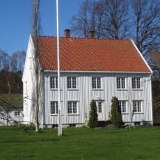
Oddernes prestegård
2.7 km
Holbergs gate 17, Kristiansand
3.1 km
Odderøytjønna
2.9 km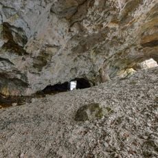
Sømsgruva
17 m
ODDERNES PRESTEGÅRD
2.7 km
Stiftsgården
2.9 km
Oddernessteinen
2.6 km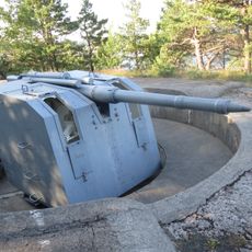
Mellombatteriet, Odderøya
3 km
Øvre Kongsgård
2.2 km
Ringåsen
1.9 km
ODDERØYA
3 km
HOLBERGSGATE 17
3.1 km
Søm
785 m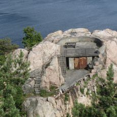
Lyskasteren, Odderøya
2.8 kmReviews
Visited this place? Tap the stars to rate it and share your experience / photos with the community! Try now! You can cancel it anytime.
Discover hidden gems everywhere you go!
From secret cafés to breathtaking viewpoints, skip the crowded tourist spots and find places that match your style. Our app makes it easy with voice search, smart filtering, route optimization, and insider tips from travelers worldwide. Download now for the complete mobile experience.

A unique approach to discovering new places❞
— Le Figaro
All the places worth exploring❞
— France Info
A tailor-made excursion in just a few clicks❞
— 20 Minutes