Reisavatnet
Location: Nordreisa Municipality
GPS coordinates: 69.18926,22.38032
Latest update: November 22, 2025 10:05
Reisa National Park
16.4 km
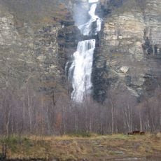
Mollisfossen
28.9 km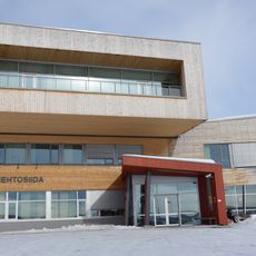
Diehtosiida
32.5 km
Imofossen
19.5 km
Kautokeino municipal museum
33.3 km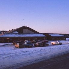
Kautokeino Cultural Centre
32.9 km
Imofossen
19.5 km
Miellegáddi
19.2 km
Stađđoaivi
9.7 km
Mollešgorŋi
28.9 km
Gæđaščåkka (tumoy sa bukid)
5.2 km
Nokinivat
22.9 km
Liev'lamas
19.3 km
Čoavjebåttusčåkkat
26.2 km
Ravdoaivi (tumoy sa bukid)
33.1 km
Reisavatnet
158 m
Waterfall
32.7 km
Scenic viewpoint
19.3 km
Kautokeino kulturhus
32.9 km
Waterfall
32.1 km
Waterfall
29.8 km
Waterfall
30.5 km
Waterfall
30.7 km
Imofossen
19.3 km
Mollisfossen
28.9 km
Mollisfossen - Mollešgorži - Molliskurkkii
28.9 km
Imofossen - Imogorži - Iimonkurkkii
19.5 km
Waterfall
19.3 kmReviews
Visited this place? Tap the stars to rate it and share your experience / photos with the community! Try now! You can cancel it anytime.
Discover hidden gems everywhere you go!
From secret cafés to breathtaking viewpoints, skip the crowded tourist spots and find places that match your style. Our app makes it easy with voice search, smart filtering, route optimization, and insider tips from travelers worldwide. Download now for the complete mobile experience.

A unique approach to discovering new places❞
— Le Figaro
All the places worth exploring❞
— France Info
A tailor-made excursion in just a few clicks❞
— 20 Minutes