
San Antonio historical marker
San Antonio historical marker, NHCP historical marker for San Antonio, Zambales
Location: San Antonio
Inception: 1950
Creator: National Historical Commission of the Philippines
Address: National Highway
GPS coordinates: 14.94903,120.08830
Latest update: April 22, 2025 16:20

Pinatubo
35.5 km
Mount Natib
42.7 km
Fort Wint
25 km
Bataan National Park
46.1 km
Capones Island lighthouse
9.3 km
Roosevelt Protected Landscape
23.5 km
Casa Hidalgo
50.4 km
Camayan Beach Resort
26.9 km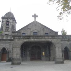
San Jose Obrero Church
47.3 km
Saint Augustine Cathedral
43.5 km
Pio Chapel
47.4 km
Subic Watershed Forest Reserve
30.5 km
Punta Belle Resort
35.9 km
Rama International Beach Resort
32.7 km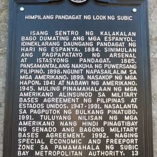
Naval Base of Subic Bay historical marker
25.6 km
Zambales Provincial Capitol
43.5 km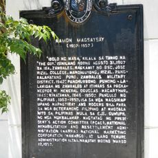
Ramon Magsaysay historical marker
43.8 km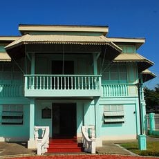
President Ramon Magsaysay House
11.7 km
Olongapo City Hall
24.5 km
Resort
8.7 km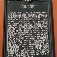
Teodoro R. Yangco historical marker
166 m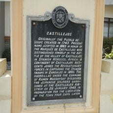
Castillejos historical marker
12.2 km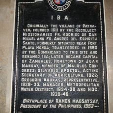
Iba historical marker
43.5 km
San Antonio Municipal Hall
174 m
Ambon-Ambon Falls
46.2 km
Castillejos Municipal Hall
12.2 km
Driftwood Beach Resort
22.1 km
Bataan and Democracy historical marker
45.1 kmVisited this place? Tap the stars to rate it and share your experience / photos with the community! Try now! You can cancel it anytime.
Discover hidden gems everywhere you go!
From secret cafés to breathtaking viewpoints, skip the crowded tourist spots and find places that match your style. Our app makes it easy with voice search, smart filtering, route optimization, and insider tips from travelers worldwide. Download now for the complete mobile experience.

A unique approach to discovering new places❞
— Le Figaro
All the places worth exploring❞
— France Info
A tailor-made excursion in just a few clicks❞
— 20 Minutes