Bataan National Park, National park in Central Luzon, Philippines.
Bataan National Park covers more than 23,000 hectares of protected land on the Bataan Peninsula and contains tropical forests, several rivers and waterfalls, plus mountain ranges. The terrain provides habitat for diverse plants and animals across different elevations and forest types.
The protected area was established in 1945 and originally designated with a larger size before being reduced later. This shift reflects changing approaches to conservation in the region over time.
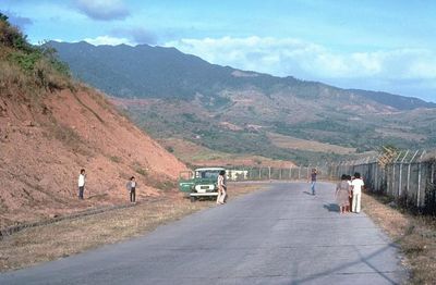
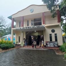
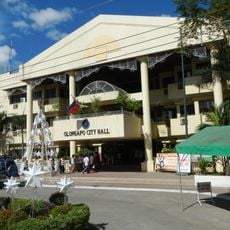
The park sits in a region of deep historical significance and is regarded by nearby communities as an important place for nature connection. The surrounding villages maintain traditional relationships with the forests and waterways that shape their way of life.
The park has several hiking trails of varying difficulty and camping areas for visitors who want to stay longer. Information centers are located at different points where you can get maps and advice for planning activities.
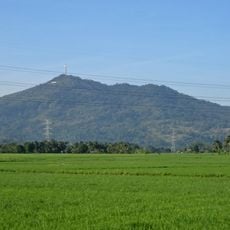
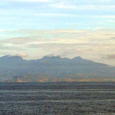
At the center of the park sits Mount Natib with a rare ring-shaped caldera formation that is covered in forest. This geological feature is visible in the landscape and contributes to the area's distinctive topography.
Location: Central Luzon
Location: Bataan
Location: Zambales
Inception: December 1, 1945
GPS coordinates: 14.68333,120.41667
Latest update: December 9, 2025 18:45
Mount Samat National Shrine
13.2 km
Mount Samat
13.2 km
Abucay Church
13.4 km
Mount Mariveles
18.6 km
Mount Natib
3.7 km
Fort Wint
22.5 km
Balanga Cathedral
13.3 km
Casa Bizantina
9.9 km
Casa Hidalgo
9.8 km
Casa Unisan
9.9 km
Casa Jaen I
9.9 kmOlongapo Naval Base Perimeter National Park
21.8 km
Subic Watershed Forest Reserve
15.8 km
The Fall of Bataan historical marker
12.3 km
Bataan World War II Museum
13.9 km
Naval Base of Subic Bay historical marker
20.7 km
Bataan Provincial Capitol
12.2 km
Francisco C. Baltazar (Balagtas) historical marker
19.4 km
Olongapo City Hall
22.5 km
Cayetano S. Arellano historical marker
18.6 km
Tomas Guillermo T. del Rosario historical marker
12.2 km
Church of Abucay historical marker
13.4 km
Church of Orani historical marker
18.3 km
Ambon-Ambon Falls
1.2 km
Starting Point of Death March historical marker
9.7 km
Church of Samal historical marker
16.6 km
Church of Balanga historical marker
13.4 km
Church of Orion historical marker
18.5 kmVisited this place? Tap the stars to rate it and share your experience / photos with the community! Try now! You can cancel it anytime.
Discover hidden gems everywhere you go!
From secret cafés to breathtaking viewpoints, skip the crowded tourist spots and find places that match your style. Our app makes it easy with voice search, smart filtering, route optimization, and insider tips from travelers worldwide. Download now for the complete mobile experience.
A unique approach to discovering new places❞
— Le Figaro
All the places worth exploring❞
— France Info
A tailor-made excursion in just a few clicks❞
— 20 Minutes