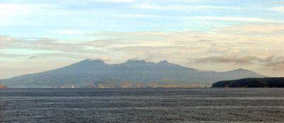
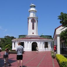
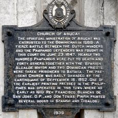
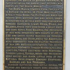
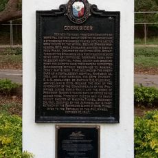
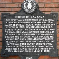
Mount Mariveles, Dormant volcano in Bataan Province, Philippines
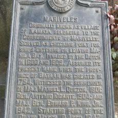
Mount Mariveles is a dormant volcano in Bataan Province with peaks reaching 1,388 meters and a caldera summit spanning about 4 kilometers across. The volcanic complex includes multiple ridges and natural hot springs scattered throughout the formation.
This volcanic formation last erupted around 2050 BCE, making it geologically inactive for thousands of years. The long period of rest has created a stable landscape where thermal springs now mark the sites of past volcanic activity.
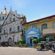
The mountain marks a natural boundary of the Zambales range and is home to communities whose daily lives remain closely connected to the land. Visitors can observe this relationship with nature as they move through the surrounding areas.
Three main routes lead up the mountain: Tarak Ridge from Barangay Alas-asin, Pantingan Peak via Sitio Duhat, and Mariveles Ridge through Sitio Parca. Each trailhead offers different levels of difficulty and views, so choose based on your hiking experience and fitness level.
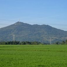
The volcanic complex contains several parasitic cones, including Mount Samat on the northern slope and Mount Limay on the eastern side of the system. These secondary formations show how the volcanic activity shaped multiple peaks across the region.
Location: Bataan
Elevation above the sea: 1,388 m
GPS coordinates: 14.52846,120.48151
Latest update: December 7, 2025 20:48
Mount Samat
8.9 km
Abucay Church
22.3 km
Fort Hughes
23.2 km
Mount Natib
22.2 km
Bataan National Park
18.6 km
Balanga Cathedral
17.9 km
Corregidor Island lighthouse
19.5 km
Casa Bizantina
12.8 km
Casa Hidalgo
12.9 km
Casa Unisan
12.8 km
Casa Jaen I
12.9 km
The Fall of Bataan historical marker
17.2 km
Bataan World War II Museum
18.3 km
Mariveles Municipal Hall
10.4 km
Bataan Provincial Capitol
17.2 km
Francisco C. Baltazar (Balagtas) historical marker
15.6 km
Corregidor Island lighthouse
19.5 km
Corregidor historical marker
10.8 km
Cayetano S. Arellano historical marker
14.6 km
Mariveles historical marker
10.4 km
Tomas Guillermo T. del Rosario historical marker
17.2 km
Church of Abucay historical marker
22.3 km
The Death March of Filipino and American Prisoners of War from Mariveles and Bagac to Camp O’Donnell, Capas, Tarlac historical markers
10.4 km
Ambon-Ambon Falls
18 km
Starting Point of Death March historical marker
12.2 km
Corregidor historical marker
19.6 km
Church of Balanga historical marker
18 km
Church of Orion historical marker
14.6 kmVisited this place? Tap the stars to rate it and share your experience / photos with the community! Try now! You can cancel it anytime.
Discover hidden gems everywhere you go!
From secret cafés to breathtaking viewpoints, skip the crowded tourist spots and find places that match your style. Our app makes it easy with voice search, smart filtering, route optimization, and insider tips from travelers worldwide. Download now for the complete mobile experience.
A unique approach to discovering new places❞
— Le Figaro
All the places worth exploring❞
— France Info
A tailor-made excursion in just a few clicks❞
— 20 Minutes