Log in to your account

AroundUs is a community-driven map of interesting places, built by curious explorers like you. It grows with every review, story, and photo you share.
Connect to save your favorite spots, contribute locations, and create personalized routes.
Continue with Google
Continue with Apple
Continue with X
Continue with Facebook
Continue with email
By continuing, you accept our Terms and Conditions and our Privacy Policy
Create an account

Assabet River Rail Trail

Add to collection
Map
Suggest a change
Share

Assabet River Rail Trail, Multi-use rail trail in Massachusetts, United States

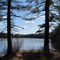
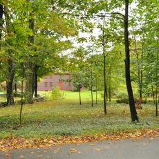
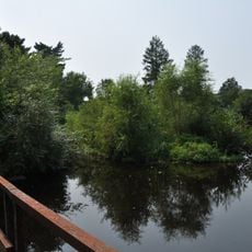
The Assabet River Rail Trail is a multi-use path extending roughly 20 kilometers across five communities, offering paved routes alongside forests, wetlands, and water bodies. The path follows a historic railroad corridor and connects multiple access points, including parking areas and boat launches.

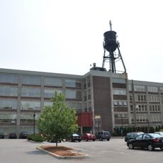
The corridor follows the route of the former Marlborough Branch Railroad, which operated passenger service from 1849 through 1958 and continued freight operations until 1980. This rail line was central to the region's transportation network before closure and eventual conversion to public use.

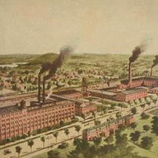
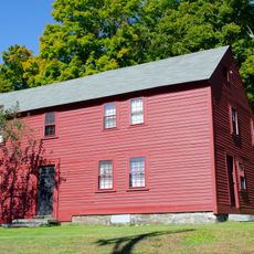
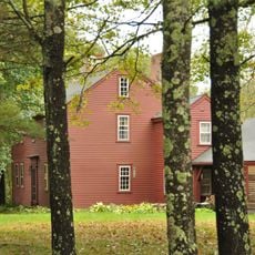
The trail links five former mill towns that shifted from industrial centers to modern communities while keeping their historical roots visible along the Assabet River. Local people use the path regularly for everyday activities, connecting recreation with care for their shared heritage.

The path has several entry points including a parking area on Maple Street, additional access at South Acton Station, and multiple boat launches for water activities. Visitors should know the paved surface is accessible year-round and suited for different activities like walking, cycling, and paddling.

The Trail of Flowers initiative planted thousands of flowering plants that create seasonal displays of native species throughout the path. Visitors encounter different wildflowers and blooms at various times of year, adding layers of color and variety to the walking experience.

Location: Massachusetts

GPS coordinates: 42.38820,-71.56530

Latest update: December 10, 2025 16:30

Photos
Around this place
American Heritage Museum
United States of America

American Heritage Museum

4.9 km
Collings Foundation
United States of America

Collings Foundation

5 km
New England Sports Center
United States of America

New England Sports Center

3.8 km
Wayside Inn Historic District
United States of America

Wayside Inn Historic District

8.7 km
Assabet River National Wildlife Refuge
United States of America

Assabet River National Wildlife Refuge

8.1 km
Firestone-Apsley Rubber Company
United States of America

Firestone-Apsley Rubber Company

1.2 km
Dennison Manufacturing Co. Paper Box Factory
United States of America

Dennison Manufacturing Co. Paper Box Factory

5.6 km
United States of America

John J. Carroll Water Treatment Plant

8.5 km
Bullard House
United States of America

Bullard House

6 km
Goodale Homestead
United States of America

Goodale Homestead

5.1 km
J.D.C. Bradley House
United States of America

J.D.C. Bradley House

8.2 km
Marlborough Center Historic District
United States of America

Marlborough Center Historic District

4.7 km
Capt. Peter Rice House
United States of America

Capt. Peter Rice House

4.6 km
Hapgood House
United States of America

Hapgood House

5.8 km
Berlin Town Hall
United States of America

Berlin Town Hall

5.9 km
Marlborough Brook Filter Beds
United States of America

Marlborough Brook Filter Beds

6.9 km
Col. Adelbert Mossman House
United States of America

Col. Adelbert Mossman House

850 m
American Heritage Museum
United States of America

American Heritage Museum

5 km
John Cotting House
United States of America

John Cotting House

4.9 km
Tenney Homestead
United States of America

Tenney Homestead

7.8 km
Pleasant Street Historic District
United States of America

Pleasant Street Historic District

4.3 km
West Main Street Historic District
United States of America

West Main Street Historic District

4.9 km
Whitcomb Inn and Farm
United States of America

Whitcomb Inn and Farm

6.5 km
Brown-Stow House
United States of America

Brown-Stow House

6.2 km
Bolton Center Historic District
United States of America

Bolton Center Historic District

6.1 km
Pan Historic District
United States of America

Pan Historic District

4.6 km
Randall-Hale Homestead
United States of America

Randall-Hale Homestead

4 km
Sudbury Reservoir
United States of America

Sudbury Reservoir

8.5 km
Show the full map
Reviews

Visited this place? Tap the stars to rate it and share your experience / photos with the community! Try now! You can cancel it anytime.

« Assabet River Rail Trail - Multi-use rail trail in Massachusetts, United States » is provided by Around Us (aroundus.com). Images and texts are derived from Wikimedia project under a Creative Commons license. You are allowed to copy, distribute, and modify copies of this page, under the conditions set by the license, as long as this note is clearly visible.

Discover hidden gems everywhere you go!

From secret cafés to breathtaking viewpoints, skip the crowded tourist spots and find places that match your style. Our app makes it easy with voice search, smart filtering, route optimization, and insider tips from travelers worldwide. Download now for the complete mobile experience.

Around Us App Screenshot

A unique approach to discovering new places

Le Figaro

All the places worth exploring

France Info

A tailor-made excursion in just a few clicks

20 Minutes