Enable Location

We need your location to show you interesting places around you

Discover nearby places

Find interesting locations and hidden gems around you

Precise directions

Get accurate directions and distances to places

Your location is never shared with other users. It's only used when you tap the location button.

Millers Pond State Park

Log in to your account

Start exploring — it's free

Trusted by 66,101 travelers worldwide

Continue with Google
Continue with Apple
or

We will send you a code to connect

By continuing, you accept our Terms and Conditions and our Privacy Policy

Check your inbox

We've sent a pincode in your inbox. Please enter the code below.

Millers Pond State Park
Discussion Reviews 1 Photos
3.3k Popularity

Millers Pond State Park, Public recreation area in Durham, United States.

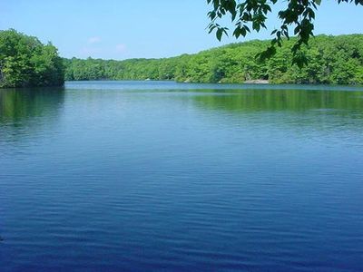
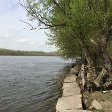
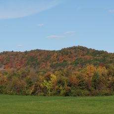
Millers Pond State Park is a forested nature area in Durham, Connecticut, made up of woodland, open meadows, and a spring-fed pond at its center. Trails loop around the pond and through the surrounding woods, giving visitors access to both the water and the quieter inland sections of the park.

The land came to the state of Connecticut through a donation in 1955, which is what turned it into a public park. Before that, the site had been in active use since the early 1700s, when a grist mill was built to take advantage of the water flow.

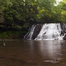
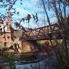
Walking along the water, visitors can spot the stone remains of an old grist mill dam that once harnessed the pond's flow for grinding grain. These visible remnants sit close to the trail and give a sense of how this land was used long before it became a park.

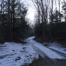
The park has trails for both easy walks and more demanding routes, as well as fishing access along the pond. Connecticut residents with a registered vehicle can enter at no cost through the state's Passport to the Parks program.

The pond is fed entirely by underground springs rather than by rain runoff or streams, which keeps the water clear and stable throughout the year. This is one reason the fishing here tends to be productive even when conditions elsewhere in the region are less favorable.

The community of curious travelers

AroundUs brings together thousands of curated places, local tips, and hidden gems, enriched daily by 60,000 contributors worldwide.

Start exploring
Location
Inception
1955
GPS coordinates
41.47639,-72.63333
Latest update
March 3, 2026 13:56
Around this place
Wadsworth Falls State Park
United States of America

Wadsworth Falls State Park

7.5 km
Wadsworth Mansion at Long Hill
United States of America

Wadsworth Mansion at Long Hill

7.9 km
Cockaponset State Forest
United States of America

Cockaponset State Forest

9.2 km
Indian Hill Cemetery
United States of America

Indian Hill Cemetery

9.2 km
Van Vleck Observatory
United States of America

Van Vleck Observatory

9 km
Hurd State Park
United States of America

Hurd State Park

8.9 km
Richard Alsop IV House
United States of America

Richard Alsop IV House

9.3 km
Wilcox, Crittenden Mill
United States of America

Wilcox, Crittenden Mill

8.3 km
Trimountain
United States of America

Trimountain

8.8 km
Broad Street Historic District
United States of America

Broad Street Historic District

9.3 km
Russell Company Upper Mill
United States of America

Russell Company Upper Mill

7.5 km
Middletown Alms House
United States of America

Middletown Alms House

8.2 km
United States of America

Higganum Reservoir State Park

6.2 km
Main Street Historic District
United States of America

Main Street Historic District

4 km
Xi Chapter, Psi Upsilon Fraternity
United States of America

Xi Chapter, Psi Upsilon Fraternity

9.1 km
William Ward Jr. House
United States of America

William Ward Jr. House

8.8 km
Middletown South Green Historic District
United States of America

Middletown South Green Historic District

9 km
Nehemiah Hubbard House
United States of America

Nehemiah Hubbard House

7.9 km
Edward Augustus Russell House
United States of America

Edward Augustus Russell House

9.4 km
David Lyman II House
United States of America

David Lyman II House

6.9 km
Town Farms Inn
United States of America

Town Farms Inn

9.1 km
Thomas Lyman House
United States of America

Thomas Lyman House

4.4 km
Starr Mill Road Bridge
United States of America

Starr Mill Road Bridge

8.9 km
Higganum Landing Historic District
United States of America

Higganum Landing Historic District

7.7 km
Coite-Hubbard House
United States of America

Coite-Hubbard House

9.2 km
Metro South Historic District
United States of America

Metro South Historic District

9.1 km
Middlesex Opera House
United States of America

Middlesex Opera House

9.3 km
Capitol Theatre
United States of America

Capitol Theatre

9.3 km
Show the full map
Reviews
Share your experience

No review yet

Discussions
Start a discussion...

No discussion yet

« Millers Pond State Park - Public recreation area in Durham, United States » is provided by Around Us (aroundus.com). Images and texts are derived from Wikimedia project under a Creative Commons license. You are allowed to copy, distribute, and modify copies of this page, under the conditions set by the license, as long as this note is clearly visible.

Discover hidden gems everywhere you go!

From secret cafés to breathtaking viewpoints, skip the crowded tourist spots and find places that match your style. Our app makes it easy with voice search, smart filtering, route optimization, and insider tips from travelers worldwide. Download now for the complete mobile experience.

Around Us App Screenshot

A unique approach to discovering new places

Le Figaro

All the places worth exploring

France Info

A tailor-made excursion in just a few clicks

20 Minutes

Around Us
Travel Guide & Maps
Download

Send to your phone

QR Code
1

Open the camera app on your mobile.

2

Point at the QR code with your camera. A notification will appear.

3

Tap the notification to open the link.