Cockaponset State Forest

Log in to your account

AroundUs is a community-driven map of interesting places, built by curious explorers like you. It grows with every review, story, and photo you share.
Connect to save your favorite spots, contribute locations, and create personalized routes.
By continuing, you accept our Terms and Conditions and our Privacy Policy
Add to collection
Map
Suggest a change
Share

Cockaponset State Forest, State forest and national natural landmark in Connecticut.

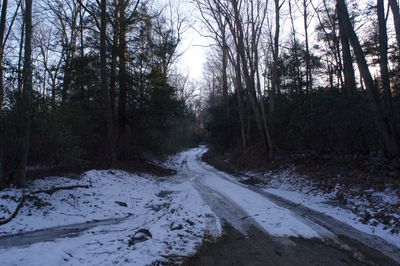
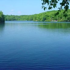
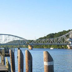
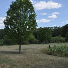
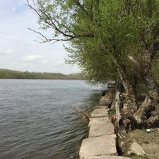
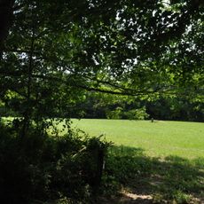
Cockaponset State Forest is a large woodland area designated as both a state forest and national natural landmark, covering over 17,000 acres across eleven Connecticut towns with dense woodlands, hiking trails, and the Pattaconk Lake. The forest supports multiple recreational activities including hiking, horseback riding, and mountain biking across its network of paths.

The area was once part of the Wangunk village of Cockaponset before European settlement transformed the landscape. Modern forest acquisitions began in 1926, establishing the foundation for the protected area that exists today.

The forest bears the name of a Native American chief whose burial site is located in Haddam's Ponset section, reflecting the deep connection this land holds to its original inhabitants. Visitors can sense this historical link while walking through woodlands that were home to these communities for generations.

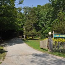
The forest has several entry points, with Cedar Lake Road being a main access route that allows visitors to easily reach the trail network. It helps to check which activities are permitted on specific trails before arriving, as some paths are limited to hiking while others allow horseback riding and mountain biking.

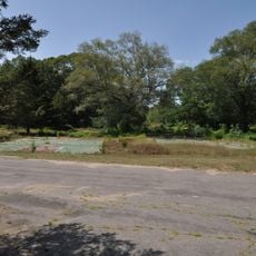
The Chester Cedar Swamp section contains one of the finest remaining Atlantic white cedar forests in the Northeast and holds designation as a National Natural Landmark. This rare ecosystem with its distinctive cedar trees stands apart from the other woodland areas throughout the forest.

Location: Connecticut

Elevation above the sea: 185 m

GPS coordinates: 41.44111,-72.53361

Latest update: December 8, 2025 21:02

Photos
Around this place
Gillette Castle State Park
United States of America

Gillette Castle State Park

8.8 km
Goodspeed Musicals
United States of America

Goodspeed Musicals

6 km
Chatfield Hollow State Park
United States of America

Chatfield Hollow State Park

9.6 km
Millers Pond State Park
United States of America

Millers Pond State Park

9.2 km
East Haddam Bridge
United States of America

East Haddam Bridge

5.9 km
Sunrise Resort State Park
United States of America

Sunrise Resort State Park

8.6 km
Hadlyme North Historic District
United States of America

Hadlyme North Historic District

10.7 km
Machimoodus State Park
United States of America

Machimoodus State Park

7.5 km
Hurd State Park
United States of America

Hurd State Park

8.8 km
United States of America

Nathan Hale School House

6.1 km
Brainard Homestead State Park
United States of America

Brainard Homestead State Park

6.6 km
Camp Bethel
United States of America

Camp Bethel

5.2 km
Eagle Landing State Park
United States of America

Eagle Landing State Park

5.7 km
Villa Bella Vista
United States of America

Villa Bella Vista

8.8 km
Amasa Day House
United States of America

Amasa Day House

9.6 km
Haddam Meadows State Park
United States of America

Haddam Meadows State Park

4.8 km
United States of America

Higganum Reservoir State Park

5.6 km
Deep River Town Hall
United States of America

Deep River Town Hall

10.2 km
Oak Lodge
United States of America

Oak Lodge

9.3 km
James Hazelton House
United States of America

James Hazelton House

4.5 km
East Haddam Historic District
United States of America

East Haddam Historic District

6.2 km
Higganum Landing Historic District
United States of America

Higganum Landing Historic District

1.6 km
Dr. Ambrose Pratt House
United States of America

Dr. Ambrose Pratt House

8.7 km
Parmelee House
United States of America

Parmelee House

7.7 km
Old Town Hall
United States of America

Old Town Hall

7.8 km
Jonathan Warner House
United States of America

Jonathan Warner House

8.2 km
Charles Daniels House
United States of America

Charles Daniels House

7.3 km
Boardman House Inn Bed & Breakfast
United States of America

Boardman House Inn Bed & Breakfast

6.3 km
Show the full map
Reviews

Visited this place? Tap the stars to rate it and share your experience / photos with the community! Try now! You can cancel it anytime.

« Cockaponset State Forest - State forest and national natural landmark in Connecticut » is provided by Around Us (aroundus.com). Images and texts are derived from Wikimedia project under a Creative Commons license. You are allowed to copy, distribute, and modify copies of this page, under the conditions set by the license, as long as this note is clearly visible.

Discover hidden gems everywhere you go!

From secret cafés to breathtaking viewpoints, skip the crowded tourist spots and find places that match your style. Our app makes it easy with voice search, smart filtering, route optimization, and insider tips from travelers worldwide. Download now for the complete mobile experience.

Around Us App Screenshot

A unique approach to discovering new places

Le Figaro

All the places worth exploring

France Info

A tailor-made excursion in just a few clicks

20 Minutes