Nashua Manufacturing Company Historic District

Log in to your account

AroundUs is a community-driven map of interesting places, built by curious explorers like you. It grows with every review, story, and photo you share.
Connect to save your favorite spots, contribute locations, and create personalized routes.
Continue with Google
Continue with Apple
Continue with X
Continue with Facebook
Continue with email
By continuing, you accept our Terms and Conditions and our Privacy Policy
Create an account
Add to collection
Map
Suggest a change
Share

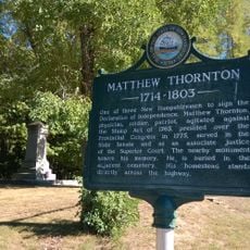
Nashua Manufacturing Company Historic District, Industrial heritage site in Nashua, United States.

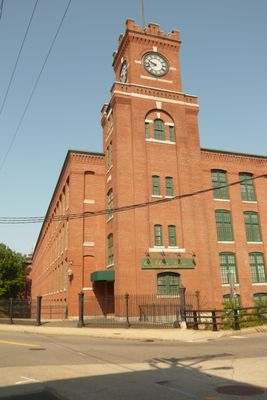
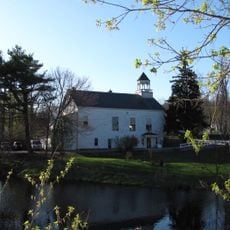
Nashua Manufacturing Company Historic District is an industrial complex along the southern bank of the Nashua River featuring brick mill buildings, a clock tower, and a distinctive smokestack. The site spans multiple structures connected by canals built to harness water power for the mills.

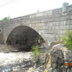
The company started cotton production in 1823 and built a three-mile canal system by 1830 to power the mills with water. This infrastructure allowed the operation to grow and established Nashua as a major industrial hub in New England.

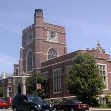
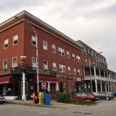
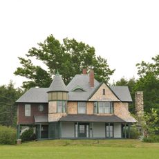
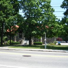
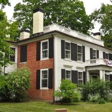
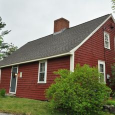
The worker houses and company churches scattered throughout reveal how deeply the mill shaped daily community life in Nashua. These buildings show the relationship between industrial work and where families lived during the boom years.

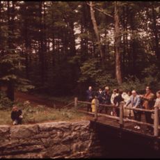
The district extends from Mine Falls Park to Factory Street and includes walking paths and open areas for exploration. Visitors can move through the site on foot at their own pace and view the buildings from multiple angles along the canal.

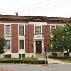
Mill Number 3, built between 1835 and 1836, remains the oldest standing structure in the entire complex and shows how early American mills were constructed. Many visitors walk past this building without realizing its age and importance to understanding how the site developed.

Location: Nashua

Part of: National Register of Historic Places listings in Hillsborough County, New Hampshire

GPS coordinates: 42.75970,-71.47280

Latest update: December 14, 2025 12:26

Photos
Around this place
Nashua Public Library
United States of America

Nashua Public Library

784 m
Nashville Historic District
United States of America

Nashville Historic District

1.2 km
Tyngsborough Bridge
United States of America

Tyngsborough Bridge

10.2 km
Signer's House and Matthew Thornton Cemetery
United States of America

Signer's House and Matthew Thornton Cemetery

9 km
Hills House
United States of America

Hills House

5.1 km
Silver Lake State Park
United States of America

Silver Lake State Park

9.9 km
Charles-George Reclamation Trust Landfill
United States of America

Charles-George Reclamation Trust Landfill

10.7 km
Hills Memorial Library
United States of America

Hills Memorial Library

2.9 km
Abbot House
United States of America

Abbot House

750 m
Soldiers and Sailors Monument
United States of America

Soldiers and Sailors Monument

790 m
Hunt Memorial Library
United States of America

Hunt Memorial Library

681 m
Old Town Hall
United States of America

Old Town Hall

10.2 km
Hillsborough County Registry of Deeds
United States of America

Hillsborough County Registry of Deeds

665 m
Killicut-Way House
United States of America

Killicut-Way House

3.1 km
G.O. Sanders House
United States of America

G.O. Sanders House

2.7 km
Dunstable Town Hall
United States of America

Dunstable Town Hall

9.3 km
Winslow School and Littlefield Library
United States of America

Winslow School and Littlefield Library

9.9 km
Hollis Village Historic District
United States of America

Hollis Village Historic District

9.5 km
McClure-Hilton House
United States of America

McClure-Hilton House

7.3 km
Gen. George Stark House
United States of America

Gen. George Stark House

1 km
The Meetinghouse
United States of America

The Meetinghouse

9.7 km
Marion Nichols Summer Home
United States of America

Marion Nichols Summer Home

10.8 km
Dunstable Center Historic District
United States of America

Dunstable Center Historic District

9.5 km
Mine Falls Park
United States of America

Mine Falls Park

2.8 km
Souhegan River Bridge
United States of America

Souhegan River Bridge

11.4 km
B&M Merrimack River Bridge
United States of America

B&M Merrimack River Bridge

2.5 km
Runnels Bridge
United States of America

Runnels Bridge

8.1 km
Daniel Webster Highway Bridge
United States of America

Daniel Webster Highway Bridge

670 m
Show the full map
Reviews

Visited this place? Tap the stars to rate it and share your experience / photos with the community! Try now! You can cancel it anytime.

« Nashua Manufacturing Company Historic District - Industrial heritage site in Nashua, United States » is provided by Around Us (aroundus.com). Images and texts are derived from Wikimedia project under a Creative Commons license. You are allowed to copy, distribute, and modify copies of this page, under the conditions set by the license, as long as this note is clearly visible.

Discover hidden gems everywhere you go!

From secret cafés to breathtaking viewpoints, skip the crowded tourist spots and find places that match your style. Our app makes it easy with voice search, smart filtering, route optimization, and insider tips from travelers worldwide. Download now for the complete mobile experience.

Around Us App Screenshot

A unique approach to discovering new places

Le Figaro

All the places worth exploring

France Info

A tailor-made excursion in just a few clicks

20 Minutes