Renick Farm

Log in to your account

AroundUs is a community-driven map of interesting places, built by curious explorers like you. It grows with every review, story, and photo you share.
Connect to save your favorite spots, contribute locations, and create personalized routes.
Continue with Google
Continue with Apple
Continue with X
Continue with Facebook
Continue with email
By continuing, you accept our Terms and Conditions and our Privacy Policy
Create an account
Add to collection
Map
Suggest a change
Share

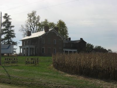
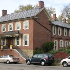
Renick Farm, Historic farmstead in South Bloomfield, Ohio.

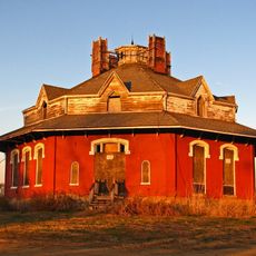
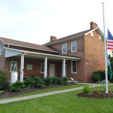
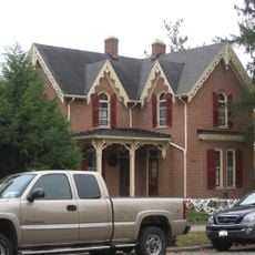
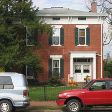
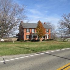
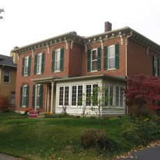
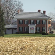
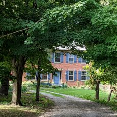
Renick Farm is a historic farmstead in South Bloomfield in northern Pickaway County, Ohio, encompassing six buildings situated on four acres near U.S. Route 23. The structures display mixed architectural styles and were constructed with brick walls on stone foundations, with some features covered by metal roofing.

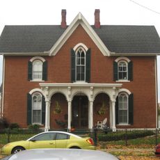
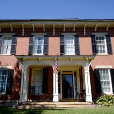
Edward Williams established the farm in 1820 and built the original farmhouse before selling it to Joseph Renick in 1850, who expanded it significantly. The Renick family maintained ownership from 1850 to 1918 and again from 1977 until the main structure was demolished in 2016.

The farmhouse displayed a blend of Greek Revival and Italianate styles that represented how rural families in the region built and modified their homes during the 1800s. The combination of architectural elements reflects the practical choices made by generations living and working on the land.

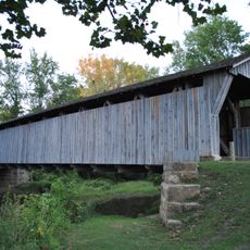
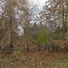
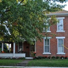
The property sits directly along Route 23 and remains visible from the road, with the surviving buildings reflecting the site's historical importance. Note that the main house is no longer standing, and only the additional structures remain to view.

The main residence featured two spiral staircases and decorative cornices, unusual details for a rural farmhouse that suggested the family's prosperity and refined tastes. These elaborate interior elements were rarely seen in agricultural buildings of that era.

Location: Ohio

Architectural style: Greek Revival architecture, Renaissance Revival architecture, Italianate architecture

GPS coordinates: 39.75028,-82.99111

Latest update: December 13, 2025 12:23

Photos
Around this place
World Harvest Church
United States of America

World Harvest Church

21 km
Fortress Obetz
United States of America

Fortress Obetz

15.7 km
Scioto Downs
United States of America

Scioto Downs

10.1 km
A. W. Marion State Park
United States of America

A. W. Marion State Park

16.4 km
Gregg-Crites Octagon House
United States of America

Gregg-Crites Octagon House

18.8 km
United States of America

Stage's Pond State Nature Preserve

9.3 km
Bergstresser/Dietz Covered Bridge
United States of America

Bergstresser/Dietz Covered Bridge

17.4 km
Slate Run Metro Park
United States of America

Slate Run Metro Park

11.9 km
W.C. Clemmons Mound
United States of America

W.C. Clemmons Mound

11.7 km
A.G. Grant Homestead
United States of America

A.G. Grant Homestead

16.5 km
Gantz Homestead
United States of America

Gantz Homestead

17.5 km
Groveport United Methodist Church
United States of America

Groveport United Methodist Church

14.5 km
William Marshall Anderson House
United States of America

William Marshall Anderson House

17.2 km
Morris House
United States of America

Morris House

17.4 km
Matthew McCrea House
United States of America

Matthew McCrea House

17 km
Stevenson Peters House
United States of America

Stevenson Peters House

15.6 km
Ansel T. Walling House
United States of America

Ansel T. Walling House

17.2 km
Redlands
United States of America

Redlands

13.5 km
David's Reformed Church
United States of America

David's Reformed Church

18.6 km
Lyman Allen House and Barn
United States of America

Lyman Allen House and Barn

17.9 km
Perrill-Goodman Farmhouse
United States of America

Perrill-Goodman Farmhouse

10.2 km
Watt-Groce-Fickhardt House
United States of America

Watt-Groce-Fickhardt House

17.3 km
Samuel Landes House
United States of America

Samuel Landes House

10.2 km
Arendt–Seymour House
United States of America

Arendt–Seymour House

18.7 km
Luthor List Mound
United States of America

Luthor List Mound

20.3 km
T. A. Boor traffic light
United States of America

T. A. Boor traffic light

5.2 km
Circleville Historic District
United States of America

Circleville Historic District

17 km
Ohio's Small Town Museum
United States of America

Ohio's Small Town Museum

5.2 km
Show the full map
Reviews

Visited this place? Tap the stars to rate it and share your experience / photos with the community! Try now! You can cancel it anytime.

« Renick Farm - Historic farmstead in South Bloomfield, Ohio » is provided by Around Us (aroundus.com). Images and texts are derived from Wikimedia project under a Creative Commons license. You are allowed to copy, distribute, and modify copies of this page, under the conditions set by the license, as long as this note is clearly visible.

Discover hidden gems everywhere you go!

From secret cafés to breathtaking viewpoints, skip the crowded tourist spots and find places that match your style. Our app makes it easy with voice search, smart filtering, route optimization, and insider tips from travelers worldwide. Download now for the complete mobile experience.

Around Us App Screenshot

A unique approach to discovering new places

Le Figaro

All the places worth exploring

France Info

A tailor-made excursion in just a few clicks

20 Minutes