Weston Aqueduct

Log in to your account

AroundUs is a community-driven map of interesting places, built by curious explorers like you. It grows with every review, story, and photo you share.
Connect to save your favorite spots, contribute locations, and create personalized routes.
Continue with Google
Continue with Apple
Continue with X
Continue with Facebook
Continue with email
By continuing, you accept our Terms and Conditions and our Privacy Policy
Create an account
Add to collection
Map
Suggest a change
Share

Weston Aqueduct, Historic water infrastructure district in Weston, Massachusetts, United States.

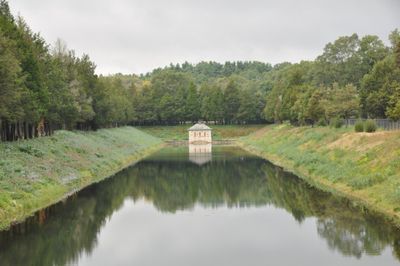
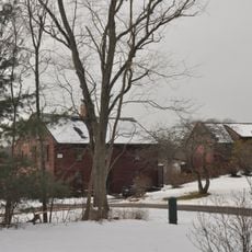
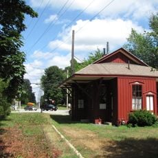
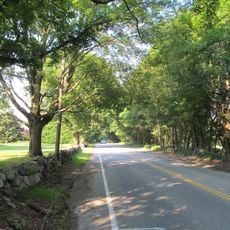
The Weston Aqueduct Linear District is a historic water system stretching about 13.5 miles through Southborough, Framingham, Wayland, and Weston, featuring numerous chambers, bridges, and water control structures. This gravity-fed system connects the Sudbury Reservoir to the Weston Reservoir and continues to serve the region's emergency water supply needs.

Construction occurred between 1901 and 1903 as the third phase of Boston's metropolitan water supply development. This engineering project represented a major advancement in bringing reliable water to the growing urban region.

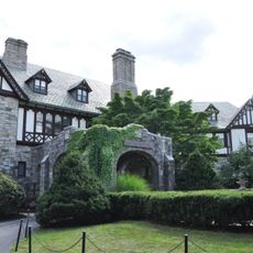
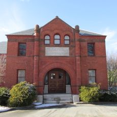
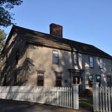
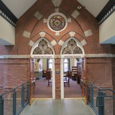
The Renaissance Revival structures along the route feature polychrome granite facades with decorative details designed by the prominent Boston architectural firm Shepley, Rutan and Coolidge. These buildings remain visible reminders of early 1900s craftsmanship and contribute to the character of the landscape today.

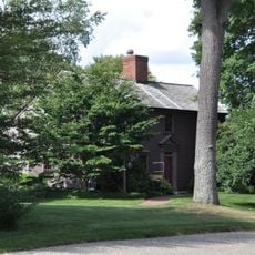
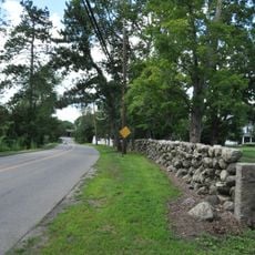
The Massachusetts Water Resources Authority maintains this working system today, so some areas may have restricted access for operational reasons. Visitors can explore the route on foot along public roads and pathways where the engineering structures are visible above ground or in the landscape.

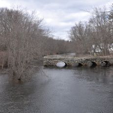
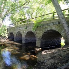
The aqueduct contains two distinct siphon sections, including a steel pipe crossing the Sudbury River supported by stone abutments that descends below the river bed. This underground solution was an elegant way to carry water across the river without interrupting the landscape above.

Location: Massachusetts

GPS coordinates: 42.33333,-71.37556

Latest update: December 14, 2025 09:41

Photos
Around this place
Garden in the Woods
United States of America

Garden in the Woods

4.3 km
Cochituate State Park
United States of America

Cochituate State Park

3.9 km
Nobscot Hill
United States of America

Nobscot Hill

6.2 km
Henderson House
United States of America

Henderson House

6.5 km
Goodnow Library
United States of America

Goodnow Library

4.8 km
Sudbury Center Historic District
United States of America

Sudbury Center Historic District

5.9 km
Stone's Bridge
United States of America

Stone's Bridge

1.7 km
Vokes Theatre
United States of America

Vokes Theatre

4.3 km
First Baptist Church
United States of America

First Baptist Church

6.4 km
Old Town Bridge
United States of America

Old Town Bridge

4.7 km
Framingham Centre Common Historic District
United States of America

Framingham Centre Common Historic District

5.9 km
Saxonville Historic District
United States of America

Saxonville Historic District

2.3 km
Robert Jenison House
United States of America

Robert Jenison House

3.5 km
Noyes-Parris House
United States of America

Noyes-Parris House

2.1 km
Morse Institute Library
United States of America

Morse Institute Library

6 km
Abel Allen House
United States of America

Abel Allen House

6.3 km
Wellington Farm Historic District
United States of America

Wellington Farm Historic District

5.6 km
Harrington House
United States of America

Harrington House

5.4 km
Hopestill Bent Tavern
United States of America

Hopestill Bent Tavern

1 km
Clark Houses
United States of America

Clark Houses

5.9 km
Samuel Train House
United States of America

Samuel Train House

4.3 km
Moses Brewer House
United States of America

Moses Brewer House

5 km
Stephen Bacon House
United States of America

Stephen Bacon House

4.9 km
Reeves Tavern
United States of America

Reeves Tavern

2.9 km
Bogle-Walker House
United States of America

Bogle-Walker House

4.1 km
Wayland Center Historic District
United States of America

Wayland Center Historic District

3.6 km
Spellman Museum of Stamps & Postal History
United States of America

Spellman Museum of Stamps & Postal History

5.9 km
Old Connecticut Path
United States of America

Old Connecticut Path

3.5 km
Show the full map
Reviews

Visited this place? Tap the stars to rate it and share your experience / photos with the community! Try now! You can cancel it anytime.

« Weston Aqueduct - Historic water infrastructure district in Weston, Massachusetts, United States » is provided by Around Us (aroundus.com). Images and texts are derived from Wikimedia project under a Creative Commons license. You are allowed to copy, distribute, and modify copies of this page, under the conditions set by the license, as long as this note is clearly visible.

Discover hidden gems everywhere you go!

From secret cafés to breathtaking viewpoints, skip the crowded tourist spots and find places that match your style. Our app makes it easy with voice search, smart filtering, route optimization, and insider tips from travelers worldwide. Download now for the complete mobile experience.

Around Us App Screenshot

A unique approach to discovering new places

Le Figaro

All the places worth exploring

France Info

A tailor-made excursion in just a few clicks

20 Minutes