Chest opened
+${chestReward.xp} XP
Explorer
NOUVEAU ×${chestReward.collectible.quantity}
tapez pour fermer

See the monuments around you in AR Open chests in the app

Around Us is built for your phone — point your camera at the streets and discover the monuments and places around you in augmented reality. Around Us is built for your phone — chests unlock when you walk, explore and capture nearby places.

•

Enable Location

We need your location to show you interesting places around you

Discover nearby places

Find interesting locations and hidden gems around you

Precise directions

Get accurate directions and distances to places

Your location is never shared with other users. It's only used when you tap the location button.

Stone's Bridge

Log in to your account

Start exploring — it's free

Trusted by 92,602 travelers worldwide

Continue with Google
Continue with Apple
or

We will send you a code to connect

By continuing, you accept our Terms and Conditions and our Privacy Policy

Check your inbox

We've sent a pincode in your inbox. Please enter the code below.

Stone's Bridge, Historic bridge in Massachusetts, United States

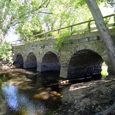
Stone's Bridge is a four-arch bridge over the Sudbury River on the Framingham–Wayland line, built of dry-laid split granite and topped with a grassy surface. Its western end stops short of the Framingham shore at a stone-faced concrete pier, and the span is closed to all access.

A crossing existed here since colonial times: a 1674 record mentions a "horse bridge" near Daniel Stone's home, and a marker on the Wayland end notes the Henry Knox Trail, the route of Ticonderoga's guns during the Revolutionary War. The present four-arch bridge was built in 1857-58 by William Simonds, recorded in Framingham town records and noted by Henry David Thoreau in 1859 diary entries. Hurricane Diane damaged it in 1955, when Stonebridge Road was rerouted to a new bridge south and the western end was stabilized.

The name honours Daniel Stone, a local resident recorded near a "horse bridge" at this crossing in 1674, so it refers to a person rather than the material. A marker at the Wayland end notes the Henry Knox Trail, the route of the Ticonderoga guns during the Revolutionary War.

Stone's Bridge is closed to all access, so it can only be viewed from the banks of the Sudbury River or from Stonebridge Road. The surviving western end stops short of the Framingham shore at a stone-faced concrete pier. A Henry Knox Trail marker stands at the Wayland end.

The name comes from Daniel Stone, a local resident whose home stood by a "horse bridge" recorded here in 1674, not from the granite. A marker at the Wayland end notes the Henry Knox Trail, the route of guns hauled from Ticonderoga during the Revolutionary War.

The community of curious travelers

AroundUs brings together thousands of curated places, local tips, and hidden gems, enriched daily by 92,602 contributors worldwide.


Start exploring
Location
GPS coordinates
42.33917,-71.39500
Latest update
October 24, 2026 18:23
Around this place
Lincoln-Sudbury Regional High School
United States of America

Lincoln-Sudbury Regional High School

4.1 mi
Wayside Inn Historic District
United States of America

Wayside Inn Historic District

4 mi
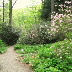
Garden in the Woods
United States of America

Garden in the Woods

1.6 mi
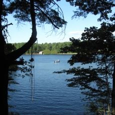
Callahan State Park
United States of America

Callahan State Park

4.4 mi
Cochituate State Park
United States of America

Cochituate State Park

3 mi
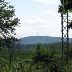
Nobscot Hill
United States of America

Nobscot Hill

2.8 mi
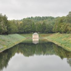
Weston Aqueduct
United States of America

Weston Aqueduct

1.1 mi
Danforth Museum
United States of America

Danforth Museum

4.2 mi
Goodnow Library
United States of America

Goodnow Library

2 mi
Sudbury Center Historic District
United States of America

Sudbury Center Historic District

3 mi
Vokes Theatre
United States of America

Vokes Theatre

3.2 mi
First Baptist Church
United States of America

First Baptist Church

3.5 mi
Old Town Bridge
United States of America

Old Town Bridge

2.6 mi
Framingham Centre Common Historic District
United States of America

Framingham Centre Common Historic District

3.2 mi
Concord Square Historic District
United States of America

Concord Square Historic District

4.4 mi
Saxonville Historic District
United States of America

Saxonville Historic District

1 mi
Robert Jenison House
United States of America

Robert Jenison House

3.2 mi
Noyes-Parris House
United States of America

Noyes-Parris House

1.8 mi
Harrington House
United States of America

Harrington House

4.4 mi
Hopestill Bent Tavern
United States of America

Hopestill Bent Tavern

1.3 mi
Moses Ellis House
United States of America

Moses Ellis House

3.7 mi
Samuel Train House
United States of America

Samuel Train House

3.8 mi
Moses Brewer House
United States of America

Moses Brewer House

2.2 mi
Stephen Bacon House
United States of America

Stephen Bacon House

3.8 mi
Reeves Tavern
United States of America

Reeves Tavern

2.4 mi
Bogle-Walker House
United States of America

Bogle-Walker House

1.8 mi
Wayland Center Historic District
United States of America

Wayland Center Historic District

2.5 mi
Old Connecticut Path
United States of America

Old Connecticut Path

2.8 mi
Show the full map
Reviews
Share your experience

No review yet

Discussions
Start a discussion...

No discussion yet

« Stone's Bridge - Historic bridge in Massachusetts, United States » is provided by Around Us (aroundus.com). Images and texts are derived from Wikimedia project under a Creative Commons license. You are allowed to copy, distribute, and modify copies of this page, under the conditions set by the license, as long as this note is clearly visible.

Discover hidden gems everywhere you go!

From secret cafés to breathtaking viewpoints, skip the crowded tourist spots and find places that match your style. Our app makes it easy with voice search, smart filtering, route optimization, and insider tips from travelers worldwide. Download now for the complete mobile experience.
Around Us App Screenshot
❝

A unique approach to discovering new places❞

— Le Figaro

❝

All the places worth exploring❞

— France Info

❝

A tailor-made excursion in just a few clicks❞

— 20 Minutes

Around Us
Travel Guide & Maps
Download

Send to your phone

QR Code
1

Open the camera app on your mobile.

2

Point at the QR code with your camera. A notification will appear.

3

Tap the notification to open the link.