Enable Location

We need your location to show you interesting places around you

Discover nearby places

Find interesting locations and hidden gems around you

Precise directions

Get accurate directions and distances to places

Your location is never shared with other users. It's only used when you tap the location button.

Yellow Creek State Park

Log in to your account

Start exploring — it's free

Trusted by 62,214 travelers worldwide

Continue with Google
Continue with Apple
or

We will send you a code to connect

By continuing, you accept our Terms and Conditions and our Privacy Policy

Check your inbox

We've sent a pincode in your inbox. Please enter the code below.

Yellow Creek State Park

Yellow Creek State Park, State park in Indiana County, Pennsylvania

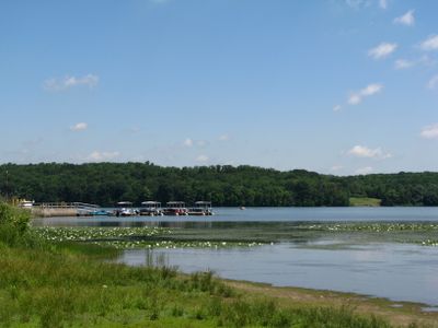
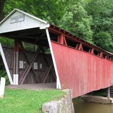
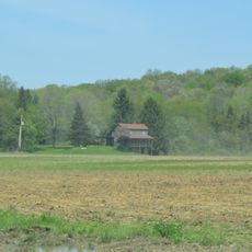
Yellow Creek State Park is a recreation area in Indiana County featuring a large lake surrounded by forests and walking trails across varied terrain. The grounds provide boat launch areas, beach sections, and facilities for water sports activities.

The grounds contain sections of the Kittanning Path, a historic route that Delaware and Shawnee nations used for travel before European settlement in Pennsylvania. These trails connected different regions and show how people moved through this landscape long ago.

The environmental education center here offers programs about local wildlife, natural resources, and ecological systems through guided walks and hands-on activities.

The park has several boat launch areas suitable for small motorized boats and rental options for canoes, kayaks, and paddleboats at beach sections. Most areas are easy to reach and well-marked, making it simple to explore and try different activities.

The park was among the first in Pennsylvania to use propane-powered lawn mowers for grounds maintenance starting in 2008. This shift away from gasoline equipment became a model that other recreation areas in the state eventually followed.

The community of curious travelers

AroundUs brings together thousands of curated places, local tips, and hidden gems, enriched daily by 60,000 contributors worldwide.

Start exploring
Location
Inception
1963
GPS coordinates
40.56830,-79.02640
Latest update
December 9, 2025 18:49
Around this place
Ghost Town Trail
United States of America

Ghost Town Trail

12.9 km
Miller Stadium
United States of America

Miller Stadium

12.5 km
Old Indiana County Courthouse
United States of America

Old Indiana County Courthouse

12.2 km
Buttermilk Falls Natural Area
United States of America

Buttermilk Falls Natural Area

16.9 km
Cambria City Historic District
United States of America

Cambria City Historic District

26.6 km
Silas M. Clark House
United States of America

Silas M. Clark House

12 km
Breezedale
United States of America

Breezedale

12.4 km
James Mitchell House
United States of America

James Mitchell House

12.1 km
Downtown Indiana Historic District
United States of America

Downtown Indiana Historic District

12.2 km
A.W. Buck House
United States of America

A.W. Buck House

26.9 km
Minersville Historic District
United States of America

Minersville Historic District

26.5 km
Kintersburg Covered Bridge
United States of America

Kintersburg Covered Bridge

16.8 km
Laurel Hill Furnace
United States of America

Laurel Hill Furnace

22.6 km
Thomas Covered Bridge
United States of America

Thomas Covered Bridge

20.7 km
Colver Historic District
United States of America

Colver Historic District

19.7 km
Ormsby Lodge
United States of America

Ormsby Lodge

26.3 km
Berwind-White Mine 40 Historic District
United States of America

Berwind-White Mine 40 Historic District

23.8 km
Trusal Covered Bridge
United States of America

Trusal Covered Bridge

22.4 km
St. Peter's Episcopal Church and Rectory
United States of America

St. Peter's Episcopal Church and Rectory

25.2 km
George Diehl Homestead
United States of America

George Diehl Homestead

6 km
Harmon's Covered Bridge
United States of America

Harmon's Covered Bridge

16.8 km
Revloc Historic District
United States of America

Revloc Historic District

23.8 km
Bridge in West Wheatfield Township
United States of America

Bridge in West Wheatfield Township

20.3 km
Heritage Discovery Center
United States of America

Heritage Discovery Center

26.7 km
Christ the Saviour Orthodox Cathedral (Johnstown, Pennsylvania)
United States of America

Christ the Saviour Orthodox Cathedral (Johnstown, Pennsylvania)

25.3 km
Indiana Theatre
United States of America

Indiana Theatre

12.2 km
John Sutton Hall
United States of America

John Sutton Hall

12.5 km
Commodore Historic District
United States of America

Commodore Historic District

17.6 km
Show the full map
« Yellow Creek State Park - State park in Indiana County, Pennsylvania » is provided by Around Us (aroundus.com). Images and texts are derived from Wikimedia project under a Creative Commons license. You are allowed to copy, distribute, and modify copies of this page, under the conditions set by the license, as long as this note is clearly visible.

Discover hidden gems everywhere you go!

From secret cafés to breathtaking viewpoints, skip the crowded tourist spots and find places that match your style. Our app makes it easy with voice search, smart filtering, route optimization, and insider tips from travelers worldwide. Download now for the complete mobile experience.

Around Us App Screenshot

A unique approach to discovering new places

Le Figaro

All the places worth exploring

France Info

A tailor-made excursion in just a few clicks

20 Minutes

Around Us
Travel Guide & Maps
Download

Send to your phone

QR Code
1

Open the camera app on your mobile.

2

Point at the QR code with your camera. A notification will appear.

3

Tap the notification to open the link.