Enable Location

We need your location to show you interesting places around you

Discover nearby places

Find interesting locations and hidden gems around you

Precise directions

Get accurate directions and distances to places

Your location is never shared with other users. It's only used when you tap the location button.

Indiana County

Log in to your account

Start exploring — it's free

Trusted by 61,344 travelers worldwide

Continue with Google
Continue with Apple
or

We will send you a code to connect

By continuing, you accept our Terms and Conditions and our Privacy Policy

Check your inbox

We've sent a pincode in your inbox. Please enter the code below.

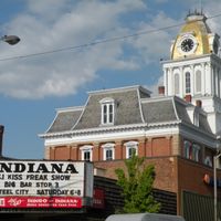
Indiana County, Administrative division in western Pennsylvania, United States.

Description

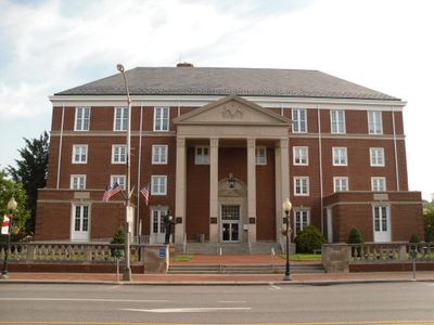
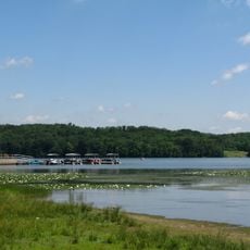
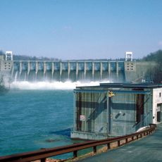
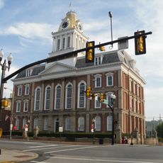
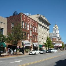
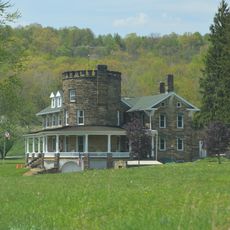
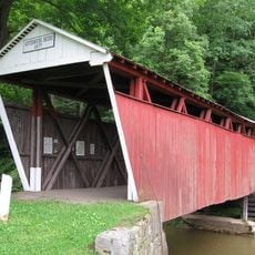
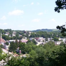
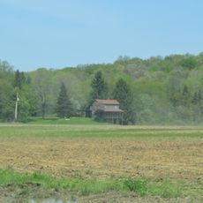
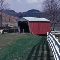
Indiana County is an administrative division in western Pennsylvania characterized by rolling terrain, valleys, and numerous small communities spread throughout its rural landscape. Government operations center in the city of Indiana, where residents access services related to taxation, infrastructure maintenance, and public safety.

History

The county was officially established on November 3, 1806, following land treaties that transferred territories from Native American nations to settler communities. This early founding reflects the region's expansion during the early 19th century.

Culture

Agriculture shapes daily life across the region, with farmers markets and county fairs bringing residents together to celebrate local products and customs passed down through generations.

Practical

Visitors will find the main administrative offices and public services in the city of Indiana, which serves as the county seat. Plan for longer travel times between communities, as the area is rural and distances between towns can be significant.

Did you know?

The region operates a local procurement program that directs a substantial portion of state purchasing funds toward businesses located within its boundaries. This initiative demonstrates how the area prioritizes supporting its own economy and workforce.

Location
Inception
November 3, 1806
Capital city
Indiana
Shares border with
Jefferson County, Clearfield County, Armstrong County, Westmoreland County, Cambria County
GPS coordinates
40.65000,-79.09000
Latest update
December 20, 2025 00:45

AroundUs brings together thousands of curated places, local tips, and hidden gems, enriched daily by 60,000 contributors worldwide. Discover all places nearby (Pennsylvania).

Around this place
Ghost Town Trail
United States of America

Ghost Town Trail

23.3 km
Keystone State Park
United States of America

Keystone State Park

39.7 km
Yellow Creek State Park
United States of America

Yellow Creek State Park

10.6 km
Conemaugh Dam
United States of America

Conemaugh Dam

30.9 km
United States of America

The Jimmy Stewart Museum

6.3 km
Miller Stadium
United States of America

Miller Stadium

7.3 km
Old Indiana County Courthouse
United States of America

Old Indiana County Courthouse

6 km
Buttermilk Falls Natural Area
United States of America

Buttermilk Falls Natural Area

25.7 km
United States of America

Loyalhanna Lake

37.4 km
United States of America

Keystone Lake

20 km
Silas M. Clark House
United States of America

Silas M. Clark House

6.2 km
Breezedale
United States of America

Breezedale

6.5 km
James Mitchell House
United States of America

James Mitchell House

6 km
Downtown Indiana Historic District
United States of America

Downtown Indiana Historic District

6.1 km
John B. McCormick House
United States of America

John B. McCormick House

21.1 km
Old Indiana County Jail and Sheriff's Office
United States of America

Old Indiana County Jail and Sheriff's Office

6.1 km
Graff's Market
United States of America

Graff's Market

5.9 km
Kintersburg Covered Bridge
United States of America

Kintersburg Covered Bridge

7.1 km
Thomas Covered Bridge
United States of America

Thomas Covered Bridge

12.5 km
Trusal Covered Bridge
United States of America

Trusal Covered Bridge

12 km
St. Peter's Episcopal Church and Rectory
United States of America

St. Peter's Episcopal Church and Rectory

28.4 km
Thomas Marshall House
United States of America

Thomas Marshall House

28.7 km
Saltsburg Historic District
United States of America

Saltsburg Historic District

35.7 km
George Diehl Homestead
United States of America

George Diehl Homestead

10.5 km
Sen. Joseph O. Clark House
United States of America

Sen. Joseph O. Clark House

29 km
Harmon's Covered Bridge
United States of America

Harmon's Covered Bridge

7.1 km
Bridge in West Wheatfield Township
United States of America

Bridge in West Wheatfield Township

27.7 km
Samuel Patterson House
United States of America

Samuel Patterson House

39.6 km
Show the full map
Administrative divisions
« Indiana County - Administrative division in western Pennsylvania, United States » is provided by Around Us (aroundus.com). Images and texts are derived from Wikimedia project under a Creative Commons license. You are allowed to copy, distribute, and modify copies of this page, under the conditions set by the license, as long as this note is clearly visible.

Discover hidden gems everywhere you go!

From secret cafés to breathtaking viewpoints, skip the crowded tourist spots and find places that match your style. Our app makes it easy with voice search, smart filtering, route optimization, and insider tips from travelers worldwide. Download now for the complete mobile experience.

Around Us App Screenshot

A unique approach to discovering new places

Le Figaro

All the places worth exploring

France Info

A tailor-made excursion in just a few clicks

20 Minutes

Around Us
Travel Guide & Maps
Download

Send to your phone

QR Code
1

Open the camera app on your mobile.

2

Point at the QR code with your camera. A notification will appear.

3

Tap the notification to open the link.