Chest opened
+${chestReward.xp} XP
Explorer
NOUVEAU ×${chestReward.collectible.quantity}
tapez pour fermer

See the monuments around you in AR Open chests in the app

Around Us is built for your phone — point your camera at the streets and discover the monuments and places around you in augmented reality. Around Us is built for your phone — chests unlock when you walk, explore and capture nearby places.

Enable Location

We need your location to show you interesting places around you

Discover nearby places

Find interesting locations and hidden gems around you

Precise directions

Get accurate directions and distances to places

Your location is never shared with other users. It's only used when you tap the location button.

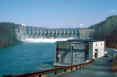
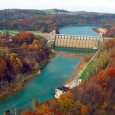
Conemaugh Dam

Log in to your account

Start exploring — it's free

Trusted by 86,340 travelers worldwide

Continue with Google
Continue with Apple
or

We will send you a code to connect

By continuing, you accept our Terms and Conditions and our Privacy Policy

Check your inbox

We've sent a pincode in your inbox. Please enter the code below.

Conemaugh Dam
Discussion Reviews 1 Photos
3.7k Popularity

Conemaugh Dam, Gravity dam in Indiana County, US

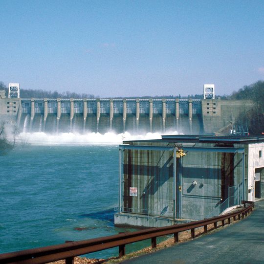
Conemaugh Dam is a gravity dam that holds back water across the Conemaugh River in the region. The structure was constructed to manage water flow and protect surrounding communities from flooding.

This dam was built in the 1950s after major floods demonstrated the need for water control measures. The project was part of a broader effort to manage flood risks across the region.

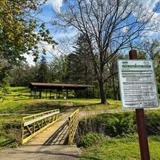
The Tunnelview Historic Park near the dam preserves sections of the Western Division canal, showing the evolution of transportation infrastructure in Pennsylvania.

The dam can be viewed from designated areas that offer views of the structure and the water behind it. Visit on a clear day to get the best experience of the location and its surroundings.

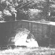
Two generations of railroad infrastructure at Bow Ridge include a 1907 stone arch bridge and a 1952 steel bridge, marking different engineering periods.

The community of curious travelers

AroundUs brings together thousands of curated places, local tips, and hidden gems, enriched daily by 60,000 contributors worldwide.
Start exploring
Location
GPS coordinates
40.46810,-79.36620
Latest update
September 12, 2026 09:35
Around this place
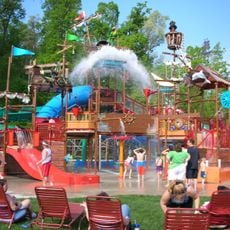
Idlewild and Soak Zone
United States of America

Idlewild and Soak Zone

15.1 mi
Keystone State Park
United States of America

Keystone State Park

6.7 mi
Westmoreland County Courthouse
United States of America

Westmoreland County Courthouse

14.9 mi
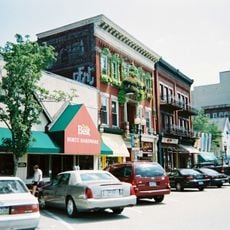
Greensburg Downtown Historic District
United States of America

Greensburg Downtown Historic District

14.8 mi
Cathedral of the Blessed Sacrament
United States of America

Cathedral of the Blessed Sacrament

14.7 mi
Five Star Trail
United States of America

Five Star Trail

19.3 mi
Miller Stadium
United States of America

Miller Stadium

14.7 mi
Academy Hill Historic District
United States of America

Academy Hill Historic District

14.4 mi
Site of Old Hannastown
United States of America

Site of Old Hannastown

11.3 mi
Drake Log Cabin
United States of America

Drake Log Cabin

13 mi
St. Gertrude Roman Catholic Church
United States of America

St. Gertrude Roman Catholic Church

14.1 mi
Fairview Park
United States of America

Fairview Park

10.9 mi
Citizens National Bank of Latrobe
United States of America

Citizens National Bank of Latrobe

10.5 mi
St. Vincent Archabbey Gristmill
United States of America

St. Vincent Archabbey Gristmill

12.1 mi
St. Peter's Episcopal Church and Rectory
United States of America

St. Peter's Episcopal Church and Rectory

5.9 mi
Vandergrift Historic District
United States of America

Vandergrift Historic District

13.9 mi
John Walter Farmstead
United States of America

John Walter Farmstead

13 mi
Saltsburg Historic District
United States of America

Saltsburg Historic District

4.6 mi
Salem Crossroads Historic District
United States of America

Salem Crossroads Historic District

11.4 mi
Hannastown Farm
United States of America

Hannastown Farm

10.8 mi
Bridge in West Wheatfield Township
United States of America

Bridge in West Wheatfield Township

13.3 mi
Samuel Patterson House
United States of America

Samuel Patterson House

5.6 mi
Slickville Historic District
United States of America

Slickville Historic District

8.3 mi
Westmoreland Museum of American Art
United States of America

Westmoreland Museum of American Art

14.6 mi
Conemaugh River Lake Dam
United States of America

Conemaugh River Lake Dam

3.5 mi
Lincoln Highway Experience
United States of America

Lincoln Highway Experience

12.3 mi
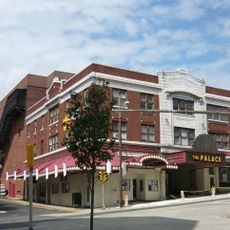
Palace Theatre
United States of America

Palace Theatre

14.8 mi
John Sutton Hall
United States of America

John Sutton Hall

15 mi
Show the full map
Reviews
Share your experience

No review yet

Discussions
Start a discussion...

No discussion yet

« Conemaugh Dam - Gravity dam in Indiana County, US » is provided by Around Us (aroundus.com). Images and texts are derived from Wikimedia project under a Creative Commons license. You are allowed to copy, distribute, and modify copies of this page, under the conditions set by the license, as long as this note is clearly visible.

Discover hidden gems everywhere you go!

From secret cafés to breathtaking viewpoints, skip the crowded tourist spots and find places that match your style. Our app makes it easy with voice search, smart filtering, route optimization, and insider tips from travelers worldwide. Download now for the complete mobile experience.
Around Us App Screenshot

A unique approach to discovering new places

Le Figaro

All the places worth exploring

France Info

A tailor-made excursion in just a few clicks

20 Minutes

Around Us
Travel Guide & Maps
Download

Send to your phone

QR Code
1

Open the camera app on your mobile.

2

Point at the QR code with your camera. A notification will appear.

3

Tap the notification to open the link.