Log in to your account

AroundUs is a community-driven map of interesting places, built by curious explorers like you. It grows with every review, story, and photo you share.
Connect to save your favorite spots, contribute locations, and create personalized routes.
Continue with Google
Continue with Apple
Continue with X
Continue with Facebook
Continue with email
By continuing, you accept our Terms and Conditions and our Privacy Policy
Create an account

Prairie Band of Potawatomi Nation

Add to collection
Map
Suggest a change
Share

Prairie Band of Potawatomi Nation, Native American reservation in Mayetta, Kansas.
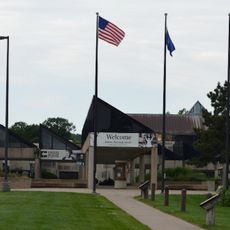
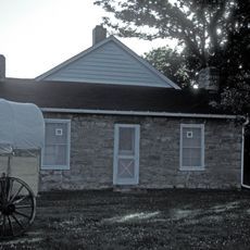
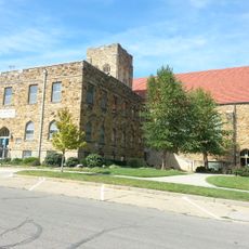
The Prairie Band Potawatomi Nation is a tribal territory in Mayetta with administrative buildings, community centers, and residential areas. The land covers approximately 50 square kilometers and serves as the homeland of the nation with functioning infrastructure for the population.

After the Indian Removal Act of 1830, the Potawatomi were forced from the Great Lakes region and migrated through Missouri and Iowa before settling in Kansas. This journey was part of a broader forced migration that affected many tribal groups across North America.

The nation preserves its traditions through regular ceremonies and language programs that are passed down in the community. Visitors can participate in cultural events and experience the living connection to Potawatomi identity.

Visitors should know that this is a private tribal territory and some areas may be restricted. Ask at visitor centers about current access rules and safety guidelines before exploring the territory.

The nation operates a casino resort that generates revenue to support community development while maintaining tribal independence. This is a self-directed economic initiative managed entirely by the community.

Location: Kansas

Website: http://pbpindiantribe.com

GPS coordinates: 39.34078,-95.84040

Latest update: December 10, 2025 15:57

Photos
Around this place
Equality House
United States of America

Equality House

34.4 km
Cedar Crest
United States of America

Cedar Crest

31.6 km
Gage Park
United States of America

Gage Park

33.1 km
Topeka Zoo
United States of America

Topeka Zoo

33.1 km
Topeka & Shawnee County Public Library
United States of America

Topeka & Shawnee County Public Library

34.6 km
Kansas Museum of History
United States of America

Kansas Museum of History

32.2 km
Great Overland Station
United States of America

Great Overland Station

33.9 km
United States of America

St. Mary's Mission

25.3 km
Reinisch Rose Garden and Doran Rock Garden
United States of America

Reinisch Rose Garden and Doran Rock Garden

33.3 km
Constitution Hall
United States of America

Constitution Hall

35 km
United States of America

Kanza Bowl

33.1 km
St. Joseph's Catholic Church
United States of America

St. Joseph's Catholic Church

34.7 km
Ward-Meade House
United States of America

Ward-Meade House

33.8 km
Church of the Assumption and Rectory
United States of America

Church of the Assumption and Rectory

35.2 km
Pottawatomie Indian Pay Station
United States of America

Pottawatomie Indian Pay Station

25.3 km
Topeka Council of Colored Women's Clubs Building
United States of America

Topeka Council of Colored Women's Clubs Building

35 km
Pottawatomie Baptist Mission Building
United States of America

Pottawatomie Baptist Mission Building

32.2 km
Discovery Center of Kansas
United States of America

Discovery Center of Kansas

33.4 km
St. John's Lutheran School
United States of America

St. John's Lutheran School

34.8 km
St. John African Methodist Episcopal Church
United States of America

St. John African Methodist Episcopal Church

35 km
Hughes Conoco Service Station
United States of America

Hughes Conoco Service Station

34.4 km
Westminster Presbyterian Church of Topeka
United States of America

Westminster Presbyterian Church of Topeka

35.2 km
McFadden House
United States of America

McFadden House

16.4 km
Holton Bath House
United States of America

Holton Bath House

16.2 km
North Topeka Baptist Church
United States of America

North Topeka Baptist Church

33.7 km
Crawford Building
United States of America

Crawford Building

35.1 km
Church of the Assumption Historic District
United States of America

Church of the Assumption Historic District

35.3 km
Meriden Rock Creek Bridge
United States of America

Meriden Rock Creek Bridge

30 km
Show the full map
Reviews

Visited this place? Tap the stars to rate it and share your experience / photos with the community! Try now! You can cancel it anytime.

« Prairie Band of Potawatomi Nation - Native American reservation in Mayetta, Kansas » is provided by Around Us (aroundus.com). Images and texts are derived from Wikimedia project under a Creative Commons license. You are allowed to copy, distribute, and modify copies of this page, under the conditions set by the license, as long as this note is clearly visible.

Discover hidden gems everywhere you go!

From secret cafés to breathtaking viewpoints, skip the crowded tourist spots and find places that match your style. Our app makes it easy with voice search, smart filtering, route optimization, and insider tips from travelers worldwide. Download now for the complete mobile experience.

Around Us App Screenshot

A unique approach to discovering new places

Le Figaro

All the places worth exploring

France Info

A tailor-made excursion in just a few clicks

20 Minutes