Chest opened
+${chestReward.xp} XP
Explorer
NOUVEAU ×${chestReward.collectible.quantity}
tapez pour fermer
Chest locked

Open chests in the app

Around Us is built for your phone — chests unlock when you walk, explore and capture nearby places.

Enable Location

We need your location to show you interesting places around you

Discover nearby places

Find interesting locations and hidden gems around you

Precise directions

Get accurate directions and distances to places

Your location is never shared with other users. It's only used when you tap the location button.

Log in to your account

Start exploring — it's free

Trusted by 72,914 travelers worldwide

Continue with Google
Continue with Apple
or

We will send you a code to connect

By continuing, you accept our Terms and Conditions and our Privacy Policy

Check your inbox

We've sent a pincode in your inbox. Please enter the code below.

Pleasure Beach Bridge
Discussion Reviews Photo
1.1k Popularity

Pleasure Beach Bridge, bridge in United States of America

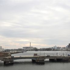
Pleasure Beach Bridge is a movable bridge in Bridgeport, Connecticut, connecting the island of Pleasure Beach to the mainland. Built and completed in 1927, the structure is about 383 meters long and features a Warren through-truss design with a swing span that could pivot to allow boats to pass underneath while vehicles and pedestrians crossed above.

The bridge was completed in 1927 after the city approved building a movable crossing to the island in 1907. During the Great Depression, the city of Bridgeport took over control from the operating company and eliminated toll fees, making the bridge free for the community to use.

The name Pleasure Beach came from when the city of Bridgeport bought the island in 1919 and turned it into an amusement park. Visitors can still see how the place served as a gathering spot where people came together for music, entertainment, and social life.

The bridge was long used by pedestrians and vehicles to reach the island but was damaged by fire in summer 1996 and closed afterward. Today, visitors can reach the island by water taxi, a service that began running around 2013 as an alternative to crossing the bridge.

A fire destroyed the middle section of the bridge in 1996, rendering it permanently unusable and marking the end of an important local era. The operator's house still stands on the mainland side as a reminder of when the bridge was actively used.

The community of curious travelers

AroundUs brings together thousands of curated places, local tips, and hidden gems, enriched daily by 60,000 contributors worldwide.

Start exploring
Official opening
1927
GPS coordinates
41.16600,-73.16780
Latest update
February 10, 2026 22:29
Around this place
Total Mortgage Arena
United States of America

Total Mortgage Arena

1.8 km
Seaside Village Historic District
United States of America

Seaside Village Historic District

1.8 km
Mary and Eliza Freeman Houses
United States of America

Mary and Eliza Freeman Houses

1.6 km
Bridgeport Harbor Light
United States of America

Bridgeport Harbor Light

1.5 km
Tongue Point Light
United States of America

Tongue Point Light

817 m
Statue of Christopher Columbus
United States of America

Statue of Christopher Columbus

1.9 km
Seaside Institute
United States of America

Seaside Institute

1.7 km
Perry Memorial Arch
United States of America

Perry Memorial Arch

1.8 km
Sterling Hill Historic District
United States of America

Sterling Hill Historic District

1.9 km
United States of America

P.T. Barnum Bridge

1.9 km
Eagle's Nest
United States of America

Eagle's Nest

1.5 km
United States of America

Marina Park Historic District

1.9 km
Ein Jacob Synagogue
United States of America

Ein Jacob Synagogue

1.6 km
Barnum/Palliser Historic District
United States of America

Barnum/Palliser Historic District

1.4 km
Gateway Village Historic District
United States of America

Gateway Village Historic District

2 km
David Perry House
United States of America

David Perry House

1.9 km
Deacon's Point Historic District
United States of America

Deacon's Point Historic District

1.9 km
Bridgeport Harbor Light
United States of America

Bridgeport Harbor Light

1.5 km
United States of America

Johnson Oak Park

1.6 km
United States of America

Pleasure Beach Park

729 m
Bridgeport Harbor Light
United States of America

Bridgeport Harbor Light

1.5 km
United States of America

Long Beach

854 m
United States of America

Barnum-Palliser Historic District

1.9 km
Yellow Mill Bridge
United States of America

Yellow Mill Bridge

1.4 km
United States of America

Statue, Work of art

1.7 km
United States of America

Scenic viewpoint

1.7 km
United States of America

Scenic viewpoint

1.7 km
United States of America

Cannon

1.7 km
Show the full map
Reviews
Share your experience

No review yet

Discussions
Start a discussion...

No discussion yet

« Pleasure Beach Bridge - bridge in United States of America » is provided by Around Us (aroundus.com). Images and texts are derived from Wikimedia project under a Creative Commons license. You are allowed to copy, distribute, and modify copies of this page, under the conditions set by the license, as long as this note is clearly visible.

Discover hidden gems everywhere you go!

From secret cafés to breathtaking viewpoints, skip the crowded tourist spots and find places that match your style. Our app makes it easy with voice search, smart filtering, route optimization, and insider tips from travelers worldwide. Download now for the complete mobile experience.

Around Us App Screenshot

A unique approach to discovering new places

Le Figaro

All the places worth exploring

France Info

A tailor-made excursion in just a few clicks

20 Minutes

Around Us
Travel Guide & Maps
Download

Send to your phone

QR Code
1

Open the camera app on your mobile.

2

Point at the QR code with your camera. A notification will appear.

3

Tap the notification to open the link.