Seaside Village Historic District

Log in to your account

AroundUs is a community-driven map of interesting places, built by curious explorers like you. It grows with every review, story, and photo you share.
Connect to save your favorite spots, contribute locations, and create personalized routes.
Continue with Google
Continue with Apple
Continue with X
Continue with Facebook
Continue with email
By continuing, you accept our Terms and Conditions and our Privacy Policy
Create an account
Add to collection
Map
Suggest a change
Share

Seaside Village Historic District, Historic residential district in South End, Bridgeport, US.

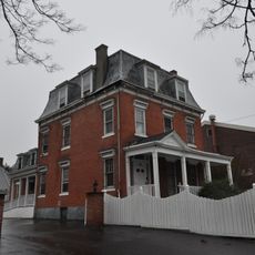
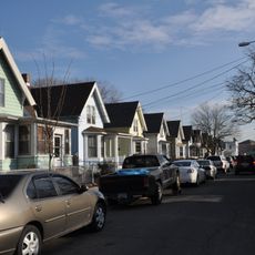
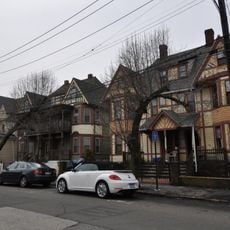
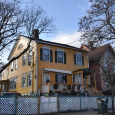
Seaside Village Historic District is a residential area in Bridgeport featuring brick row houses built in Colonial Revival style arranged around courtyards and tree-lined streets. The approximately 257 homes form a cohesive neighborhood where buildings alternate with open green spaces and pathways designed to connect residents.

The neighborhood was built during World War I to provide housing for factory workers and support the local industrial economy. In the 1950s, most residents gained ownership of their homes through a cooperative arrangement, which fundamentally changed how the community developed.

The neighborhood reflects how working-class families built their lives here over many decades, creating strong bonds between residents. The way people use their homes and streets today shows the community spirit that has endured throughout its existence.

The district is easy to explore on foot because the streets are designed for pedestrians and the neighborhood blocks connect directly to one another. Visitors should allow time to walk through different sections to see how the housing and green spaces work together throughout the area.

The neighborhood was designed as an experimental model for worker housing and remains one of the few surviving examples of planned communities from that era. Its layout shows how thoughtful design created places where residents could form strong communities without feeling cramped.

Location: Bridgeport

Architectural style: Colonial Revival architecture

Elevation above the sea: 9 m

GPS coordinates: 41.16482,-73.18928

Latest update: December 12, 2025 07:55

Photos
Around this place
Total Mortgage Arena
United States of America

Total Mortgage Arena

952 m
Iranistan
United States of America

Iranistan

1.5 km
Barnum Museum
United States of America

Barnum Museum

1.2 km
Seaside Park
United States of America

Seaside Park

1.2 km
Mary and Eliza Freeman Houses
United States of America

Mary and Eliza Freeman Houses

588 m
Klein Memorial Auditorium
United States of America

Klein Memorial Auditorium

1.5 km
Bridgeport Harbor Light
United States of America

Bridgeport Harbor Light

1.2 km
Tongue Point Light
United States of America

Tongue Point Light

1 km
Fairfield County Courthouse
United States of America

Fairfield County Courthouse

1.8 km
Elmer S. Dailey
United States of America

Elmer S. Dailey

1.5 km
Nathaniel Wheeler Memorial Fountain
United States of America

Nathaniel Wheeler Memorial Fountain

1.3 km
Statue of Christopher Columbus
United States of America

Statue of Christopher Columbus

570 m
Priscilla Dailey
United States of America

Priscilla Dailey

1.5 km
Berkshire No. 7
United States of America

Berkshire No. 7

1.5 km
Perry Memorial Arch
United States of America

Perry Memorial Arch

227 m
Bridgeport Downtown South Historic District
United States of America

Bridgeport Downtown South Historic District

1.4 km
United States Post Office–Bridgeport Main
United States of America

United States Post Office–Bridgeport Main

1.8 km
Connecticut Railway and Lighting Company Car Barn
United States of America

Connecticut Railway and Lighting Company Car Barn

1.9 km
Golden Hill Historic District
United States of America

Golden Hill Historic District

1.8 km
Peyton Randolph Bishop House
United States of America

Peyton Randolph Bishop House

1.6 km
Bassickville Historic District
United States of America

Bassickville Historic District

2 km
Bridgeport City Hall
United States of America

Bridgeport City Hall

1.3 km
Railroad Avenue Industrial District
United States of America

Railroad Avenue Industrial District

1.7 km
Barnum/Palliser Historic District
United States of America

Barnum/Palliser Historic District

540 m
David Perry House
United States of America

David Perry House

613 m
Bridgeport Harbor Light
United States of America

Bridgeport Harbor Light

1.2 km
Bridgeport Harbor Light
United States of America

Bridgeport Harbor Light

1.2 km
Yellow Mill Bridge
United States of America

Yellow Mill Bridge

1.7 km
Show the full map
Reviews

Visited this place? Tap the stars to rate it and share your experience / photos with the community! Try now! You can cancel it anytime.

« Seaside Village Historic District - Historic residential district in South End, Bridgeport, US » is provided by Around Us (aroundus.com). Images and texts are derived from Wikimedia project under a Creative Commons license. You are allowed to copy, distribute, and modify copies of this page, under the conditions set by the license, as long as this note is clearly visible.

Discover hidden gems everywhere you go!

From secret cafés to breathtaking viewpoints, skip the crowded tourist spots and find places that match your style. Our app makes it easy with voice search, smart filtering, route optimization, and insider tips from travelers worldwide. Download now for the complete mobile experience.

Around Us App Screenshot

A unique approach to discovering new places

Le Figaro

All the places worth exploring

France Info

A tailor-made excursion in just a few clicks

20 Minutes