Enable Location

We need your location to show you interesting places around you

Discover nearby places

Find interesting locations and hidden gems around you

Precise directions

Get accurate directions and distances to places

Your location is never shared with other users. It's only used when you tap the location button.

Tunxis State Forest

Log in to your account

Start exploring — it's free

Trusted by 63,223 travelers worldwide

Continue with Google
Continue with Apple
or

We will send you a code to connect

By continuing, you accept our Terms and Conditions and our Privacy Policy

Check your inbox

We've sent a pincode in your inbox. Please enter the code below.

Tunxis State Forest
Discussion Reviews 1 Photos
1.6k Popularity

Tunxis State Forest, State forest in Connecticut, United States.

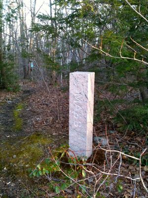
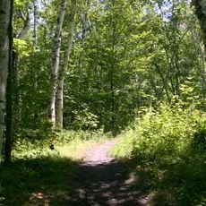
Tunxis State Forest is a state forest in Connecticut spanning three towns with mixed woodland habitats and natural trail systems. The forest encompasses forested areas and open spaces connected by paths suitable for day trips and exploration.

The forest was established in 1923 by Connecticut state government as part of efforts to protect natural areas. This creation reflected broader conservation goals of that era.

The forest serves as a gathering place where visitors connect with the natural world through hiking and outdoor recreation. It holds meaning for locals as a space where they can experience Connecticut's native forests and wildlife.

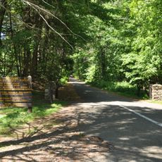
The forest has multiple parking areas at different access points throughout the three towns. Trails vary in difficulty, so visitors can choose routes that match their comfort level and available time.

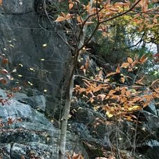
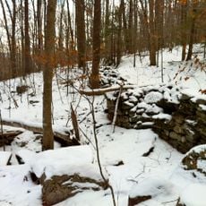
The forest contains several distinct habitat types within a relatively small area, including wetlands and open meadows alongside forests. These varied environments support different combinations of plant and animal species found throughout Connecticut.

The community of curious travelers

AroundUs brings together thousands of curated places, local tips, and hidden gems, enriched daily by 60,000 contributors worldwide.

Start exploring
Location
Location
Location
Inception
1923
Elevation above the sea
319 m
GPS coordinates
42.01890,-72.95830
Latest update
December 14, 2025 14:23
Around this place
Gilbert Clock Factory
United States of America

Gilbert Clock Factory

12.9 km
Tolland State Forest
United States of America

Tolland State Forest

14.1 km
Riverton Historic District
United States of America

Riverton Historic District

8.1 km
Peoples State Forest
United States of America

Peoples State Forest

10.6 km
American Legion State Forest
United States of America

American Legion State Forest

10.2 km
Frederick H. Cossitt Library
United States of America

Frederick H. Cossitt Library

10.9 km
American Legion State Forest Trails
United States of America

American Legion State Forest Trails

10.5 km
New Boston Village Historic District
United States of America

New Boston Village Historic District

12.9 km
Colebrook Store
United States of America

Colebrook Store

11.9 km
Barkhamsted Center Historic District
United States of America

Barkhamsted Center Historic District

10 km
Granville Center Historic District
United States of America

Granville Center Historic District

8.7 km
Phelps Farms Historic District
United States of America

Phelps Farms Historic District

13 km
Peoples State Forest Nature Museum
United States of America

Peoples State Forest Nature Museum

10.9 km
West Granville Historic District
United States of America

West Granville Historic District

6.7 km
Tunxis Forest Ski Cabin
United States of America

Tunxis Forest Ski Cabin

2.6 km
William Moore Jr. House
United States of America

William Moore Jr. House

7.9 km
Union Church/St. Paul's Church
United States of America

Union Church/St. Paul's Church

8.1 km
Winsted Green Historic District
United States of America

Winsted Green Historic District

13.7 km
Granville Village Historic District
United States of America

Granville Village Historic District

9.4 km
Samuel Hayes II House
United States of America

Samuel Hayes II House

14.2 km
Winsted Hosiery Mill
United States of America

Winsted Hosiery Mill

13.5 km
Arah Phelps Inn
United States of America

Arah Phelps Inn

13 km
John and Ruth Rose House
United States of America

John and Ruth Rose House

7.7 km
Colebrook Center Historic District
United States of America

Colebrook Center Historic District

11.8 km
Judah Holcomb House
United States of America

Judah Holcomb House

12.3 km
Moses Camp House
United States of America

Moses Camp House

14.3 km
New Boston Inn
United States of America

New Boston Inn

12.9 km
Falls Brook Trail
United States of America

Falls Brook Trail

576 m
Show the full map
Reviews
Share your experience

No review yet

Discussions
Start a discussion...

No discussion yet

« Tunxis State Forest - State forest in Connecticut, United States » is provided by Around Us (aroundus.com). Images and texts are derived from Wikimedia project under a Creative Commons license. You are allowed to copy, distribute, and modify copies of this page, under the conditions set by the license, as long as this note is clearly visible.

Discover hidden gems everywhere you go!

From secret cafés to breathtaking viewpoints, skip the crowded tourist spots and find places that match your style. Our app makes it easy with voice search, smart filtering, route optimization, and insider tips from travelers worldwide. Download now for the complete mobile experience.

Around Us App Screenshot

A unique approach to discovering new places

Le Figaro

All the places worth exploring

France Info

A tailor-made excursion in just a few clicks

20 Minutes

Around Us
Travel Guide & Maps
Download

Send to your phone

QR Code
1

Open the camera app on your mobile.

2

Point at the QR code with your camera. A notification will appear.

3

Tap the notification to open the link.