Enable Location

We need your location to show you interesting places around you

Discover nearby places

Find interesting locations and hidden gems around you

Precise directions

Get accurate directions and distances to places

Your location is never shared with other users. It's only used when you tap the location button.

American Legion State Forest

Log in to your account

Start exploring — it's free

Trusted by 61,559 travelers worldwide

Continue with Google
Continue with Apple
or

We will send you a code to connect

By continuing, you accept our Terms and Conditions and our Privacy Policy

Check your inbox

We've sent a pincode in your inbox. Please enter the code below.

American Legion State Forest

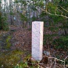
American Legion State Forest, State forest in Barkhamsted, Connecticut, US.

Description

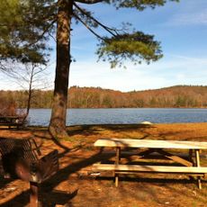
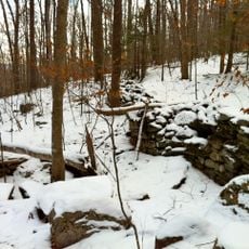
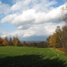
American Legion State Forest is a state forest in Barkhamsted, Connecticut, that spreads along the West Branch Farmington River with a network of hiking trails through varied natural habitats. The property includes campgrounds with basic facilities, picnic areas, and direct river access for swimming and fishing.

History

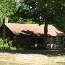
The American Legion donated the initial land to Connecticut in 1927, establishing the foundation for this protected forest. During the 1930s, workers from the Civilian Conservation Corps constructed trails, facilities, and infrastructure that shaped the forest into a public recreation area.

Culture

The forest serves as an outdoor classroom for environmental education, allowing visitors to learn about local ecosystems and wildlife conservation practices.

Practical

Wear sturdy shoes when exploring the trails, as paths can be uneven and muddy, especially near the river and wooded sections. The forest is accessible during daylight hours, with both shaded woodland walks and open areas for relaxation and picnicking.

Did you know?

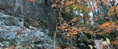
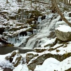
The Henry Buck Trail leads hikers past notable cliff formations and rock outcroppings that reveal geological features rarely seen elsewhere in the region. These natural rock faces create unexpected views within the forest landscape.

Elevation above the sea
182 m
GPS coordinates
41.93621,-73.01038
Latest update
December 14, 2025 16:45

AroundUs brings together thousands of curated places, local tips, and hidden gems, enriched daily by 60,000 contributors worldwide. Discover all places nearby (United States of America).

Around this place
Satan's Kingdom State Recreation Area
United States of America

Satan's Kingdom State Recreation Area

10 km
Gilbert Clock Factory
United States of America

Gilbert Clock Factory

4 km
Burr Pond State Park
United States of America

Burr Pond State Park

10.2 km
Riverton Historic District
United States of America

Riverton Historic District

2.8 km
Peoples State Forest
United States of America

Peoples State Forest

8 km
Pine Meadow Historic District
United States of America

Pine Meadow Historic District

7.6 km
Canton Center Historic District
United States of America

Canton Center Historic District

11.7 km
Tunxis State Forest
United States of America

Tunxis State Forest

10.2 km
American Legion State Forest Trails
United States of America

American Legion State Forest Trails

361 m
Platt Hill State Park
United States of America

Platt Hill State Park

9 km
Sun Terrace
United States of America

Sun Terrace

9.1 km
Colebrook Store
United States of America

Colebrook Store

9.3 km
Barkhamsted Center Historic District
United States of America

Barkhamsted Center Historic District

3.7 km
Philip Chapin House
United States of America

Philip Chapin House

7.6 km
Peoples State Forest Nature Museum
United States of America

Peoples State Forest Nature Museum

1.6 km
Gillette's Grist Mill
United States of America

Gillette's Grist Mill

11 km
Tunxis Forest Ski Cabin
United States of America

Tunxis Forest Ski Cabin

10.5 km
William Moore Jr. House
United States of America

William Moore Jr. House

3 km
Esperanza
United States of America

Esperanza

8.9 km
Union Church/St. Paul's Church
United States of America

Union Church/St. Paul's Church

3 km
Winsted Green Historic District
United States of America

Winsted Green Historic District

4.5 km
Solomon Rockwell House
United States of America

Solomon Rockwell House

5.8 km
Winsted Hosiery Mill
United States of America

Winsted Hosiery Mill

4.3 km
Paugnut State Forest Administration Building
United States of America

Paugnut State Forest Administration Building

10 km
West End Commercial District
United States of America

West End Commercial District

5.4 km
Colebrook Center Historic District
United States of America

Colebrook Center Historic District

9.2 km
Moses Camp House
United States of America

Moses Camp House

5.6 km
Falls Brook Trail
United States of America

Falls Brook Trail

10.6 km
Show the full map
« American Legion State Forest - State forest in Barkhamsted, Connecticut, US » is provided by Around Us (aroundus.com). Images and texts are derived from Wikimedia project under a Creative Commons license. You are allowed to copy, distribute, and modify copies of this page, under the conditions set by the license, as long as this note is clearly visible.

Discover hidden gems everywhere you go!

From secret cafés to breathtaking viewpoints, skip the crowded tourist spots and find places that match your style. Our app makes it easy with voice search, smart filtering, route optimization, and insider tips from travelers worldwide. Download now for the complete mobile experience.

Around Us App Screenshot

A unique approach to discovering new places

Le Figaro

All the places worth exploring

France Info

A tailor-made excursion in just a few clicks

20 Minutes

Around Us
Travel Guide & Maps
Download

Send to your phone

QR Code
1

Open the camera app on your mobile.

2

Point at the QR code with your camera. A notification will appear.

3

Tap the notification to open the link.