Pine Meadow Historic District

Log in to your account

AroundUs is a community-driven map of interesting places, built by curious explorers like you. It grows with every review, story, and photo you share.
Connect to save your favorite spots, contribute locations, and create personalized routes.
Continue with Google
Continue with Apple
Continue with X
Continue with Facebook
Continue with email
By continuing, you accept our Terms and Conditions and our Privacy Policy
Create an account
Add to collection
Map
Suggest a change
Share

Pine Meadow Historic District, Historical district in New Hartford, Connecticut, United States.

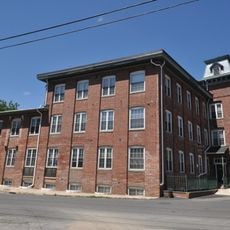
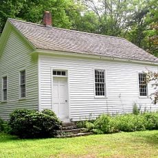
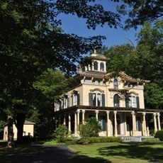
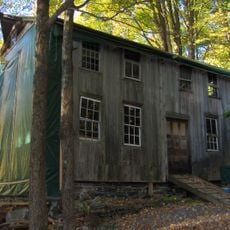
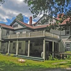
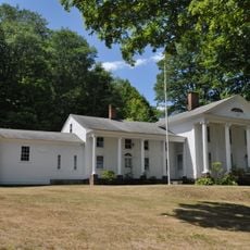
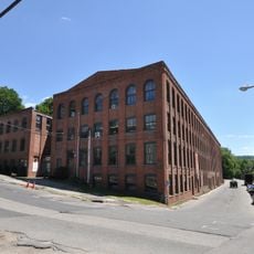
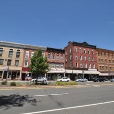
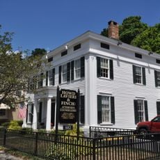
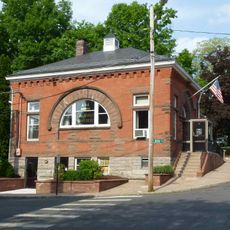
Pine Meadow Historic District spreads across a large area along the West Branch of the Farmington River, displaying Federal, Greek Revival, and Queen Anne architectural styles. The site contains various structures ranging from single-family homes to multi-story buildings, each showing different levels of preservation from the 1800s industrial village.

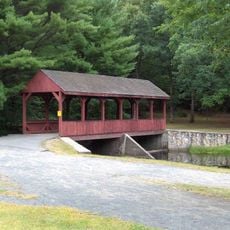
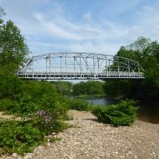
Development of the area began in 1806 when Roger Sheldon built a dam on the West Branch Farmington River to create a power canal for industrial operations. This infrastructure transformed the location into a center for brass and textile manufacturing in the region.

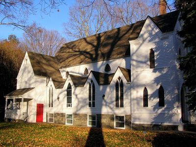
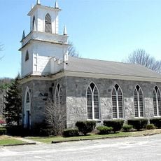
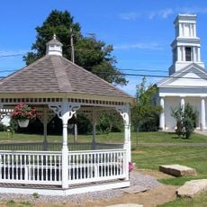
The green space between Main Street and Church Street brings together structures from different architectural periods side by side. Walking through this area, you see St. John's Episcopal Church and the Philip Chapin House standing as examples of how building styles evolved over time.

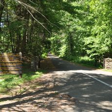
Walking through the district requires patience with uneven, historical pathways and grass areas between structures. Wear sturdy shoes, as the ground surface varies and some paths are narrower than contemporary standards.

The district once relied on a series of water-powered facilities that drove brass and textile mills using river energy. The canals and control structures along Wickett Street remain visible today, showing how cleverly the river's flow was harnessed for manufacturing.

Location: Connecticut

Architectural style: Greek Revival architecture

GPS coordinates: 41.87528,-72.96778

Latest update: December 14, 2025 09:40

Photos
Around this place
Satan's Kingdom State Recreation Area
United States of America

Satan's Kingdom State Recreation Area

2.4 km
Gilbert Clock Factory
United States of America

Gilbert Clock Factory

9.7 km
Burr Pond State Park
United States of America

Burr Pond State Park

10.5 km
Riverton Historic District
United States of America

Riverton Historic District

10.4 km
Peoples State Forest
United States of America

Peoples State Forest

7.5 km
Nepaug State Forest
United States of America

Nepaug State Forest

4.3 km
Stratton Brook State Park
United States of America

Stratton Brook State Park

11.1 km
Town Bridge
United States of America

Town Bridge

6.5 km
Canton Center Historic District
United States of America

Canton Center Historic District

4.7 km
American Legion State Forest
United States of America

American Legion State Forest

7.6 km
American Legion State Forest Trails
United States of America

American Legion State Forest Trails

7.4 km
Sun Terrace
United States of America

Sun Terrace

4.4 km
Barkhamsted Center Historic District
United States of America

Barkhamsted Center Historic District

6.1 km
Philip Chapin House
United States of America

Philip Chapin House

97 m
Peoples State Forest Nature Museum
United States of America

Peoples State Forest Nature Museum

6.1 km
Gillette's Grist Mill
United States of America

Gillette's Grist Mill

6.3 km
United States of America

John Wiard House

11.1 km
William Moore Jr. House
United States of America

William Moore Jr. House

10.6 km
Massaco Forest Pavilion
United States of America

Massaco Forest Pavilion

11 km
Esperanza
United States of America

Esperanza

3.5 km
Union Church/St. Paul's Church
United States of America

Union Church/St. Paul's Church

10.6 km
Winsted Green Historic District
United States of America

Winsted Green Historic District

9.3 km
Solomon Rockwell House
United States of America

Solomon Rockwell House

10.7 km
Winsted Hosiery Mill
United States of America

Winsted Hosiery Mill

9.3 km
Paugnut State Forest Administration Building
United States of America

Paugnut State Forest Administration Building

10.4 km
West End Commercial District
United States of America

West End Commercial District

10 km
Moses Camp House
United States of America

Moses Camp House

10.5 km
Collinsville Historic District
United States of America

Collinsville Historic District

8 km
Show the full map
Reviews

Visited this place? Tap the stars to rate it and share your experience / photos with the community! Try now! You can cancel it anytime.

« Pine Meadow Historic District - Historical district in New Hartford, Connecticut, United States » is provided by Around Us (aroundus.com). Images and texts are derived from Wikimedia project under a Creative Commons license. You are allowed to copy, distribute, and modify copies of this page, under the conditions set by the license, as long as this note is clearly visible.

Discover hidden gems everywhere you go!

From secret cafés to breathtaking viewpoints, skip the crowded tourist spots and find places that match your style. Our app makes it easy with voice search, smart filtering, route optimization, and insider tips from travelers worldwide. Download now for the complete mobile experience.

Around Us App Screenshot

A unique approach to discovering new places

Le Figaro

All the places worth exploring

France Info

A tailor-made excursion in just a few clicks

20 Minutes