Nepaug State Forest

Log in to your account

AroundUs is a community-driven map of interesting places, built by curious explorers like you. It grows with every review, story, and photo you share.
Connect to save your favorite spots, contribute locations, and create personalized routes.
Continue with Google
Continue with Apple
Continue with X
Continue with Facebook
Continue with email
By continuing, you accept our Terms and Conditions and our Privacy Policy
Create an account
Add to collection
Map
Suggest a change
Share

Nepaug State Forest, State forest in New Hartford, Connecticut, United States.

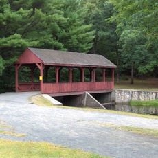
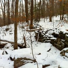
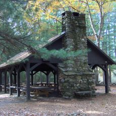
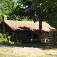
Nepaug State Forest is a protected woodland area near New Hartford covering 1,373 acres with diverse landscapes, forested slopes, and natural streams. The land includes numerous marked trails for different activities and forest recreation areas throughout the property.

This forest was established in 1942 by the Connecticut Department of Energy and Environmental Protection to protect natural resources and provide public recreation space. The creation reflected the state's commitment to preserving woodland for future generations.

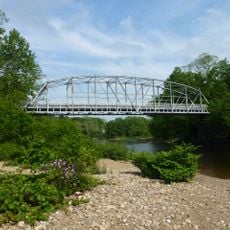
The Tunxis Trail connects hikers to a larger network of walking paths across Connecticut and invites visitors to explore the region's outdoor tradition. This blue-blazed route has become part of the local hiking culture that spans generations.

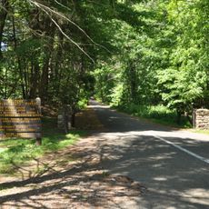
Visitors can hike on marked trails including the Valley Outlook Trail, which leads to viewpoints with valley views and suits different fitness levels. The paths are well marked but can become muddy seasonally, so plan accordingly for your visit.

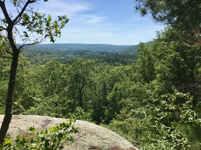
The Valley Outlook Trail leads hikers to elevated vantage points overlooking the Nepaug Valley and distant Yellow Mountain. These viewpoint locations reward those who take this specific route and are not immediately obvious to casual visitors.

Elevation above the sea: 188 m

GPS coordinates: 41.83778,-72.95750

Latest update: December 14, 2025 11:23

Photos
Around this place
Satan's Kingdom State Recreation Area
United States of America

Satan's Kingdom State Recreation Area

2 km
Burr Pond State Park
United States of America

Burr Pond State Park

11.8 km
Peoples State Forest
United States of America

Peoples State Forest

10.8 km
Pine Meadow Historic District
United States of America

Pine Meadow Historic District

4.3 km
Stratton Brook State Park
United States of America

Stratton Brook State Park

10.5 km
Town Bridge
United States of America

Town Bridge

2.8 km
Canton Center Historic District
United States of America

Canton Center Historic District

4.1 km
American Legion State Forest
United States of America

American Legion State Forest

11.8 km
Horse Guard State Park
United States of America

Horse Guard State Park

8.8 km
American Legion State Forest Trails
United States of America

American Legion State Forest Trails

11.5 km
Avon Congregational Church
United States of America

Avon Congregational Church

11 km
West End Library
United States of America

West End Library

10.6 km
Sun Terrace
United States of America

Sun Terrace

5 km
Barkhamsted Center Historic District
United States of America

Barkhamsted Center Historic District

10.3 km
Philip Chapin House
United States of America

Philip Chapin House

4.3 km
Soldiers' Monument in Bristol, Connecticut
United States of America

Soldiers' Monument in Bristol, Connecticut

10.5 km
Peoples State Forest Nature Museum
United States of America

Peoples State Forest Nature Museum

10.3 km
Gillette's Grist Mill
United States of America

Gillette's Grist Mill

5.6 km
United States of America

John Wiard House

7.2 km
Esperanza
United States of America

Esperanza

4.2 km
Massaco Forest Pavilion
United States of America

Massaco Forest Pavilion

10.5 km
American Legion Forest CCC Shelter
United States of America

American Legion Forest CCC Shelter

10.9 km
Brown Tavern
United States of America

Brown Tavern

7.7 km
Paugnut State Forest Administration Building
United States of America

Paugnut State Forest Administration Building

11.8 km
Burlington–Harmony Hill Roads Historic District
United States of America

Burlington–Harmony Hill Roads Historic District

10.3 km
Litchfield–South Roads Historic District
United States of America

Litchfield–South Roads Historic District

11.3 km
Pine Grove Historic District
United States of America

Pine Grove Historic District

11.3 km
United States of America

Treadwell House

7.7 km
Show the full map
Reviews

Visited this place? Tap the stars to rate it and share your experience / photos with the community! Try now! You can cancel it anytime.

« Nepaug State Forest - State forest in New Hartford, Connecticut, United States » is provided by Around Us (aroundus.com). Images and texts are derived from Wikimedia project under a Creative Commons license. You are allowed to copy, distribute, and modify copies of this page, under the conditions set by the license, as long as this note is clearly visible.

Discover hidden gems everywhere you go!

From secret cafés to breathtaking viewpoints, skip the crowded tourist spots and find places that match your style. Our app makes it easy with voice search, smart filtering, route optimization, and insider tips from travelers worldwide. Download now for the complete mobile experience.

Around Us App Screenshot

A unique approach to discovering new places

Le Figaro

All the places worth exploring

France Info

A tailor-made excursion in just a few clicks

20 Minutes