Enable Location

We need your location to show you interesting places around you

Discover nearby places

Find interesting locations and hidden gems around you

Precise directions

Get accurate directions and distances to places

Your location is never shared with other users. It's only used when you tap the location button.

Platt Hill State Park

Log in to your account

Start exploring — it's free

Trusted by 62,487 travelers worldwide

Continue with Google
Continue with Apple
or

We will send you a code to connect

By continuing, you accept our Terms and Conditions and our Privacy Policy

Check your inbox

We've sent a pincode in your inbox. Please enter the code below.

Platt Hill State Park

Platt Hill State Park, State park in Litchfield County, Connecticut

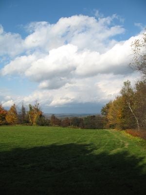
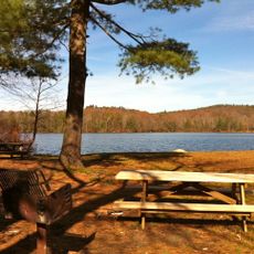
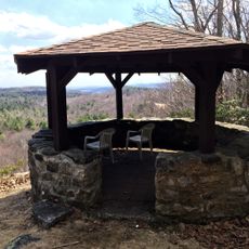
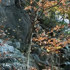
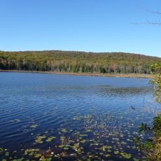
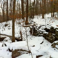
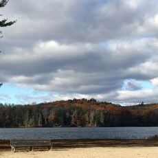
Platt Hill State Park is a 159-acre natural area in Winchester with open meadows and wooded slopes. The park offers simple walking trails through forests and across gentle hills, along with picnic spots on the grassy areas.

The park was established in the 1960s after George Dudley Seymour purchased land for public recreation and nature preservation. This donation was part of a larger effort to provide Connecticut with accessible green spaces.

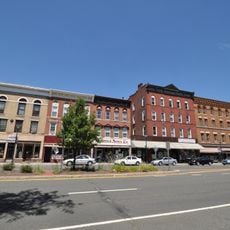
The park takes its name from the hilltop where it sits, reflecting the land's long connection to the local area. Visitors can see how it serves today as a simple retreat where people come to appreciate nature in its most basic form.

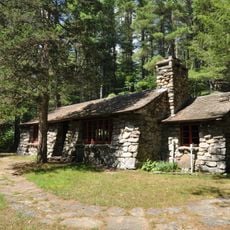
The park has no on-site management or extensive facilities, so visitors should bring water and food for themselves. It is best to arrive with comfortable shoes and a simple map or smartphone with GPS, since the trails lack signs.

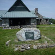
The park's highest point sits above 1,000 feet in elevation, offering views of the surrounding forests and Connecticut landscape from that vantage point. This raised location makes it a special place to watch the seasons and weather patterns of the region shift throughout the year.

The community of curious travelers

AroundUs brings together thousands of curated places, local tips, and hidden gems, enriched daily by 60,000 contributors worldwide.

Start exploring
Location
Inception
1960
Elevation above the sea
397 m
GPS coordinates
41.90000,-73.10694
Latest update
February 9, 2026 07:42
Around this place
Gilbert Clock Factory
United States of America

Gilbert Clock Factory

5.3 km
Burr Pond State Park
United States of America

Burr Pond State Park

3.6 km
Riverton Historic District
United States of America

Riverton Historic District

10 km
Dennis Hill State Park
United States of America

Dennis Hill State Park

9.3 km
United States of America

Sunnybrook State Park

7.2 km
American Legion State Forest
United States of America

American Legion State Forest

9 km
Beckley Bog
United States of America

Beckley Bog

8.9 km
American Legion State Forest Trails
United States of America

American Legion State Forest Trails

8.8 km
Warrenton Woolen Mill
United States of America

Warrenton Woolen Mill

9.2 km
Rock Hall
United States of America

Rock Hall

9.7 km
Sun Terrace
United States of America

Sun Terrace

9.3 km
Colebrook Store
United States of America

Colebrook Store

10 km
Paugnut State Forest
United States of America

Paugnut State Forest

4.9 km
Peoples State Forest Nature Museum
United States of America

Peoples State Forest Nature Museum

9.6 km
Gillette's Grist Mill
United States of America

Gillette's Grist Mill

9.7 km
Amos Baldwin House
United States of America

Amos Baldwin House

8.9 km
William Moore Jr. House
United States of America

William Moore Jr. House

10.3 km
Esperanza
United States of America

Esperanza

10 km
Union Church/St. Paul's Church
United States of America

Union Church/St. Paul's Church

10 km
Winsted Green Historic District
United States of America

Winsted Green Historic District

4.5 km
Solomon Rockwell House
United States of America

Solomon Rockwell House

3.5 km
Thomas Shepard House
United States of America

Thomas Shepard House

8.3 km
Winsted Hosiery Mill
United States of America

Winsted Hosiery Mill

4.8 km
Paugnut State Forest Administration Building
United States of America

Paugnut State Forest Administration Building

3.5 km
West End Commercial District
United States of America

West End Commercial District

3.7 km
Colebrook Center Historic District
United States of America

Colebrook Center Historic District

10 km
Moses Camp House
United States of America

Moses Camp House

3.7 km
Tamarack Lodge Bungalow
United States of America

Tamarack Lodge Bungalow

9.4 km
Show the full map
« Platt Hill State Park - State park in Litchfield County, Connecticut » is provided by Around Us (aroundus.com). Images and texts are derived from Wikimedia project under a Creative Commons license. You are allowed to copy, distribute, and modify copies of this page, under the conditions set by the license, as long as this note is clearly visible.

Discover hidden gems everywhere you go!

From secret cafés to breathtaking viewpoints, skip the crowded tourist spots and find places that match your style. Our app makes it easy with voice search, smart filtering, route optimization, and insider tips from travelers worldwide. Download now for the complete mobile experience.

Around Us App Screenshot

A unique approach to discovering new places

Le Figaro

All the places worth exploring

France Info

A tailor-made excursion in just a few clicks

20 Minutes

Around Us
Travel Guide & Maps
Download

Send to your phone

QR Code
1

Open the camera app on your mobile.

2

Point at the QR code with your camera. A notification will appear.

3

Tap the notification to open the link.