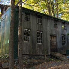
Sunnybrook State Park, State recreation area in Torrington, United States.
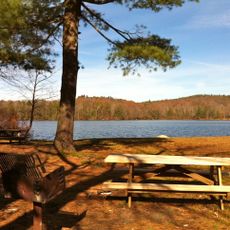
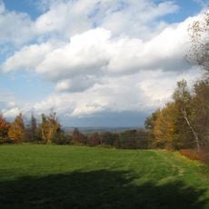
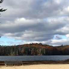
Sunnybrook State Park is a 464-acre natural space featuring Madden Pond, wetlands, forests, and meadows along the East Branch Naugatuck River in Litchfield County. The park's varied landscapes support hiking, fishing, and hunting throughout its trails and open areas.
The property entered Connecticut's state park system in 1970 and was first officially documented in the 1971 register. This addition protected the natural landscape for public recreation and conservation.
The park's main trail honors a former landowner, connecting visitors through forests and along the river as a way to remember local ties to the property.
The park is accessible from Newfield Road in Torrington with parking available near the main entrance. Trails are marked and visitors should come prepared for changing weather and bring water for their outdoor activities.
The park serves as the starting point for the blue-marked John Muir Trail, which winds two miles through neighboring Paugnut State Forest. This connection extends your visit into a larger network of protected woodland.
Location: Litchfield County
Inception: 1970
Website: https://portal.ct.gov/DEEP/State-Parks/Locate-Park-Forest/Other-State-Parks-and-Forests
GPS coordinates: 41.83610,-73.12030
Latest update: December 14, 2025 12:22
Warner Theatre
3.8 km
Stillman House
10.7 km
Burr Pond State Park
4.3 km
Topsmead
10.5 km
James Alldis House
3.5 km
First Congregational Church of Litchfield
11.3 km
Downtown Torrington Historic District
3.8 km
Platt Hill State Park
7.2 km
Warrenton Woolen Mill
2 km
West Goshen Historic District
11.2 km
Sun Terrace
9.1 km
Paugnut State Forest
2.7 km
Water Street Historic District
3.8 km
Villa Friuli
3.8 km
Fyler-Hotchkiss Estate
3.5 km
Gillette's Grist Mill
7.9 km
Esperanza
10.1 km
Migeon Avenue Historic District
3.2 km
Winsted Green Historic District
10.8 km
Jason Skinner House
8.8 km
Solomon Rockwell House
10.4 km
Winsted Hosiery Mill
11 km
Thomas Shepard House
10.8 km
Paugnut State Forest Administration Building
4.4 km
West End Commercial District
10.3 km
Burlington–Harmony Hill Roads Historic District
9 km
Litchfield–South Roads Historic District
8.8 km
Moses Camp House
10.5 kmVisited this place? Tap the stars to rate it and share your experience / photos with the community! Try now! You can cancel it anytime.
Discover hidden gems everywhere you go!
From secret cafés to breathtaking viewpoints, skip the crowded tourist spots and find places that match your style. Our app makes it easy with voice search, smart filtering, route optimization, and insider tips from travelers worldwide. Download now for the complete mobile experience.
A unique approach to discovering new places❞
— Le Figaro
All the places worth exploring❞
— France Info
A tailor-made excursion in just a few clicks❞
— 20 Minutes