Enable Location

We need your location to show you interesting places around you

Discover nearby places

Find interesting locations and hidden gems around you

Precise directions

Get accurate directions and distances to places

Your location is never shared with other users. It's only used when you tap the location button.

West Goshen Historic District

Log in to your account

Start exploring — it's free

Trusted by 62,464 travelers worldwide

Continue with Google
Continue with Apple
or

We will send you a code to connect

By continuing, you accept our Terms and Conditions and our Privacy Policy

Check your inbox

We've sent a pincode in your inbox. Please enter the code below.

West Goshen Historic District, historic district in Connecticut, United States

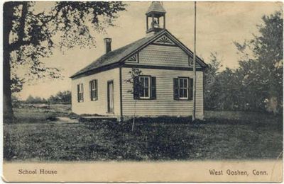
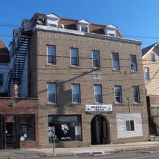
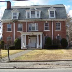
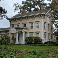
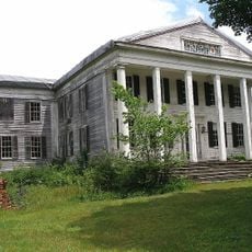
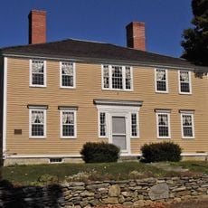
West Goshen Historic District is a National Register listed place in Connecticut covering about 29 acres with buildings from the early 1800s. The area includes residential homes, a schoolhouse built in 1911, and remnants of former commercial and industrial buildings along Connecticut Route 4.

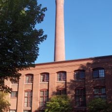
The area began growing around 1770 after the Sharon Turnpike was built, expanding in the early 1800s with water-powered mills and industry. Decline came during the Civil War period when water power was replaced by newer industrial methods.

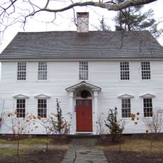
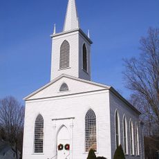
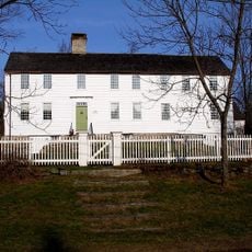
The name West Goshen reflects the Goshen family who settled in the region. The houses display Federal and Greek Revival styles from the early 1800s, showing how the community valued craftsmanship and built structures meant to last.

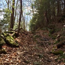
The district lies along Connecticut Route 4 between Beach Street and Thompson Road, with a branch of the Marshepaug River running through it. The best way to explore the architecture and layout is by walking the quiet streets where buildings from different periods are visible.

The district is roughly divided in half by a branch of the Marshepaug River, still marking the area's former reliance on water power. Although the original mills no longer operate, remnants of industrial buildings like the 1818 carding mill shape its appearance today.

The community of curious travelers

AroundUs brings together thousands of curated places, local tips, and hidden gems, enriched daily by 60,000 contributors worldwide.

Start exploring
Location
GPS coordinates
41.82556,-73.25444
Latest update
February 9, 2026 11:06
Around this place
House VI
United States of America

House VI

5.6 km
West Cornwall Covered Bridge
United States of America

West Cornwall Covered Bridge

10.5 km
Warner Theatre
United States of America

Warner Theatre

11.4 km
Stillman House
United States of America

Stillman House

9.6 km
Cathedral Pines
United States of America

Cathedral Pines

6 km
Milton Center Historic District
United States of America

Milton Center Historic District

6.6 km
Cornwall Bridge
United States of America

Cornwall Bridge

9.8 km
James Alldis House
United States of America

James Alldis House

11.1 km
Oliver Wolcott House
United States of America

Oliver Wolcott House

10.7 km
Litchfield Historic District
United States of America

Litchfield Historic District

10.2 km
United States of America

Sunnybrook State Park

11.2 km
Housatonic Meadows State Park
United States of America

Housatonic Meadows State Park

10.5 km
First Congregational Church of Litchfield
United States of America

First Congregational Church of Litchfield

10.2 km
Downtown Torrington Historic District
United States of America

Downtown Torrington Historic District

11.3 km
Housatonic State Forest
United States of America

Housatonic State Forest

11.1 km
Warrenton Woolen Mill
United States of America

Warrenton Woolen Mill

10.9 km
Trinity Church
United States of America

Trinity Church

6.2 km
Water Street Historic District
United States of America

Water Street Historic District

10.9 km
Villa Friuli
United States of America

Villa Friuli

10.5 km
Fyler-Hotchkiss Estate
United States of America

Fyler-Hotchkiss Estate

11.3 km
Amos Baldwin House
United States of America

Amos Baldwin House

11.4 km
Henry B. Bissell House
United States of America

Henry B. Bissell House

10 km
Migeon Avenue Historic District
United States of America

Migeon Avenue Historic District

10.5 km
Maj. Gen. John Sedgwick House
United States of America

Maj. Gen. John Sedgwick House

8.3 km
Rumsey Hall
United States of America

Rumsey Hall

6.8 km
Thomas Shepard House
United States of America

Thomas Shepard House

10.2 km
Cream Hill Shelter
United States of America

Cream Hill Shelter

11.2 km
David Welch House
United States of America

David Welch House

6.2 km
Show the full map
« West Goshen Historic District - historic district in Connecticut, United States » is provided by Around Us (aroundus.com). Images and texts are derived from Wikimedia project under a Creative Commons license. You are allowed to copy, distribute, and modify copies of this page, under the conditions set by the license, as long as this note is clearly visible.

Discover hidden gems everywhere you go!

From secret cafés to breathtaking viewpoints, skip the crowded tourist spots and find places that match your style. Our app makes it easy with voice search, smart filtering, route optimization, and insider tips from travelers worldwide. Download now for the complete mobile experience.

Around Us App Screenshot

A unique approach to discovering new places

Le Figaro

All the places worth exploring

France Info

A tailor-made excursion in just a few clicks

20 Minutes

Around Us
Travel Guide & Maps
Download

Send to your phone

QR Code
1

Open the camera app on your mobile.

2

Point at the QR code with your camera. A notification will appear.

3

Tap the notification to open the link.