Enable Location

We need your location to show you interesting places around you

Discover nearby places

Find interesting locations and hidden gems around you

Precise directions

Get accurate directions and distances to places

Your location is never shared with other users. It's only used when you tap the location button.

Litchfield Historic District

Log in to your account

Start exploring — it's free

Trusted by 61,862 travelers worldwide

Continue with Google
Continue with Apple
or

We will send you a code to connect

By continuing, you accept our Terms and Conditions and our Privacy Policy

Check your inbox

We've sent a pincode in your inbox. Please enter the code below.

Litchfield Historic District, Colonial historic district in Litchfield, Connecticut.

Description

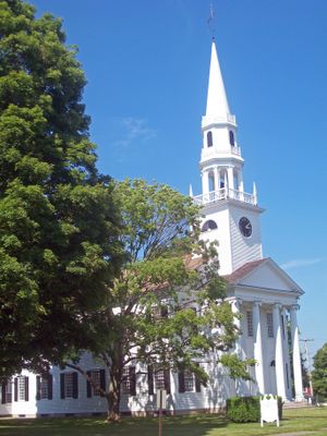
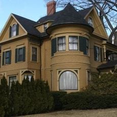
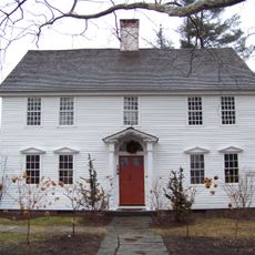
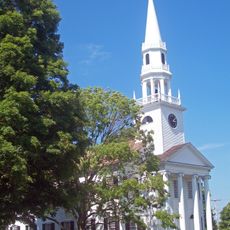
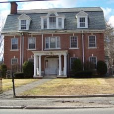
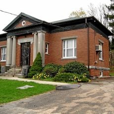
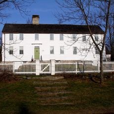
Litchfield Historic District is a colonial-era neighborhood with approximately 475 structures built in the Georgian style, featuring clapboard siding and gabled roofs throughout. The heart of the area centers on a green space located where two main roads intersect.

History

The area was formally recognized in 1959 as Connecticut's first historic district, followed by National Historic Landmark status in 1968. These designations confirmed the national importance of this well-preserved early American settlement.

Culture

The district reflects the early days of American settlement through its street layout and building styles that remain visually intact from centuries past. Walking through, you notice how people have maintained these structures as a collective memory of colonial life.

Practical

The district is best explored on foot since it is compact and structures are visible from the streets. Any exterior work on buildings visible from public areas requires review to maintain consistency with the original architectural style.

Did you know?

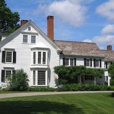
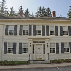
The Tapping Reeve House once housed the first law school in the United States, where individuals including Aaron Burr and John C. Calhoun received instruction. This school played an important role in training early American leaders.

Location
Elevation above the sea
333 m
GPS coordinates
41.74739,-73.19014
Latest update
December 14, 2025 11:24

AroundUs brings together thousands of curated places, local tips, and hidden gems, enriched daily by 60,000 contributors worldwide. Discover all places nearby (Litchfield).

Around this place
Rye House
United States of America

Rye House

8 km
Bellamy-Ferriday House and Garden
United States of America

Bellamy-Ferriday House and Garden

11.5 km
Warner Theatre
United States of America

Warner Theatre

8.3 km
Stillman House
United States of America

Stillman House

770 m
Mount Tom State Park
United States of America

Mount Tom State Park

9.6 km
Garbage Museum
United States of America

Garbage Museum

7.8 km
Topsmead
United States of America

Topsmead

2.5 km
Milton Center Historic District
United States of America

Milton Center Historic District

7.2 km
James Alldis House
United States of America

James Alldis House

8.4 km
Oliver Wolcott House
United States of America

Oliver Wolcott House

492 m
White Memorial Foundation
United States of America

White Memorial Foundation

3.8 km
United States of America

Sunnybrook State Park

11.5 km
First Congregational Church of Litchfield
United States of America

First Congregational Church of Litchfield

163 m
Downtown Torrington Historic District
United States of America

Downtown Torrington Historic District

8.3 km
Humaston Brook State Park
United States of America

Humaston Brook State Park

8.5 km
Warrenton Woolen Mill
United States of America

Warrenton Woolen Mill

9.6 km
West Goshen Historic District
United States of America

West Goshen Historic District

10.2 km
Trinity Church
United States of America

Trinity Church

6.9 km
Water Street Historic District
United States of America

Water Street Historic District

8.1 km
Villa Friuli
United States of America

Villa Friuli

7.9 km
Fyler-Hotchkiss Estate
United States of America

Fyler-Hotchkiss Estate

8.6 km
Henry B. Bissell House
United States of America

Henry B. Bissell House

4 km
Migeon Avenue Historic District
United States of America

Migeon Avenue Historic District

8.5 km
Jason Skinner House
United States of America

Jason Skinner House

10.1 km
Litchfield–South Roads Historic District
United States of America

Litchfield–South Roads Historic District

11.1 km
David Welch House
United States of America

David Welch House

6.8 km
Town Hall and District School No. 6
United States of America

Town Hall and District School No. 6

7.3 km
Mount Tom Tower
United States of America

Mount Tom Tower

9.2 km
Show the full map
« Litchfield Historic District - Colonial historic district in Litchfield, Connecticut » is provided by Around Us (aroundus.com). Images and texts are derived from Wikimedia project under a Creative Commons license. You are allowed to copy, distribute, and modify copies of this page, under the conditions set by the license, as long as this note is clearly visible.

Discover hidden gems everywhere you go!

From secret cafés to breathtaking viewpoints, skip the crowded tourist spots and find places that match your style. Our app makes it easy with voice search, smart filtering, route optimization, and insider tips from travelers worldwide. Download now for the complete mobile experience.

Around Us App Screenshot

A unique approach to discovering new places

Le Figaro

All the places worth exploring

France Info

A tailor-made excursion in just a few clicks

20 Minutes

Around Us
Travel Guide & Maps
Download

Send to your phone

QR Code
1

Open the camera app on your mobile.

2

Point at the QR code with your camera. A notification will appear.

3

Tap the notification to open the link.