Burnt Island Rapids
Location: St. Lawrence County
GPS coordinates: 44.29256,-74.59934
Latest update: November 5, 2025 19:24

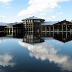
Wild Center
15.2 km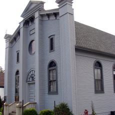
Beth Joseph Synagogue
13.1 km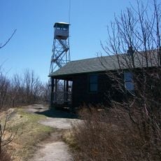
Arab Mountain Fire Observation Station
9.8 km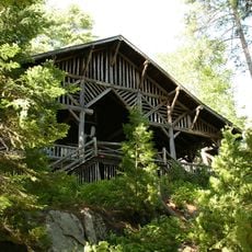
Camp Eagle Island
21.4 km
Carry Falls Reservoir
16.6 km
Higley Falls Reservoir
4.3 km
Childwold Memorial Presbyterian Church
5.6 km
Stark Falls Reservoir
20.7 km
Newton Falls Reservoir
18 km
Horseshoe Lake Wild Forest
16.2 km
Long Rapids
11.6 km
Deerlick Rapids
22.1 km
Cranberry Lake Campground
21.1 km
Scenic viewpoint
12.5 km
Rollins Pond Campground
15.7 km
Mount Arab
9.8 km
Bear Mountain Lookout
20.6 km
Scenic viewpoint
18.8 km
Scenic viewpoint
18.7 km
Fish Creek Pond Campground
18.3 km
Scenic viewpoint
12.5 km
Scenic viewpoint
13 km
Augerhole Falls
14.9 km
High Falls
19.5 km
Waterfall
18.8 km
Waterfall
18.7 km
Waterfall
9.9 km
Waterfall
9.8 kmReviews
Visited this place? Tap the stars to rate it and share your experience / photos with the community! Try now! You can cancel it anytime.
Discover hidden gems everywhere you go!
From secret cafés to breathtaking viewpoints, skip the crowded tourist spots and find places that match your style. Our app makes it easy with voice search, smart filtering, route optimization, and insider tips from travelers worldwide. Download now for the complete mobile experience.

A unique approach to discovering new places❞
— Le Figaro
All the places worth exploring❞
— France Info
A tailor-made excursion in just a few clicks❞
— 20 Minutes