Log in to your account

AroundUs is a community-driven map of interesting places, built by curious explorers like you. It grows with every review, story, and photo you share.
Connect to save your favorite spots, contribute locations, and create personalized routes.
Continue with Google
Continue with Apple
Continue with X
Continue with Facebook
Continue with email
By continuing, you accept our Terms and Conditions and our Privacy Policy
Create an account

Medicine Creek State Recreation Area

Add to collection
Map
Suggest a change
Share

Medicine Creek State Recreation Area, Protected recreation area in Frontier County, Nebraska.

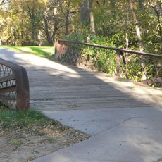
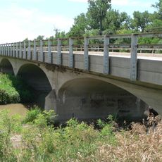
Medicine Creek State Recreation Area is a protected outdoor space built around a large reservoir in Frontier County. The grounds include camping areas, boat access points, fishing spots, and walking trails that spread across the surrounding land.

The recreation area developed in the mid-20th century when a dam project created the reservoir for water supply and flood control. This development shaped the land into a public space for outdoor recreation.

The Nebraska Game and Parks Commission manages this recreation space, promoting environmental education and conservation through informative programs.

The area has clear access routes and marked zones for different activities, making it straightforward to find your way around. Seasonal changes affect water levels and what you can do, so plan accordingly.

Locals know the reservoir by a second name, Harry Strunk Lake, reflecting the area's deeper connection to regional history. This local naming shows how the space has become woven into the life of those who live nearby.

Location: Nebraska

Operator: Nebraska Game and Parks Commission

GPS coordinates: 40.37759,-100.21918

Latest update: December 14, 2025 16:42

Photos
Around this place
Harvey P. Sutton House
United States of America

Harvey P. Sutton House

39.6 km
Heartland Museum of Military Vehicles
United States of America

Heartland Museum of Military Vehicles

57.6 km
Prairie Dog State Park
United States of America

Prairie Dog State Park

67.5 km
St. John's Evangelical Lutheran German Church and Cemetery
United States of America

St. John's Evangelical Lutheran German Church and Cemetery

56.7 km
George W. Norris House
United States of America

George W. Norris House

39.5 km
Massacre Canyon Historical Monument
United States of America

Massacre Canyon Historical Monument

66.1 km
St. Paul's Methodist Protestant Church
United States of America

St. Paul's Methodist Protestant Church

58.5 km
W. H. Faling House
United States of America

W. H. Faling House

11.4 km
Bank of Oberlin
United States of America

Bank of Oberlin

67.5 km
Mowry Bluff Archeological Site
United States of America

Mowry Bluff Archeological Site

754 m
Dawson County Courthouse
United States of America

Dawson County Courthouse

60.4 km
Gosper County Courthouse
United States of America

Gosper County Courthouse

38.3 km
McCook Public-Carnegie Library
United States of America

McCook Public-Carnegie Library

39.7 km
Kinner House
United States of America

Kinner House

71.3 km
Norton Downtown Historic District
United States of America

Norton Downtown Historic District

67.2 km
Allen's Opera House
United States of America

Allen's Opera House

57.2 km
Ernest A. Calling House
United States of America

Ernest A. Calling House

62.1 km
Red Willow County Courthouse
United States of America

Red Willow County Courthouse

39.7 km
Ira Webster Olive House
United States of America

Ira Webster Olive House

61.2 km
Norcatur City Hall
United States of America

Norcatur City Hall

60.2 km
McCook YMCA
United States of America

McCook YMCA

39.7 km
Phelps County Courthouse
United States of America

Phelps County Courthouse

72.3 km
Hendee Hotel
United States of America

Hendee Hotel

57.3 km
Gothenburg Carnegie Library
United States of America

Gothenburg Carnegie Library

61.7 km
North Fork Solomon River Lattice Truss Bridge
United States of America

North Fork Solomon River Lattice Truss Bridge

68.7 km
United States of America

Highland Precinct

52.2 km
Tobin Indian Raid Historical Marker
United States of America

Tobin Indian Raid Historical Marker

72.3 km
Republican State Aid Bridge
United States of America

Republican State Aid Bridge

12.4 km
Show the full map
Reviews

Visited this place? Tap the stars to rate it and share your experience / photos with the community! Try now! You can cancel it anytime.

« Medicine Creek State Recreation Area - Protected recreation area in Frontier County, Nebraska » is provided by Around Us (aroundus.com). Images and texts are derived from Wikimedia project under a Creative Commons license. You are allowed to copy, distribute, and modify copies of this page, under the conditions set by the license, as long as this note is clearly visible.

Discover hidden gems everywhere you go!

From secret cafés to breathtaking viewpoints, skip the crowded tourist spots and find places that match your style. Our app makes it easy with voice search, smart filtering, route optimization, and insider tips from travelers worldwide. Download now for the complete mobile experience.

Around Us App Screenshot

A unique approach to discovering new places

Le Figaro

All the places worth exploring

France Info

A tailor-made excursion in just a few clicks

20 Minutes