Enable Location

We need your location to show you interesting places around you

Discover nearby places

Find interesting locations and hidden gems around you

Precise directions

Get accurate directions and distances to places

Your location is never shared with other users. It's only used when you tap the location button.

Rattlesnake Springs

Log in to your account

Start exploring — it's free

Trusted by travelers worldwide

Continue with Google
Continue with Apple
or

We will send you a code to connect

By continuing, you accept our Terms and Conditions and our Privacy Policy

Check your inbox

We've sent a pincode in your inbox. Please enter the code below.

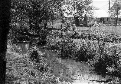
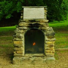
Rattlesnake Springs, Historic site in Bradley County, Tennessee

Description

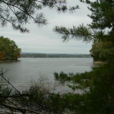
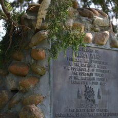
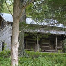
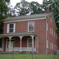
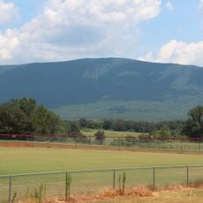
Rattlesnake Springs is a historic site located on rural farmland about five miles northeast of Cleveland, Tennessee, with natural water sources and markers from Native American times. The privately owned property is marked by interpretive signs at viewing areas for visitors to learn about its significance.

History

In 1838, the springs served as a detention point where approximately 13,000 Cherokee people were held under federal military supervision before their forced removal westward. Two military camps were established there to oversee the confinement of thousands of indigenous people.

Culture

The springs served as the gathering place where Cherokee leaders made decisions about their people's future and cultural preservation. Visitors walking through the site can sense its importance as a space where indigenous governance took place.

Practical

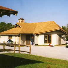
The site is privately owned, but access to certain areas is available through designated viewing points where interpretive signs are placed. Visitors should note that entry may be restricted to specific areas, so checking access conditions beforehand is helpful.

Did you know?

Two military camps, Camp Foster and Camp Worth, operated near the springs specifically to oversee the confinement, and over 200 people died there from disease and poor conditions before the westward journey began. These deaths remain a stark reminder of the hardship endured during this forced displacement.

Location
GPS coordinates
35.24444,-84.87111
Latest update
December 12, 2025 14:24

AroundUs brings together thousands of curated places, local tips, and hidden gems, enriched daily by 60,000 contributors worldwide. Discover all places nearby (Bradley County).

Around this place
Harrison Bay State Park
United States of America

Harrison Bay State Park

23.8 km
Booker T. Washington State Park
United States of America

Booker T. Washington State Park

31.6 km
Rhea County Courthouse
United States of America

Rhea County Courthouse

30.7 km
Nancy Ward Tomb
United States of America

Nancy Ward Tomb

19.5 km
Hair Conrad Cabin
United States of America

Hair Conrad Cabin

9.7 km
Red Clay State Park
United States of America

Red Clay State Park

28.8 km
Henegar House
United States of America

Henegar House

11.6 km
Oswald Dome
United States of America

Oswald Dome

29.1 km
United States of America

Museum Center at Five Points

9.6 km
James County Courthouse
United States of America

James County Courthouse

25.8 km
Broad Street United Methodist Church
United States of America

Broad Street United Methodist Church

10.3 km
Craigmiles Hall
United States of America

Craigmiles Hall

9.4 km
Centenary Avenue Historic District
United States of America

Centenary Avenue Historic District

8.6 km
P.M. Craigmiles House
United States of America

P.M. Craigmiles House

9.9 km
Clear Springs Cumberland Presbyterian Church
United States of America

Clear Springs Cumberland Presbyterian Church

16.8 km
Ocoee Street Historic District
United States of America

Ocoee Street Historic District

8.3 km
W.J. Hughes Business House
United States of America

W.J. Hughes Business House

9.5 km
Polk County Courthouse
United States of America

Polk County Courthouse

21.3 km
Copeland House
United States of America

Copeland House

25.6 km
Broyles-Darwin House
United States of America

Broyles-Darwin House

30 km
Cleveland Commercial Historic District
United States of America

Cleveland Commercial Historic District

9.4 km
Dr. Walter Thomison House
United States of America

Dr. Walter Thomison House

30.1 km
Meigs County Courthouse
United States of America

Meigs County Courthouse

31 km
Fillauer Brothers Building
United States of America

Fillauer Brothers Building

9.4 km
William Wiggins House
United States of America

William Wiggins House

21.3 km
Lake Ocoee
United States of America

Lake Ocoee

28.7 km
Rhea County Court House Historic landmark
United States of America

Rhea County Court House Historic landmark

30.7 km
Dobbs Ford Bridge
United States of America

Dobbs Ford Bridge

6.4 km
Show the full map
« Rattlesnake Springs - Historic site in Bradley County, Tennessee » is provided by Around Us (aroundus.com). Images and texts are derived from Wikimedia project under a Creative Commons license. You are allowed to copy, distribute, and modify copies of this page, under the conditions set by the license, as long as this note is clearly visible.

Discover hidden gems everywhere you go!

From secret cafés to breathtaking viewpoints, skip the crowded tourist spots and find places that match your style. Our app makes it easy with voice search, smart filtering, route optimization, and insider tips from travelers worldwide. Download now for the complete mobile experience.

Around Us App Screenshot

A unique approach to discovering new places

Le Figaro

All the places worth exploring

France Info

A tailor-made excursion in just a few clicks

20 Minutes

Around Us
Travel Guide & Maps
Download

Send to your phone

QR Code
1

Open the camera app on your mobile.

2

Point at the QR code with your camera. A notification will appear.

3

Tap the notification to open the link.