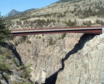
Sunlight Creek Bridge, Road bridge in Park County, Wyoming, US
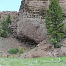
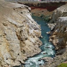
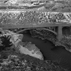
Sunlight Creek Bridge is a steel beam structure spanning Sunlight Gorge and standing as Wyoming's highest bridge at roughly 87 meters above the waterway. The roadway measures about 10 meters wide and is bordered by two pedestrian walkways.
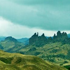
The structure was completed in 1985 and improved the Chief Joseph Scenic Byway by creating a more direct route. The highway traces a path connected to the Nez Perce journey that occurred in 1877.
The road link commemorates Chief Joseph and honors the paths that the Nez Perce traveled through this mountain landscape. The name serves as a reminder of Native American presence and movements in this remote region.
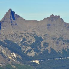
The side walkways allow visitors to stop safely and observe the granite gorge without mixing with traffic. Daily vehicle passage is moderate enough that you can pause and take in the views without feeling rushed.
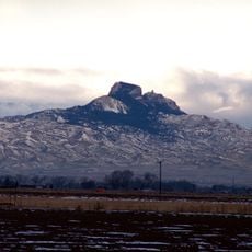
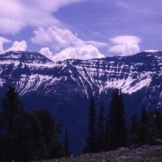
The basin below was named by early settlers who noticed that sunlight was the sole element capable of penetrating this remote valley. This hidden gem lies away from typical tourist paths and offers an off-the-beaten-track experience.
GPS coordinates: 44.77083,-109.42528
Latest update: December 14, 2025 09:46
Wyoming preserves geological sites that include thermal springs, canyons, and rock formations. The state protects historic locations such as forts, rock art, and dinosaur tracks. Devils Tower rises 1,267 feet (386 meters) above the terrain and represents a significant geological formation. Fossil...
Beartooth Highway
22.2 km
Smith Mansion
34.9 km
Heart Mountain
26.9 km
Buffalo Bill Center of the West
39 km
Buffalo Bill Dam
35.6 km
Mummy Cave
42.4 km
Colter's Hell
37.5 km
Buffalo Bill State Park
35.6 km
Pilot Peak
42.7 km
Wapiti Ranger Station
37.2 km
Buffalo Bill – The Scout
38.9 km
Northeast Entrance Station
53 km
Abiathar Peak
53 km
The Thunderer
52 km
Hayden Arch Bridge
36.4 km
Buffalo Bill Boyhood Home
39.4 km
Downtown Cody Historic District
39 km
Paul Stock House
38.8 km
Absaroka Mountain Lodge
45.3 km
Saddle Mountain
44.8 km
Old Trail Town
38.2 km
Ralston Community Clubhouse
44.4 km
Bearcreek Bank
48.3 km
Calvary Episcopal Church
48.4 km
Clay Butte Lookout
25 km
Cody Theatre
39.4 km
Beartooth Mountain Baptist Church (Red Lodge)
48.4 km
Hoodoo Basin
34.4 kmVisited this place? Tap the stars to rate it and share your experience / photos with the community! Try now! You can cancel it anytime.
Discover hidden gems everywhere you go!
From secret cafés to breathtaking viewpoints, skip the crowded tourist spots and find places that match your style. Our app makes it easy with voice search, smart filtering, route optimization, and insider tips from travelers worldwide. Download now for the complete mobile experience.
A unique approach to discovering new places❞
— Le Figaro
All the places worth exploring❞
— France Info
A tailor-made excursion in just a few clicks❞
— 20 Minutes