Enable Location

We need your location to show you interesting places around you

Discover nearby places

Find interesting locations and hidden gems around you

Precise directions

Get accurate directions and distances to places

Your location is never shared with other users. It's only used when you tap the location button.

Hoodoo Basin

Log in to your account

Start exploring — it's free

Trusted by 62,562 travelers worldwide

Continue with Google
Continue with Apple
or

We will send you a code to connect

By continuing, you accept our Terms and Conditions and our Privacy Policy

Check your inbox

We've sent a pincode in your inbox. Please enter the code below.

Hoodoo Basin

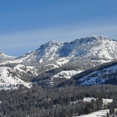
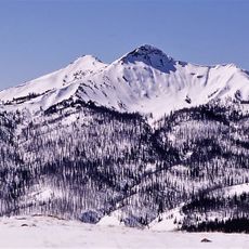
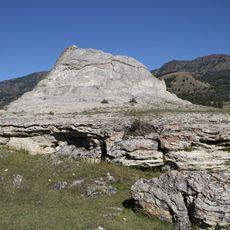
Hoodoo Basin, Geological basin in Park County, Wyoming, US

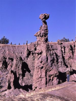
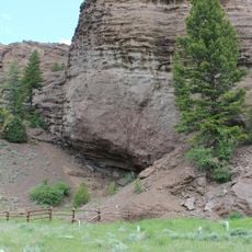
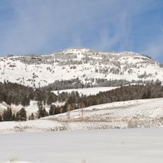
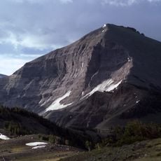
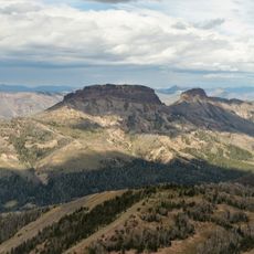
Hoodoo Basin is a geological basin near Yellowstone National Park marked by distinctive limestone columns that rise 5 to 7 meters high across the landscape. These pillars formed through slow erosion processes and create an intricate pattern of rock formations.

The limestone pillars formed over millions of years as water and weather slowly shaped the rock into its current state. This natural process began far before human presence and continues to alter the landscape.

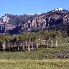
The rock formations here held meaning for the Blackfoot and Cree peoples, who incorporated them into their own stories and understanding of the land. This cultural layer remains part of how visitors experience the landscape today.

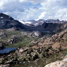
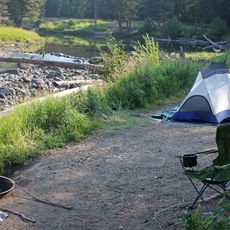
Reaching this basin requires solid hiking experience and proper preparation, as the trails are remote and demanding. Start early in the day, bring plenty of water and food, and be ready for steep sections and changing weather.

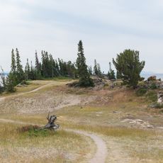
The trail to this basin climbs steeply right from the start, testing visitors' endurance before they even reach the rock formations. This demanding opening section filters out casual hikers and rewards those committed to the journey.

The community of curious travelers

AroundUs brings together thousands of curated places, local tips, and hidden gems, enriched daily by 60,000 contributors worldwide.

Start exploring
Location
GPS coordinates
44.71522,-109.85324
Latest update
December 6, 2025 19:09
Rock formations and hoodoos for Instagram photos

Rock pillars and spires shaped by erosion stand as natural monuments across various locations worldwide. These geological structures, known as hoodoos, display different colors and shapes based on their mineral composition and environmental conditions. From the red rocks of Utah to the limestone...

« Hoodoo Basin - Geological basin in Park County, Wyoming, US » is provided by Around Us (aroundus.com). Images and texts are derived from Wikimedia project under a Creative Commons license. You are allowed to copy, distribute, and modify copies of this page, under the conditions set by the license, as long as this note is clearly visible.

Discover hidden gems everywhere you go!

From secret cafés to breathtaking viewpoints, skip the crowded tourist spots and find places that match your style. Our app makes it easy with voice search, smart filtering, route optimization, and insider tips from travelers worldwide. Download now for the complete mobile experience.

Around Us App Screenshot

A unique approach to discovering new places

Le Figaro

All the places worth exploring

France Info

A tailor-made excursion in just a few clicks

20 Minutes

Around Us
Travel Guide & Maps
Download

Send to your phone

QR Code
1

Open the camera app on your mobile.

2

Point at the QR code with your camera. A notification will appear.

3

Tap the notification to open the link.